Santa Marta: what to see and where to eat

Everything below comes from open data and each row says where it came from. We have not been to any of these places and we do not rank them.

505,915 people live here

Nearest airport: Simón Bolívar International Airport (SMR), about 13.41 km from the centre

Distances are straight-line and the walking time is an estimate, not a route.

Filters

Things to see

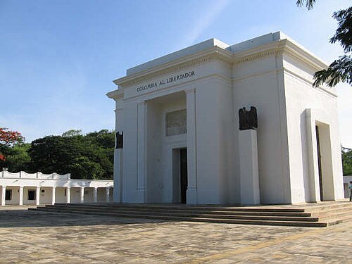
  • Quinta de San Pedro Alejandrino

    No machine-readable author provided. Mijotoba assumed (based on copyright claims). / Public domain

    museum

    Quinta de San Pedro Alejandrino

    national monument of Colombia

    Opening hours Not checked

    Admission Not checked

    Getting there Nearest stop or station Terminal de Transportes de Santa Marta, about 11 min on foot OpenStreetMap
    Map

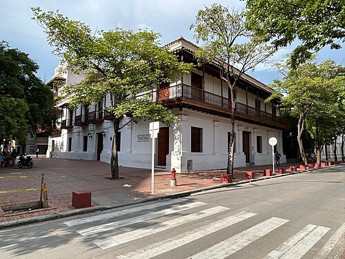
  • Museo de Oro Tairona

    Jdvillalobos / CC BY-SA 4.0

    museum

    Museo de Oro Tairona

    national monument of Colombia

    Opening hours Not checked

    Admission Not checked

    Getting there Nearest stop or station Bus to Minca, about 12 min on foot OpenStreetMap
    Map

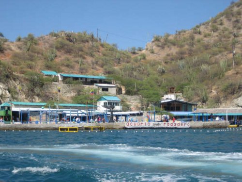
  • Rodadero Sea Aquarium and Museum

    --F3rn4nd0 21:52, 12 March 2007 (UTC) / CC BY 2.5

    public aquarium

    Rodadero Sea Aquarium and Museum

    aquarium and maritime museum in Santa Marta, Colombia
    Opening hours Not checked

    Admission Not checked

    Map

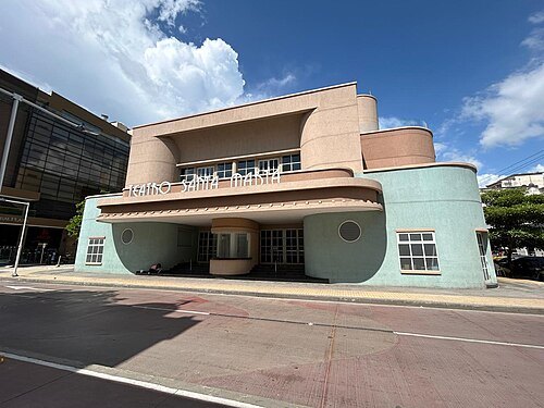
  • Teatro Santa Marta

    Jdvillalobos / CC BY-SA 4.0

    theatre building

    Teatro Santa Marta

    theatre in Santa Marta, Colombia

    Opening hours Not checked

    Admission Not checked

    Getting there Nearest stop or station Bus to Minca, about 7 min on foot OpenStreetMap
    Map

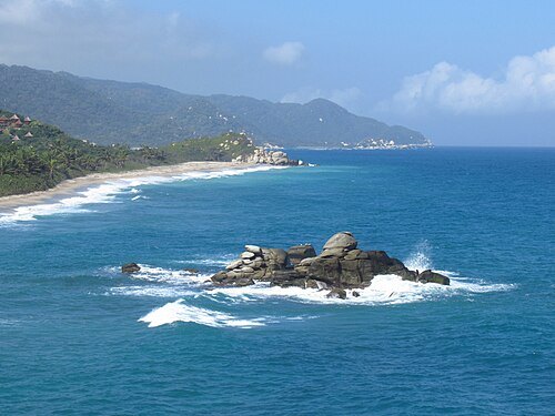
  • Tayrona National Natural Park

    Felipe Restrepo Acosta / CC BY-SA 4.0

    national park

    Tayrona National Natural Park

    national park in Colombia

    Opening hours Not checked

    Admission Not checked

    Map

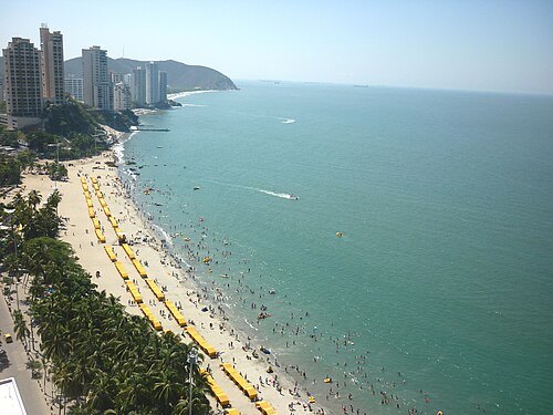
  • El Rodadero

    Sheisale / CC BY-SA 4.0

    beach

    El Rodadero

    Opening hours Not checked

    Admission Not checked

    Getting there Nearest stop or station Berlinastur, about 4 min on foot OpenStreetMap
    Map

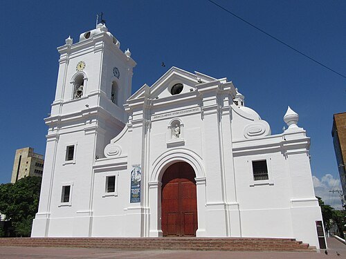
  • Cathedral of Santa Marta

    Felipe Restrepo Acosta / CC BY-SA 4.0

    minor basilica

    Cathedral of Santa Marta

    Opening hours Not checked

    Admission Not checked

    Getting there Nearest stop or station Bus to Minca, about 9 min on foot OpenStreetMap
    Map

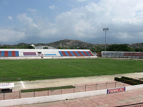
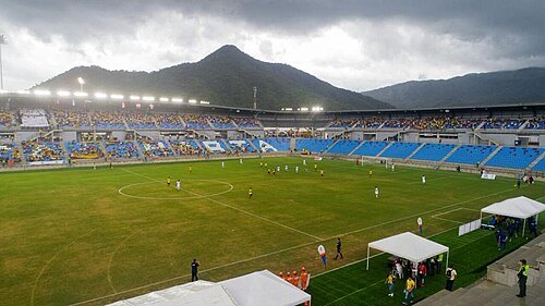
  • Estadio Eduardo Santos

    ArturoAparicio / CC BY 3.0

    stadium

    Estadio Eduardo Santos

    multi-use stadium in Santa Marta, Colombia

    Opening hours Not checked

    Admission Not checked

    Getting there Nearest stop or station Berlinas del Fonce, about 7 min on foot OpenStreetMap
    Map

  • Estadio Sierra Nevada

    MundoVinotinto / CC BY-SA 4.0

    association football venue

    Estadio Sierra Nevada

    football stadium in Colombia

    Opening hours Not checked

    Admission Not checked

    Map

  • island

    Isla El Morro

    island in Colombia

    Opening hours Not checked

    Admission Not checked

    Map

  • park

    Tayrona National Park

    park in Magdalena Department, Colombia

    Opening hours Not checked

    Admission Not checked

    About 8 km from the city centre

    Map

  • peninsula

    Punta San Antonio

    peninsula in Magdalena Department, Colombia

    Opening hours Not checked

    Admission Not checked

    Map

  • peninsula

    Punta Quitasombrero

    peninsula in Magdalena Department, Colombia

    Opening hours Not checked

    Admission Not checked

    About 14 km from the city centre

    Map

  • peninsula

    Punta Petaca

    peninsula in Magdalena Department, Colombia

    Opening hours Not checked

    Admission Not checked

    Map

  • peninsula

    Punta Placelito

    peninsula in Magdalena Department, Colombia

    Opening hours Not checked

    Admission Not checked

    About 16 km from the city centre

    Map

  • peninsula

    Punta Negra

    peninsula in Colombia

    Opening hours Not checked

    Admission Not checked

    About 15 km from the city centre

    Map

  • bay

    Ensenada de Nenguange

    bay in Colombia

    Opening hours Not checked

    Admission Not checked

    About 16 km from the city centre

    Map

  • peninsula

    Punta de Nenguange

    peninsula in Magdalena Department, Colombia

    Opening hours Not checked

    Admission Not checked

    About 16 km from the city centre

    Map

  • peninsula

    Punta Majagua

    peninsula in Magdalena Department, Colombia

    Opening hours Not checked

    Admission Not checked

    About 16 km from the city centre

    Map

  • peninsula

    Punta de Moto

    peninsula in Magdalena Department, Colombia

    Opening hours Not checked

    Admission Not checked

    About 12 km from the city centre

    Map

  • mountain

    Cerro Las Bovedas

    mountain in Colombia

    Opening hours Not checked

    Admission Not checked

    About 17 km from the city centre

    Map

  • peninsula

    Punta Las Minas

    peninsula in Magdalena Department, Colombia

    Opening hours Not checked

    Admission Not checked

    Map

  • peninsula

    Punta Macuaca

    peninsula in Magdalena Department, Colombia

    Opening hours Not checked

    Admission Not checked

    About 13 km from the city centre

    Map

  • peninsula

    Cabo de La Aguja

    peninsula in Magdalena Department, Colombia

    Opening hours Not checked

    Admission Not checked

    Map

  • island

    Isla de La Aguja

    island in Colombia

    Opening hours Not checked

    Admission Not checked

    About 9 km from the city centre

    Map

  • peninsula

    Punta de La Aguja

    peninsula in Magdalena Department, Colombia

    Opening hours Not checked

    Admission Not checked

    Map

  • peninsula

    Punta La Bomba

    peninsula in Magdalena Department, Colombia

    Opening hours Not checked

    Admission Not checked

    Map

  • peninsula

    Punta La Cueva

    peninsula in Magdalena Department, Colombia

    Opening hours Not checked

    Admission Not checked

    About 10 km from the city centre

    Map

  • peninsula

    Punta de Gayraca

    peninsula in Magdalena Department, Colombia

    Opening hours Not checked

    Admission Not checked

    About 14 km from the city centre

    Map

  • peninsula

    Punta de Granate

    peninsula in Magdalena Department, Colombia

    Opening hours Not checked

    Admission Not checked

    Map

  • mountain

    Cerro el Guaco

    mountain in Colombia

    Opening hours Not checked

    Admission Not checked

    About 17 km from the city centre

    Map

  • peninsula

    Punta Embestidero

    peninsula in Magdalena Department, Colombia

    Opening hours Not checked

    Admission Not checked

    About 18 km from the city centre

    Map

  • peninsula

    Punta El Vigía

    peninsula in Magdalena Department, Colombia

    Opening hours Not checked

    Admission Not checked

    About 11 km from the city centre

    Map

  • bay

    Ensenada de Cinto

    bay in Colombia

    Opening hours Not checked

    Admission Not checked

    About 19 km from the city centre

    Map

  • peninsula

    Punta de Cinto

    peninsula in Magdalena Department, Colombia

    Opening hours Not checked

    Admission Not checked

    About 19 km from the city centre

    Map

  • peninsula

    Punta Colorada

    peninsula in Magdalena Department, Colombia

    Opening hours Not checked

    Admission Not checked

    Map

  • bay

    Ensenada de Concha

    bay in Colombia

    Opening hours Not checked

    Admission Not checked

    About 9 km from the city centre

    Map

  • peninsula

    Punta Concha

    peninsula in Magdalena Department, Colombia

    Opening hours Not checked

    Admission Not checked

    About 8 km from the city centre

    Map

  • island

    Morro Chico

    island in Colombia

    Opening hours Not checked

    Admission Not checked

    Getting there Nearest stop or station Bus to Tayrona and Palomino, about 19 min on foot OpenStreetMap

    Map

  • bay

    Ensenada de Chengue

    bay in Colombia

    Opening hours Not checked

    Admission Not checked

    About 12 km from the city centre

    Map

  • peninsula

    Punta de Chengue

    peninsula in Magdalena Department, Colombia

    Opening hours Not checked

    Admission Not checked

    About 13 km from the city centre

    Map

  • peninsula

    Punta Betín

    peninsula in Magdalena Department, Colombia

    Opening hours Not checked

    Admission Not checked

    Map

  • peninsula

    Punta Bonito Flaco

    peninsula in Magdalena Department, Colombia

    Opening hours Not checked

    Admission Not checked

    About 11 km from the city centre

    Map

  • peninsula

    Punta Bonito Gordo

    peninsula in Magdalena Department, Colombia

    Opening hours Not checked

    Admission Not checked

    About 8 km from the city centre

    Map

  • beach

    Playa Brava

    Opening hours Not checked

    Admission Not checked

    About 15 km from the city centre

    Map

  • peninsula

    Punta Ancón

    peninsula in Magdalena Department, Colombia

    Opening hours Not checked

    Admission Not checked

    Map

  • peninsula

    Punta Voladero

    peninsula in Magdalena Department, Colombia

    Opening hours Not checked

    Admission Not checked

    Map

  • mountain

    Roca Druid

    mountain in Colombia

    Opening hours Not checked

    Admission Not checked

    Map

  • beach

    Playa Cristal

    Opening hours Not checked

    Admission Not checked

    About 17 km from the city centre

    Map

  • peninsula

    Punta de Navajita

    peninsula in Magdalena Department, Colombia

    Opening hours Not checked

    Admission Not checked

    Map

  • peninsula

    Punta Los Micos

    peninsula in Magdalena Department, Colombia

    Opening hours Not checked

    Admission Not checked

    About 13 km from the city centre

    Map

  • peninsula

    Punta de La Gloria

    peninsula in Magdalena Department, Colombia

    Opening hours Not checked

    Admission Not checked

    Getting there Nearest stop or station Terminal Intermedia de Gaira, about 18 min on foot OpenStreetMap

    About 8 km from the city centre

    Map

  • peninsula

    Punta La Legua

    peninsula in Magdalena Department, Colombia

    Opening hours Not checked

    Admission Not checked

    About 11 km from the city centre

    Map

  • peninsula

    Punta La Loma

    peninsula in Magdalena Department, Colombia

    Opening hours Not checked

    Admission Not checked

    About 13 km from the city centre

    Map

  • peninsula

    Punta de La Picúa

    peninsula in Magdalena Department, Colombia

    Opening hours Not checked

    Admission Not checked

    Map

  • peninsula

    Punta del Infierno

    peninsula in Magdalena Department, Colombia

    Opening hours Not checked

    Admission Not checked

    Map

  • island

    Morro de Gaira

    island in Colombia

    Opening hours Not checked

    Admission Not checked

    Map

  • peninsula

    Punta de Gaira

    peninsula in Magdalena Department, Colombia

    Opening hours Not checked

    Admission Not checked

    Map

  • peninsula

    Punta Ébano

    peninsula in Magdalena Department, Colombia

    Opening hours Not checked

    Admission Not checked

    About 14 km from the city centre

    Map

  • peninsula

    Punta del Cuerno

    peninsula in Magdalena Department, Colombia

    Opening hours Not checked

    Admission Not checked

    Map

Places to eat

  • restaurant

    La Gran Muralla

    Food: chinese

    Mo-Su 11:00-21:00

    Map

  • restaurant

    Uhma

    Food: european, grill

    Tu-Su 11:11-12:00

    Santa Marta

    Map

  • restaurant

    La Newyorkina

    Food: pizza

    Th-Sa 19:00-3:00

    Santa Marta

    Map

  • cafe

    Mientras

    Food: coffee, cake, sandwich, snack

    Mo 10:00-22:00, We-Su 10:00-22:00

    Santa Marta

    Map

  • cafe

    Trópico

    Food: café, smoothies, jugos

    We-Mo 07:30-20:30

    Taganga

    Map

  • restaurant

    sony's fresh bar

    Food: fish, sandwich, juice, salad

    Mo-Su 08:00-21:00

    Taganga

    Map

  • cafe

    Vívolo Café

    Food: coffee shop

    Mo-Su 07:00-20:00

    Localidad 2 Histórica - Rodrigo de Bastidas

    Map

Opening hours and tickets: OpenStreetMap contributors. Each one shows the day a volunteer last wrote it down, so check the official site before you set out.

Nothing picked yet
    Add a place that is not listed here

    One per line. Pasting a list works too.

    Colombia