Pereira: what to see and where to eat

Everything below comes from open data and each row says where it came from. We have not been to any of these places and we do not rank them.

590,554 people live here

Nearest airport: Matecaña International Airport (PEI), about 5.01 km from the centre

Distances are straight-line and the walking time is an estimate, not a route.

Filters

Things to see

  • theme park

    PANACA

    Opening hours Not checked

    Admission Not checked

    About 27 km from the city centre

    Map

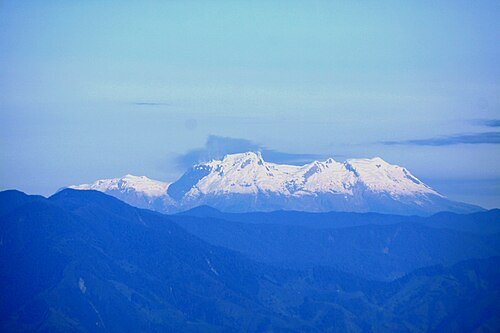
  • Cordillera Central

    Alaincho67 / CC BY-SA 4.0

    mountain range

    Cordillera Central

    mountain range in the Colombian Andes

    Opening hours Not checked

    Admission Not checked

    About 12 km from the city centre

    Map

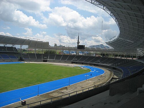
  • Estadio Hernán Ramírez Villegas

    Sebastian Betancourt / CC0

    association football venue

    Estadio Hernán Ramírez Villegas

    football stadium

    Opening hours Not checked

    Admission Not checked

    Map

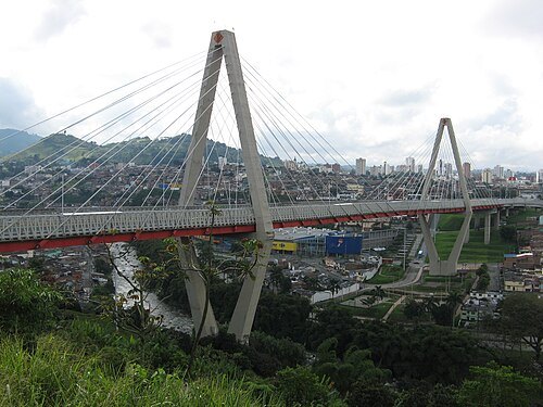
  • César Gaviria Trujillo Viaduct

    ledpup / CC BY-SA 2.0

    cable-stayed bridge

    César Gaviria Trujillo Viaduct

    cable-stayed bridge

    Opening hours Not checked

    Admission Not checked

    Getting there Nearest stop or station Terminal La Florida, about 11 min on foot OpenStreetMap
    Map

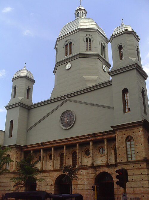
  • Catedral de Nuestra Señora de la Pobreza

    Baiji / CC BY-SA 4.0

    cathedral

    Catedral de Nuestra Señora de la Pobreza

    Cathedral of Our Lady of Poverty (Pereira)

    Opening hours Not checked

    Admission Not checked

    Getting there Nearest stop or station Terminal La Florida, about 12 min on foot OpenStreetMap

    Map

  • fauna and flora sanctuary

    Otún Quimbaya Fauna and Flora Sanctuary

    protected area in Colombia

    Opening hours Not checked

    Admission Not checked

    About 16 km from the city centre

    Map

  • stadium

    Alberto Mora Mora stadium

    Football (soccer) stadium in Pereira, Colombia

    Opening hours Not checked

    Admission Not checked

    Map

  • hill

    Cima del Rayo

    hill in Colombia

    Opening hours Not checked

    Admission Not checked

    Map

  • hill

    Paloma Cima de la

    hill in Colombia

    Opening hours Not checked

    Admission Not checked

    About 11 km from the city centre

    Map

  • hill

    Cerro Malacara

    hill in Colombia

    Opening hours Not checked

    Admission Not checked

    About 10 km from the city centre

    Map

  • hill

    Marmato

    hill in Colombia

    Opening hours Not checked

    Admission Not checked

    About 17 km from the city centre

    Map

  • hill

    Alto de La Cruz

    hill in Risaralda Department, Colombia

    Opening hours Not checked

    Admission Not checked

    Map

  • hill

    Alto El Nudo

    hill in Colombia

    Opening hours Not checked

    Admission Not checked

    Map

  • hill

    Alto El Pajuí

    hill in Colombia

    Opening hours Not checked

    Admission Not checked

    About 19 km from the city centre

    Map

  • hill

    Alto del Chuzo

    hill in Colombia

    Opening hours Not checked

    Admission Not checked

    Map

  • hill

    Cuchilla San José

    hill in Risaralda Department, Colombia

    Opening hours Not checked

    Admission Not checked

    About 16 km from the city centre

    Map

  • hill

    Pierna de María

    hill in Colombia

    Opening hours Not checked

    Admission Not checked

    About 18 km from the city centre

    Map

  • hill

    Cuchilla del Chuscal

    hill in Caldas Department, Colombia

    Opening hours Not checked

    Admission Not checked

    About 19 km from the city centre

    Map

  • hill

    Cuchilla Chaquiro

    hill in Colombia

    Opening hours Not checked

    Admission Not checked

    About 8 km from the city centre

    Map

  • botanical garden

    Jardín Botánico

    Universidad Tecnológica de Pereira

    Opening hours Not checked

    Admission Not checked

    Getting there Nearest stop or station Terminal de transportes de Pereira, about 19 min on foot OpenStreetMap

    Map

  • mountain

    Alto Morro Azul

    mountain in Quindío Department, Colombia

    Opening hours Not checked

    Admission Not checked

    About 19 km from the city centre

    Map

  • hill

    Cerro Canalete

    hill in Colombia

    Opening hours Not checked

    Admission Not checked

    About 19 km from the city centre

    Map

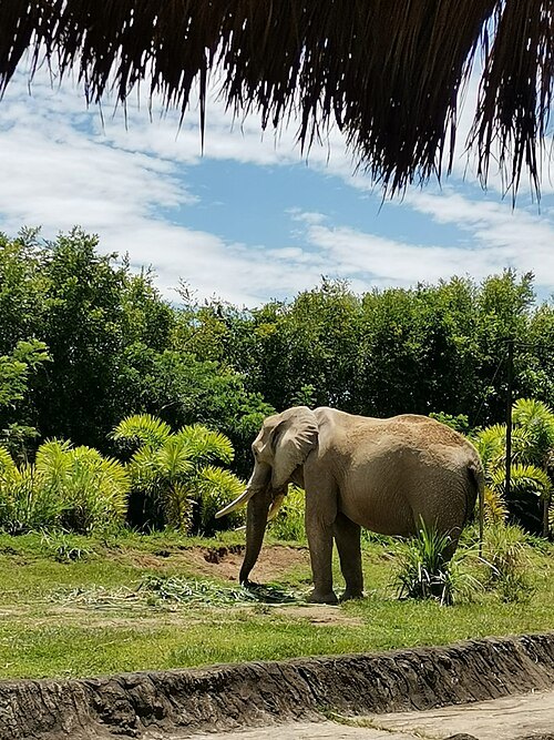
  • Ukumarí Biopark

    Jkdb12 / CC BY-SA 4.0

    theme park

    Ukumarí Biopark

    Theme park with Pereira's flora and wild life

    Opening hours Not checked

    Admission Not checked

    About 13 km from the city centre

    Map

Places to eat

  • restaurant

    Burger Green

    Food: burger, grill

    Mo-Su 11:30-21:30

    Cartago

    Map

  • cafe

    Casa Azul Boutique Hostel | Café

    Food: breakfast, coffee shop, brunch, sandwich

    Mo-Sa 07:30-21:00; Su 07:30-17:00

    Map

  • restaurant

    Kafé del Alma

    Food: coffee shop

    Mo-Fr 20:00-21:00, Sa-Su 08:00-16:00

    Pereira

    Map

  • restaurant

    Restaurante Llanero El Rosarino

    Food: steak house, restaurante, colombian, regional

    Mo-Su 10:00-22:00

    Pereira

    Map

  • cafe

    Rumi Café & Bar

    Food: coffee shop, regional

    We-Mo 16:30-23:30

    El Oso

    Map

  • restaurant

    Sumo

    Food: sushi

    Mo-Sa 12:00-15:00, 18:00-22:30

    Pereira

    Map

  • restaurant

    el Parnaso cafe bar y pizzeria

    Food: pizza, coffee shop

    Mo-Su 16:00-01:00

    Pereira

    Map

  • restaurant

    Casa y Mar

    Food: seafood

    Mo-Fr 11:00-15:45

    Pereira

    Map

  • restaurant

    La Tía

    Food: regional

    Mo-Su 6:00-18:30

    Pereira

    Map

  • restaurant

    Merienda y Café

    Food: regional

    Mo-Fr 07:00-14:30

    Pereira

    Map

  • restaurant

    Restaurante Borbón

    Food: regional, international

    06:15-21:00

    Pereira

    Map

  • restaurant

    El Parnaso Pizzeria Cafe Bar

    Food: pizza

    Mo-Su 16:00-01:00

    Pereira

    Map

Opening hours and tickets: OpenStreetMap contributors. Each one shows the day a volunteer last wrote it down, so check the official site before you set out.

Nothing picked yet
    Add a place that is not listed here

    One per line. Pasting a list works too.

    Colombia