Bucaramanga: what to see and where to eat

Everything below comes from open data and each row says where it came from. We have not been to any of these places and we do not rank them.

614,860 people live here

Nearest airport: Palonegro International Airport (BGA), about 7.6 km from the centre

Distances are straight-line and the walking time is an estimate, not a route.

Filters

Things to see

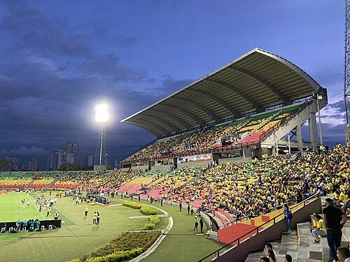
  • Américo Montanini Stadium

    Nikolaiky / CC BY-SA 4.0

    association football venue

    Américo Montanini Stadium

    football stadium

    Opening hours Not checked

    Admission Not checked

    Getting there Nearest stop or station Parque Estación UIS (plataforma oriental), about 9 min on foot OpenStreetMap
    Map

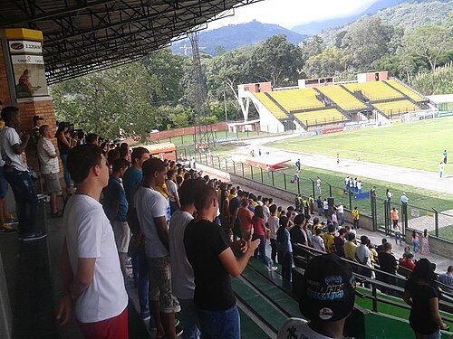
  • Estadio Álvaro Gómez Hurtado

    Juan José Moreno Correa / CC BY-SA 4.0

    stadium

    Estadio Álvaro Gómez Hurtado

    football stadium in the Colombian city of Floridablanca

    Opening hours Not checked

    Admission Not checked

    Getting there Nearest stop or station La Estancia, about 4 min on foot OpenStreetMap
    About 8 km from the city centre

    Map

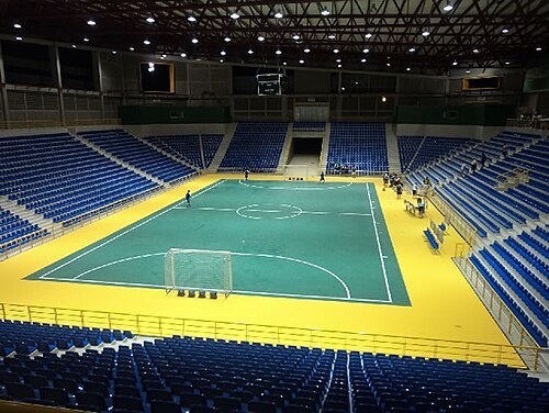
  • Coliseo Bicentenario

    RealNs7 / CC BY-SA 4.0

    venue

    Coliseo Bicentenario

    indoor arena in Bucaramanga, Colombia

    Opening hours Not checked

    Admission Not checked

    Getting there Nearest stop or station Parque Estación UIS (plataforma oriental), about 10 min on foot OpenStreetMap
    Map

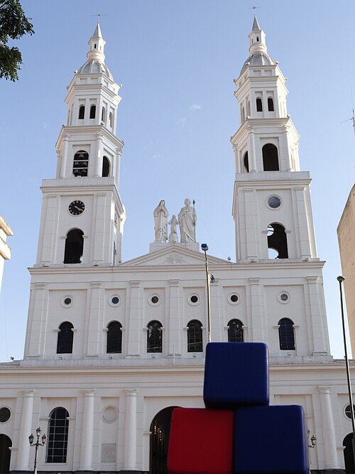
  • Catedral de la Sagrada Familia, Bucaramanga

    WebRatio Communications / CC BY 2.0

    catholic cathedral

    Catedral de la Sagrada Familia, Bucaramanga

    Opening hours Not checked

    Admission Not checked

    Getting there Nearest stop or station San Mateo, about 7 min on foot OpenStreetMap
    Map

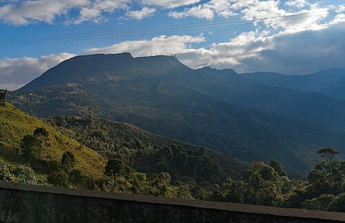
  • Cerro El Picacho

    EEIM / CC BY-SA 4.0

    mountain

    Cerro El Picacho

    mountain in Colombia
    Opening hours Not checked

    Admission Not checked

    About 16 km from the city centre

    Map

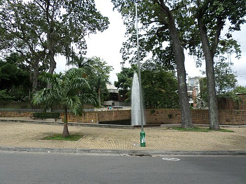
  • Parque del Agua

    EEIM / CC BY-SA 3.0

    park

    Parque del Agua

    park in Colombia
    Opening hours Not checked

    Admission Not checked

    Map

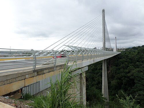
  • Provincial Viaduct

    EEIM / CC BY-SA 3.0

    bridge

    Provincial Viaduct

    bridge in Bucaramanga, Colombia

    Opening hours Not checked

    Admission Not checked

    Getting there Nearest stop or station La Rosita, about 16 min on foot OpenStreetMap

    Map

  • hill

    Cuchilla Los Argelinos

    hill in Colombia

    Opening hours Not checked

    Admission Not checked

    Map

  • hill

    Cuchilla Rionegro

    hill in Colombia

    Opening hours Not checked

    Admission Not checked

    About 16 km from the city centre

    Map

  • hill

    Cuchilla El Aliñadero

    hill in Colombia

    Opening hours Not checked

    Admission Not checked

    About 19 km from the city centre

    Map

  • hill

    Cuchilla Martín Gil

    hill in Colombia

    Opening hours Not checked

    Admission Not checked

    About 18 km from the city centre

    Map

  • hill

    Cuchilla Arnanía

    hill in Colombia

    Opening hours Not checked

    Admission Not checked

    About 14 km from the city centre

    Map

  • mountain

    Morro Ventanas

    mountain in Colombia

    Opening hours Not checked

    Admission Not checked

    About 10 km from the city centre

    Map

  • mountain

    Cerro Morronegro

    mountain in Colombia

    Opening hours Not checked

    Admission Not checked

    About 12 km from the city centre

    Map

  • hill

    Cuchilla de Cristales

    hill in Colombia

    Opening hours Not checked

    Admission Not checked

    About 15 km from the city centre

    Map

  • hill

    Cuchilla El Mourrido

    hill in Colombia

    Opening hours Not checked

    Admission Not checked

    About 15 km from the city centre

    Map

  • seasonal river

    Quebrada Calepato

    Opening hours Not checked

    Admission Not checked

    About 14 km from the city centre

    Map

  • seasonal river

    Quebrada Trinchera

    Intermittant stream in Colombia

    Opening hours Not checked

    Admission Not checked

    About 18 km from the city centre

    Map

  • hill

    Loma de Canelo

    hill in Colombia

    Opening hours Not checked

    Admission Not checked

    About 17 km from the city centre

    Map

  • mountain

    Alto El Cielo

    mountain in Colombia

    Opening hours Not checked

    Admission Not checked

    About 17 km from the city centre

    Map

  • mountain

    Alto La Esperanza

    mountain in Santander Department, Colombia

    Opening hours Not checked

    Admission Not checked

    About 9 km from the city centre

    Map

  • seasonal river

    Quebrada Chorrotarqo

    Opening hours Not checked

    Admission Not checked

    Map

  • hill

    Cuchilla San Ignacio

    hill in Colombia

    Opening hours Not checked

    Admission Not checked

    About 10 km from the city centre

    Map

  • river

    Cañada Cuñeros

    river in Colombia

    Opening hours Not checked

    Admission Not checked

    About 16 km from the city centre

    Map

  • hill

    Cuchilla de Magüeyes

    hill in Colombia

    Opening hours Not checked

    Admission Not checked

    About 13 km from the city centre

    Map

  • seasonal river

    Quebrada El Aburrido

    Opening hours Not checked

    Admission Not checked

    About 14 km from the city centre

    Map

  • seasonal river

    Quebrada El Cinto

    Opening hours Not checked

    Admission Not checked

    About 15 km from the city centre

    Map

  • seasonal river

    Quebrada Hoyarrica

    Opening hours Not checked

    Admission Not checked

    About 13 km from the city centre

    Map

  • seasonal river

    Quebrada Doscocos

    Opening hours Not checked

    Admission Not checked

    About 13 km from the city centre

    Map

  • river

    Cañada El Saman

    river in Colombia

    Opening hours Not checked

    Admission Not checked

    About 15 km from the city centre

    Map

  • seasonal river

    Quebrada La Alianza

    Opening hours Not checked

    Admission Not checked

    About 14 km from the city centre

    Map

  • bullring

    arènes Vistahermosa

    bullring

    Opening hours Not checked

    Admission Not checked

    Getting there Nearest stop or station La Estancia, about 6 min on foot OpenStreetMap

    About 9 km from the city centre

    Map

  • hill

    Cuchilla Palo Negro

    hill in Colombia

    Opening hours Not checked

    Admission Not checked

    Map

  • hill

    Cuchilla El Espino

    hill in Colombia

    Opening hours Not checked

    Admission Not checked

    About 9 km from the city centre

    Map

  • hill

    Cuchilla de San Juan

    hill in Colombia

    Opening hours Not checked

    Admission Not checked

    About 19 km from the city centre

    Map

  • mountain

    Cerro La Judía

    mountain in Colombia

    Opening hours Not checked

    Admission Not checked

    About 10 km from the city centre

    Map

  • seasonal river

    Quebrada Morronegro

    Opening hours Not checked

    Admission Not checked

    About 12 km from the city centre

    Map

  • river

    Cañada Del Oriente

    river in Colombia

    Opening hours Not checked

    Admission Not checked

    Getting there Nearest stop or station La Estancia, about 6 min on foot OpenStreetMap

    About 8 km from the city centre

    Map

  • mountain

    Alto Los Chorizos

    mountain in Colombia

    Opening hours Not checked

    Admission Not checked

    Map

  • mountain

    Alto Remoll

    mountain in Colombia

    Opening hours Not checked

    Admission Not checked

    About 11 km from the city centre

    Map

  • hill

    Lomas Los Loritos

    hill in Colombia

    Opening hours Not checked

    Admission Not checked

    About 13 km from the city centre

    Map

  • seasonal river

    Quebrada Niguas

    Opening hours Not checked

    Admission Not checked

    About 18 km from the city centre

    Map

  • mountain

    Alto La Paja

    mountain in Colombia

    Opening hours Not checked

    Admission Not checked

    About 13 km from the city centre

    Map

  • seasonal river

    Quebrada La Champa

    Opening hours Not checked

    Admission Not checked

    About 16 km from the city centre

    Map

  • stadium

    Coliseo Vicente Díaz Romero

    Sports Arena in Colombia

    Opening hours Not checked

    Admission Not checked

    Getting there Nearest stop or station Parque Estación UIS (plataforma oriental), about 11 min on foot OpenStreetMap

    Map

  • botanical garden

    Jardín botánico Eloy Valenzuela

    Eloy Valenzuela Botanical Garden

    Opening hours Not checked

    Admission Not checked

    Getting there Nearest stop or station Despacho Caracolí, about 12 min on foot OpenStreetMap

    Map

  • mountain

    Loma Las Burras

    mountain in Colombia

    Opening hours Not checked

    Admission Not checked

    About 14 km from the city centre

    Map

  • hill

    Loma Mesa de Ruitoque

    hill in Colombia

    Opening hours Not checked

    Admission Not checked

    About 11 km from the city centre

    Map

  • hill

    Mesa Rulique

    hill in Colombia

    Opening hours Not checked

    Admission Not checked

    About 13 km from the city centre

    Map

  • seasonal river

    Quebrada Suratoque

    Opening hours Not checked

    Admission Not checked

    Getting there Nearest stop or station Estación de Transferencia Cañaveral, about 8 min on foot OpenStreetMap

    Map

  • lagoon

    Lago de Florida

    lagoon in Colombia

    Opening hours Not checked

    Admission Not checked

    Getting there Nearest stop or station Estación de Transferencia Cañaveral, about 5 min on foot OpenStreetMap

    Map

  • seasonal river

    Quebrada La Cuellar

    Opening hours Not checked

    Admission Not checked

    Map

  • river

    Cañada Guacamaya

    river in Colombia

    Opening hours Not checked

    Admission Not checked

    Getting there Nearest stop or station Terminal de Transportes de Bucaramanga, about 13 min on foot OpenStreetMap

    Map

  • seasonal river

    Quebrada Hoyochiquito

    Opening hours Not checked

    Admission Not checked

    Getting there Nearest stop or station Terminal de Buses de Piedecuesta, about 10 min on foot OpenStreetMap

    About 16 km from the city centre

    Map

Places to eat

  • restaurant

    Cure Cuisine

    Food: lebanese, mediterranean, middle eastern

    Mo-Sa 11:30-21:30; Su 11:30-16:00

    Bucaramanga

    Map

  • restaurant

    Il Napolitano

    Food: italian

    Mo-We 12:00-22:00; Th-Sa 12:00-23:00; PH 12:00-21:00

    Bucaramanga

    Map

  • restaurant

    Jungla – A base de planta

    Food: burger, friture, hotdog, mexican, regional

    Mo, We-Th 10:00-21:30; Tu 10:00-15:00, 17:00-21:30; Fr-Su 10:00-22:00

    Map

  • restaurant

    Mikaela

    Food: regional

    Mo-Su 10:30-15:00

    Map

  • restaurant

    Camacho's Megamall

    Food: burger

    Mo-Su 11:00-22:00

    BUCARAMANGA

    Map

  • restaurant

    Che Porteño

    Food: argentinian

    Tu-Su 12:00-23:00

    Bucaramanga

    Map

  • restaurant

    Delicias Naturales - Restaurante Vegano

    Food: colombian

    Mo-Th 09:00-18:00; Fr 09:00-16:30; Sa off; Su 11:00-15:00

    Bucaramanga

    Map

  • restaurant

    LAB Laboratorio Gastronómico

    Food: fast food

    Mo,We-Sa 12:00-14:30,18:00-23:00; Tu 17:30-23:00; Su 12:00-15:00,18:00-22:00

    Bucaramanga

    Map

  • restaurant

    Tokima

    Food: sushi, peruvian, tacos

    Mo-Fr 12:00-15:00

    Bucaramanga

    Map

  • restaurant

    Restaurante Bacatá

    Food: regional

    Mo-Sa 06:00-20:00

    Bucaramanga

    Map

Opening hours and tickets: OpenStreetMap contributors. Each one shows the day a volunteer last wrote it down, so check the official site before you set out.

Nothing picked yet
    Add a place that is not listed here

    One per line. Pasting a list works too.

    Colombia