Iquique: what to see and where to eat
Everything below comes from open data and each row says where it came from. We have not been to any of these places and we do not rank them.
Filters
Things to see
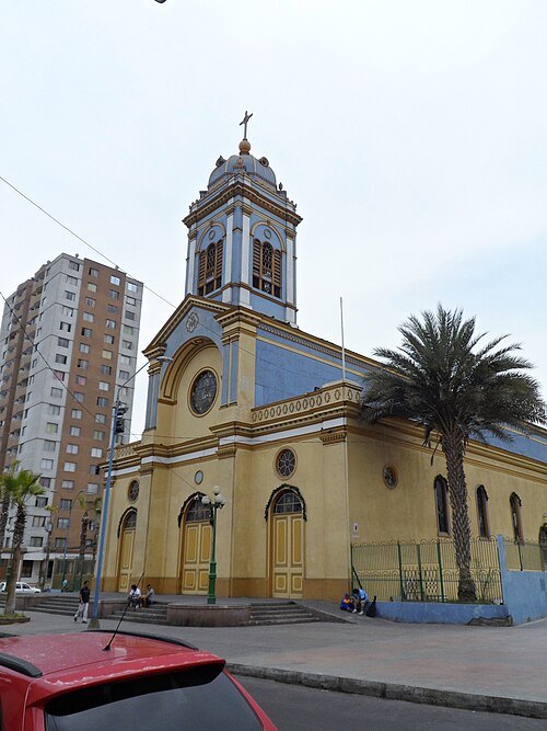 cathedral
Immaculate Conception Cathedral, Iquique
national monument of Chile
Getting there Nearest stop or station Terminal Turbus, about 1 min on foot OpenStreetMap
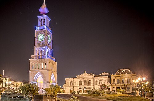
Freddy Alexander Bugueño Tolmo / CC BY-SA 3.0
clock towerClock Tower
in Iquique, Chile
Getting there Nearest stop or station Terminal Turbus, about 7 min on foot OpenStreetMap
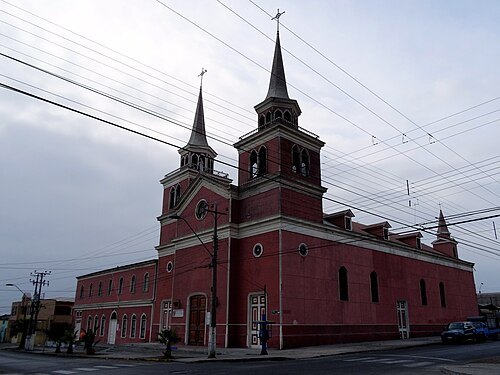
Oscar Fernández H. / CC BY-SA 3.0
church buildingchurch of Saint Anthont of Padua
Catholic church in Iquique and national monument of Chile
Getting there Nearest stop or station Terminal Turbus, about 16 min on foot OpenStreetMap
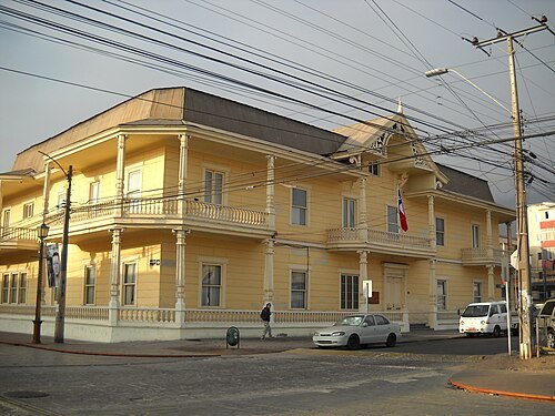 cultural property
Palacio Astoreca, Iquique
national monument of Chile
Getting there Nearest stop or station Terminal Turbus, about 13 min on foot OpenStreetMap
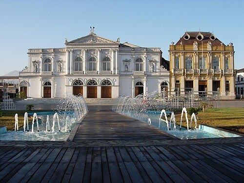 theatre building
Municipal Theatre of Iquique
theatre in Iquique, Chile
Getting there Nearest stop or station Terminal Turbus, about 8 min on foot OpenStreetMap
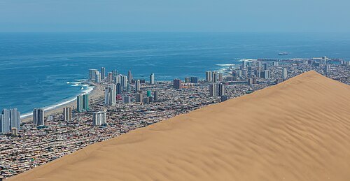 cultural property
Cerro Dragón
national monument of Chile
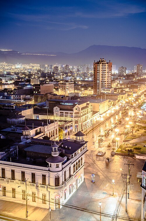
Freddy Alexander Bugueño Tolmo / CC BY-SA 3.0
streetBaquedano Street
street in Iquique, Chile
Getting there Nearest stop or station Terminal Turbus, about 7 min on foot OpenStreetMap
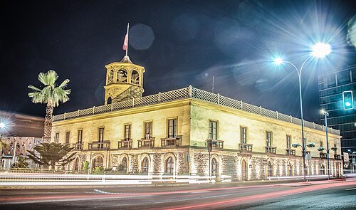
Freddy Alexander Bugueño Tolmo / CC BY-SA 3.0
cultural propertyAduana de Iquique
national monument of Chile
Getting there Nearest stop or station Terminal Turbus, about 6 min on foot OpenStreetMap
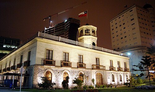
Richardfotografias / CC BY-SA 3.0
history museumNaval Museum of Iquique
Getting there Nearest stop or station Terminal Turbus, about 6 min on foot OpenStreetMap
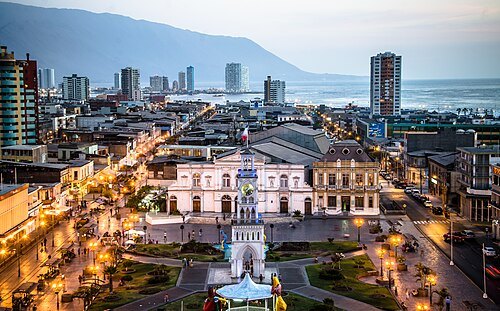
Freddy Alexander Bugueño Tolmo / CC BY-SA 3.0
cultural propertyPaseo Baquedano
national monument of Chile
Getting there Nearest stop or station Terminal Turbus, about 7 min on foot OpenStreetMap
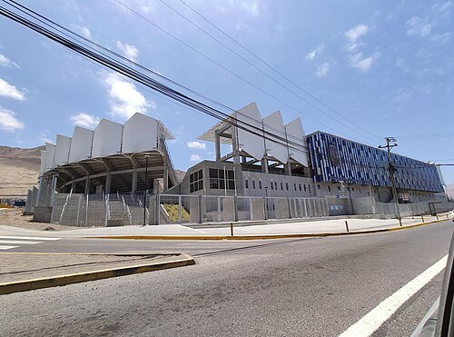
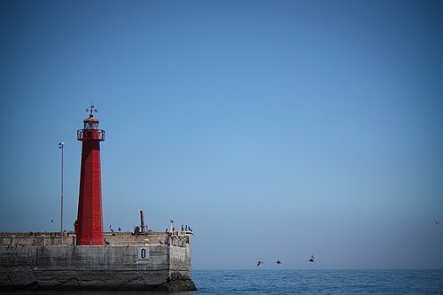
Denise Ruiz-Aburto Aguilar / CC BY 2.0
lighthouseIquique lighthouses
lighthouse in Chile
Getting there Nearest stop or station Terminal Rodoviario de Iquique, about 18 min on foot OpenStreetMap
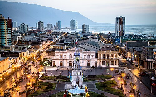
Freddy Alexander Bugueño Tolmo / CC BY-SA 3.0
monumentPlaza Arturo Prat
place in Iquique, Chile
Getting there Nearest stop or station Terminal Turbus, about 7 min on foot OpenStreetMap
- mountain
Cerro Minas Viejas
mountain in Chile
- mountain
Cerro Montecristo
mountain in Chile
- mountain
Cerro Riquelme
mountain in Chile
- mountain
Cerro Santa Rosa
mountain in Chile
- peninsula
Punta Negra
peninsula in Chile - Tarapaca Region
- peninsula
Punta Piedras
peninsula in Tarapacá Region, Chile
- mountain
Cerro Guantaca
mountain in Chile
- mountain
Cerro Huantajaya
mountain in Chile
- mountain
Cerro Gris
mountain in Chile
- mountain
Cerro El Toro
mountain in Chile
- beach
Playa El Colorado
Getting there Nearest stop or station Punta Negra, about 11 min on foot OpenStreetMap
- hill
Descubridora
hill in Tarapacá Region, Chile
- mountain
Cerro Covadonga
mountain in Tarapacá Region, Chile
- peninsula
Punta Colorada
peninsula in Tarapacá Region, Chile
- mountain
Cerro del Anzuelo
mountain in Chile
- mountain
Cerro Aldea
mountain in Tarapacá Region, Chile
- bay
Caleta Molle
bay in Tarapacá Region, Chile
- mountain
Rocas Miami
mountain in Chile
- island
Isla Serrano
Getting there Nearest stop or station Terminal Rodoviario de Iquique, about 16 min on foot OpenStreetMap
- mountain
Cerro Vista Faro
mountain in Chile
- peninsula
Punta Morro
Getting there Nearest stop or station Terminal Turbus, about 19 min on foot OpenStreetMap
- peninsula
Punta Redonda
peninsula in Tarapacá Region, Chile
- beach
Playa Larga
beach in Tarapacá Region, Chile
- peninsula
Punta Larga
peninsula in Tarapacá Region, Chile
- peninsula
Punta Gruesa
peninsula in Tarapacá Region, Chile
- bay
Chiquinata Bay
bay in Tarapacá Region, Chile
- peninsula
Punta Cavancha
peninsula in Tarapacá Region, Chile
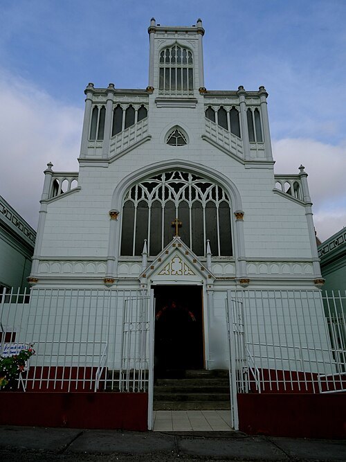
Oscar Fernández H. / CC BY-SA 3.0
church buildingIglesia del Buen Pastor, Iquique
church building in municipality Iquique, Chile


Places to eat
- restaurant
El Tercer Ojito
Food: regional
Nothing here matches that. Clear a filter and try again.
Opening hours and tickets: OpenStreetMap contributors. Each one shows the day a volunteer last wrote it down, so check the official site before you set out.