Châu Đốc: what to see and where to eat
Everything below comes from open data and each row says where it came from. We have not been to any of these places and we do not rank them.
Filters
Things to see
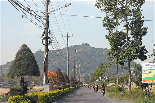
Jean-Pierre Dalbéra from Paris, France / CC BY 2.0
hillMount Sam
hill in Vietnam
Getting there Nearest stop or station Nhà ga Cáp treo Núi Sam, about 16 min on foot OpenStreetMap
- mosque
Mubarak Mosque
mosque in Phú Tân, An Giang, Vietnam
Getting there Nearest stop or station Phà Châu Giang, about 2 min on foot OpenStreetMap
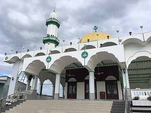
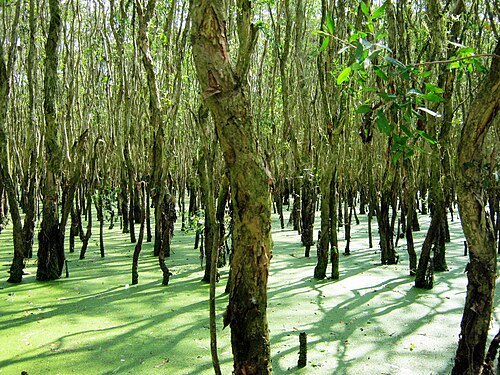
Bùi Thụy Đào Nguyên / CC BY-SA 3.0
forestTra Su Forest
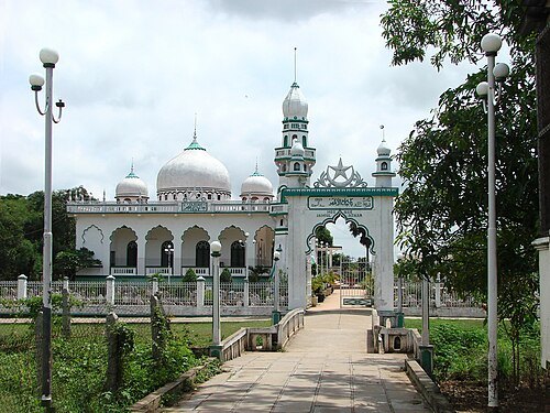
Adam Jones Adam63 / CC BY-SA 3.0
mosqueJamiul Azhar Mosque
mosque in An Giang, Vietnam
Getting there Nearest stop or station Phà Châu Giang, about 11 min on foot OpenStreetMap
- canal
Kinh Thân Nông
canal in Vietnam
- bridge
Tan An Bridge
bridge in An Giang, Vietnam
- canal
Kinh Số Hai
canal in Vietnam
- canal
Kinh Vĩnh An
canal in Vietnam
Getting there Nearest stop or station Phà Châu Giang, about 16 min on foot OpenStreetMap
- island
Cù Lao Bà
island in Vietnam
- island
Cù Lao Cỏ Tam Bôn
island in Vietnam
- canal
Kinh Bẩy Núi
canal in Vietnam
- river
Prêk Kbal Buŏn
river in Vietnam
- river
Prêk Moăt Chruk
river in Vietnam
- river
Rạch Cây Duong
river in Vietnam
Getting there Nearest stop or station Bến xe Tịnh Biên, about 6 min on foot OpenStreetMap
- river
Rạch Cây Dương
river in Vietnam
Getting there Nearest stop or station Bến xe Tịnh Biên, about 6 min on foot OpenStreetMap
- river
Rạch Cần Thảo
river in Vietnam
- river
Stœ̆ng Takêv
river in Vietnam
- bridge
Chau Doc Bridge
bridge spanning the Bassac River in An Giang, Vietnam
Getting there Nearest stop or station Bến xe Châu Đốc, about 20 min on foot OpenStreetMap


Places to eat
- restaurant
Mạnh Tường
Food: regional
Nothing here matches that. Clear a filter and try again.
Opening hours and tickets: OpenStreetMap contributors. Each one shows the day a volunteer last wrote it down, so check the official site before you set out.