Nong Khai: what to see and where to eat

Everything below comes from open data and each row says where it came from. We have not been to any of these places and we do not rank them.

48,274 people live here

Nearest airport: Wattay International Airport (VTE), about 22.44 km from the centre

Distances are straight-line and the walking time is an estimate, not a route.

Filters

Things to see

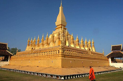
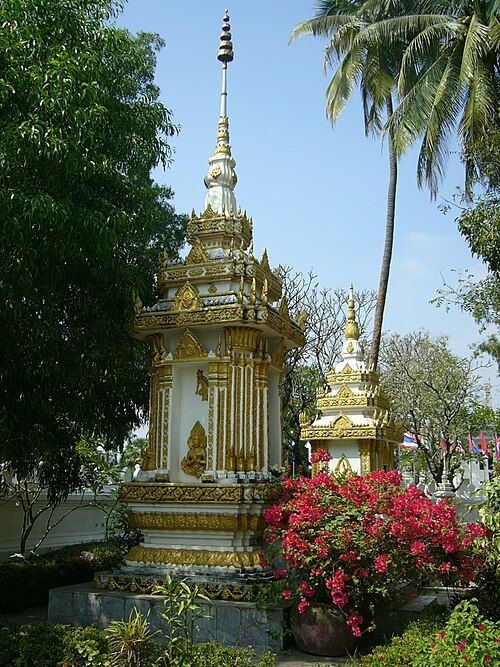
  • Pha That Luang

    Jialiang Gao www.peace-on-earth.org / CC BY-SA 3.0

    stupa

    Pha That Luang

    Laotian Buddhist stupa

    Mo-Su 8:00-17:00 OpenStreetMap, written 2024-10-31

    Ticket needed OpenStreetMap, written 2024-10-31

    Getting there Nearest stop or station BRT - ສະຖານີພິພິທະພັນປ້ອງກັນຄວາມສະຫງົບ, about 10 min on foot OpenStreetMap
    About 16 km from the city centre

    Map

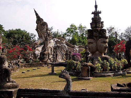
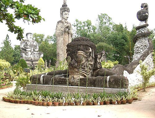
  • Buddha Park

    Dezwitser / CC BY-SA 3.0

    sculpture garden

    Buddha Park

    sculpture garden in Laos

    Mo-Su 09:00-17:00 OpenStreetMap, written 2026-01-21

    Admission Not checked

    Map

  • Sala Keoku

    Der aus Uebersee kommt / CC BY-SA 3.0

    sculpture garden

    Sala Keoku

    sculpture garden

    Opening hours Not checked

    Admission Not checked

    Map

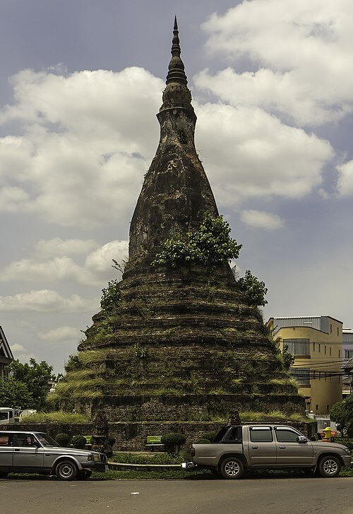
  • That Dam

    Stefan Fussan / CC BY-SA 3.0

    stupa

    That Dam

    place of worship in Laos

    24/7 OpenStreetMap, written 2026-08-04

    Admission Not checked

    Getting there Nearest stop or station BRT - Talat Sao (Morning Market), about 8 min on foot OpenStreetMap
    About 17 km from the city centre

    Map

  • wat

    Wat Si Chomphu Ong Tue

    Buddhist temple in Nong Khai province, Thailand

    Opening hours Not checked

    Admission Not checked

    About 18 km from the city centre

    Map

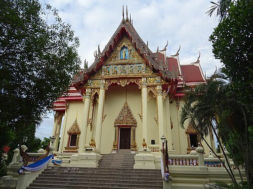
  • Wat Pho Chai

    Christophe95 / CC BY-SA 4.0

    wat

    Wat Pho Chai

    Buddhist temple in Nong Khai province, Thailand

    Opening hours Not checked

    Admission Not checked

    Getting there Nearest stop or station Nongkhai Bus Terminal, about 4 min on foot OpenStreetMap
    Map

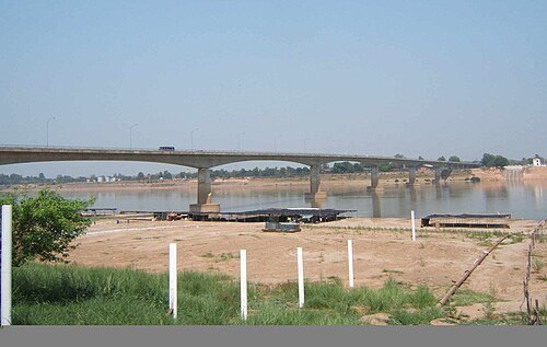
  • First Thai–Lao Friendship Bridge

    Unknown / CC BY-SA 3.0

    road-rail bridge

    First Thai–Lao Friendship Bridge

    Bridge over Mekong River

    Opening hours Not checked

    Admission Not checked

    Map

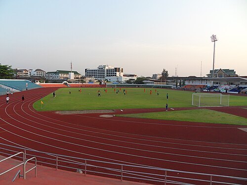
  • Laos National Stadium

    Chaoborus / CC BY-SA 3.0

    sports venue

    Laos National Stadium

    multi-purpose stadium in Vientiane, Laos

    Opening hours Not checked

    Admission Not checked

    Getting there Nearest stop or station BRT - Talat Sao (Morning Market), about 14 min on foot OpenStreetMap
    About 17 km from the city centre

    Map

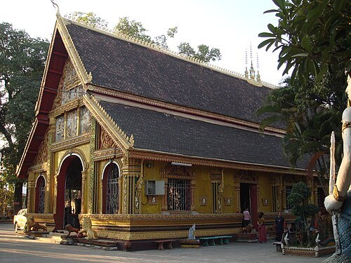
  • Wat Si Saket

    User:Mattes / Public domain

    wat

    Wat Si Saket

    wat in Vientiane, Laos

    Opening hours Not checked

    Admission Not checked

    Getting there Nearest stop or station Central Bus Station II, about 7 min on foot OpenStreetMap
    About 17 km from the city centre

    Map

  • Wat Si Muang

    Ondřej Žváček / CC BY 2.5

    wat

    Wat Si Muang

    Wat Si Muang in Vientiane, Laos

    Opening hours Not checked

    Admission Not checked

    Getting there Nearest stop or station Central Bus Station II, about 8 min on foot OpenStreetMap

    About 16 km from the city centre

    Map

  • national library

    National Library of Laos

    national library

    Opening hours Not checked

    Admission Not checked

    Getting there Nearest stop or station Central Bus Station (CBS-1), about 12 min on foot OpenStreetMap
    About 17 km from the city centre

    Map

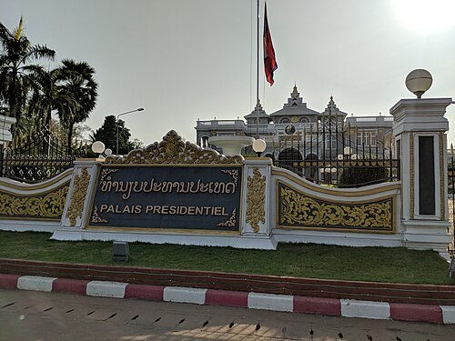
  • Presidential Palace

    Ryuch / CC BY-SA 4.0

    presidential palace

    Presidential Palace

    Presidential Palace in Vientiane, Laos

    Opening hours Not checked

    Admission Not checked

    Getting there Nearest stop or station Central Bus Station II, about 9 min on foot OpenStreetMap
    About 17 km from the city centre

    Map

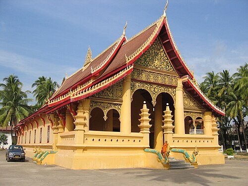
  • Wat Ong Teu Mahawihan

    Grossbildjaeger / CC BY-SA 3.0

    wat

    Wat Ong Teu Mahawihan

    Buddhist monastery in Vientiane, Laos

    Opening hours Not checked

    Admission Not checked

    Getting there Nearest stop or station BRT - Talat Sao (Morning Market), about 19 min on foot OpenStreetMap
    About 18 km from the city centre

    Map

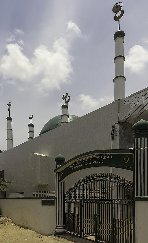
  • Vientiane Jamia Mosque

    Stefan Fussan / CC BY-SA 3.0

    mosque

    Vientiane Jamia Mosque

    mosque in Vientiane, Laos

    Opening hours Not checked

    Admission Not checked

    Getting there Nearest stop or station BRT - Talat Sao (Morning Market), about 11 min on foot OpenStreetMap
    About 17 km from the city centre

    Map

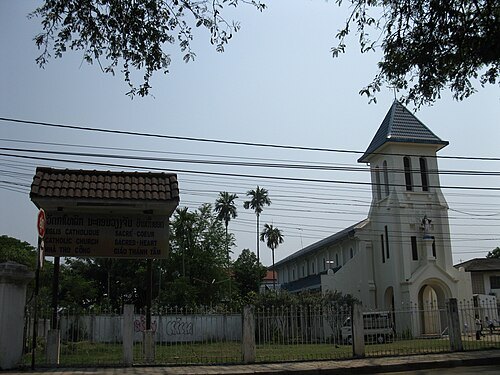
  • Sacred Heart Cathedral, Vientiane

    Torbenbrinker / CC BY-SA 3.0

    cathedral

    Sacred Heart Cathedral, Vientiane

    church in Vientiane, Laos

    Opening hours Not checked

    Admission Not checked

    Getting there Nearest stop or station Central Bus Station II, about 2 min on foot OpenStreetMap

    About 16 km from the city centre

    Map

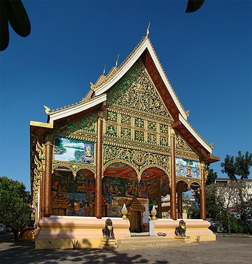
  • museum

    Kaysone Phomvihane Museum

    museum in Vientiane, Laos

    Opening hours Not checked

    Admission Not checked

    Getting there Nearest stop or station BRT - ສະຖານີຫໍພິພິທະພັນໄກສອນພົມວິຫານ, about 3 min on foot OpenStreetMap
    About 17 km from the city centre

    Map

  • mosque

    Azahar Mosque

    mosque in Vientiane, Laos

    Opening hours Not checked

    Admission Not checked

    About 19 km from the city centre

    Map

  • Wat Inpeng

    Tango7174 / CC BY-SA 4.0

    wat

    Wat Inpeng

    Buddhist temple in Vientiane, Laos

    Opening hours Not checked

    Admission Not checked

    About 18 km from the city centre

    Map

Places to eat

Opening hours and tickets: OpenStreetMap contributors. Each one shows the day a volunteer last wrote it down, so check the official site before you set out.

Nothing picked yet
    Add a place that is not listed here

    One per line. Pasting a list works too.

    Thailand