Seoul: what to see and where to eat
Everything below comes from open data and each row says where it came from. We have not been to any of these places and we do not rank them.
Filters
Things to see
- palace
Changdeokgung
palace in Seoul, South Korea
Getting there Nearest stop or station Anguk, about 9 min on foot OpenStreetMap
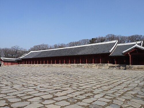 confucian royal ancestral shrine
Jongmyo
royal Confucian shrine in Seoul, South Korea
Getting there Nearest stop or station Jongno 3(sam)-ga, about 6 min on foot OpenStreetMap
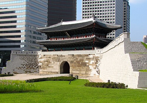 city gate
Namdaemun
main gate of Seoul fortress; one of The Four Great Gates (cardinal) as one of The Eight Gates of Seoul as part of the Fortress Wall of Seoul, South Korea
Getting there Nearest stop or station Hoehyeon, about 5 min on foot OpenStreetMap
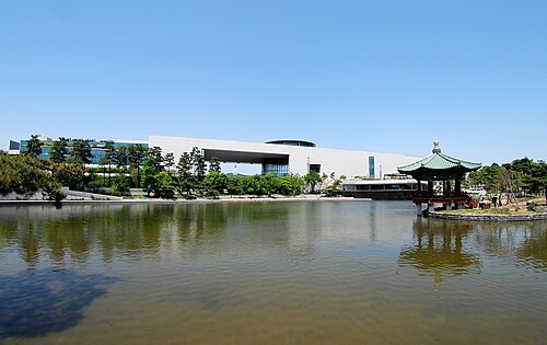 national museum
National Museum of Korea
Museum located in Seoul, Republic of Korea
Getting there Nearest stop or station Ichon, about 10 min on foot OpenStreetMap
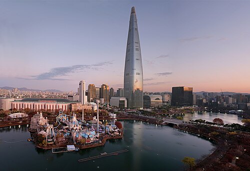 skyscraper
Lotte World Tower
Skyscraper in Seoul, South Korea
Getting there Nearest stop or station Jamsil Metro Transfer Center, about 2 min on foot OpenStreetMap
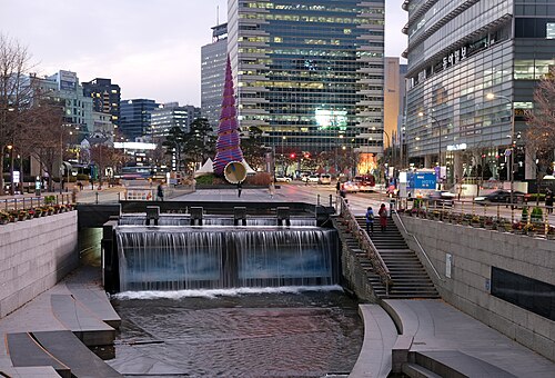
kallerna This photo was taken with Fujifilm X-T30 / CC BY-SA 4.0
linear parkCheonggyecheon
stream in Seoul, South Korea
Getting there Nearest stop or station Gwanghwamun, about 5 min on foot OpenStreetMap
- architectural landmark
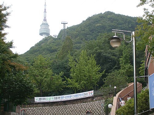
Namsan Seoul Tower
communications tower in Seoul, South Korea
Getting there Nearest stop or station Namsan Cable Car, about 2 min on foot OpenStreetMap
- palace
Deoksugung
palace
Getting there Nearest stop or station City Hall, about 3 min on foot OpenStreetMap
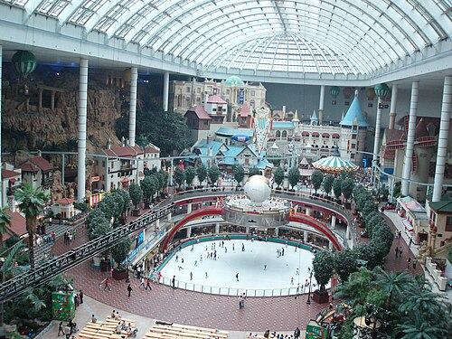 theme park
Lotte World
Indoor amusement park in Seoul
Getting there Nearest stop or station 잠실역시외버스정류소, about 3 min on foot OpenStreetMap
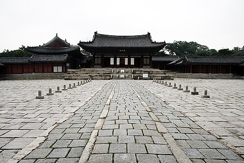
d'n'c (a flickr user) / CC BY-SA 2.0
palaceChanggyeonggung
palace
Getting there Nearest stop or station Hyehwa, about 10 min on foot OpenStreetMap
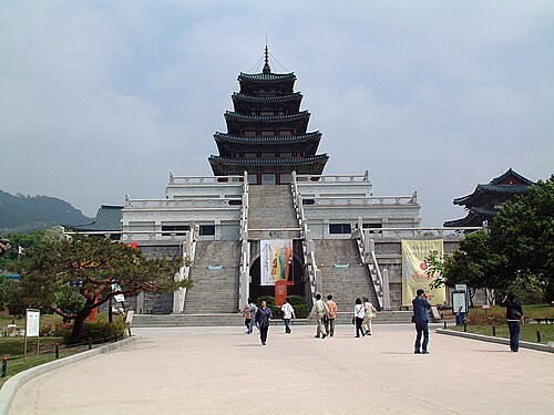 national museum
National Folk Museum of Korea
national museum in Seoul, South Korea
Getting there Nearest stop or station Gyeongbokgung, about 13 min on foot OpenStreetMap
- palace
Gyeonghuigung
Gyeonghui Palace (in Korean: Gyeonghuigung, literally Palace of Serene Harmony) was a palace located in Seoul, South Korea. It was one of the "Five Grand Palaces" built by the Joseon Dynasty.
Getting there Nearest stop or station Seodaemun, about 10 min on foot OpenStreetMap
- mosque
Seoul Central Mosque
mosque in Seoul, South Korea
Getting there Nearest stop or station Itaewon, about 5 min on foot OpenStreetMap
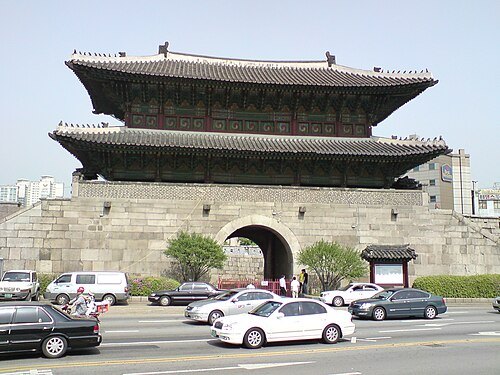 city gate
Heunginjimun
one of The Four Great Gates (cardinal) as one of The Eight Gates of Seoul as part of the Fortress Wall of Seoul, South Korea
Getting there Nearest stop or station Dongdaemun, about 1 min on foot OpenStreetMap
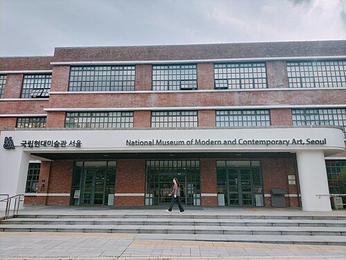 national museum
National Museum of Modern and Contemporary Art, South Korea
national museum
Getting there Nearest stop or station Anguk, about 9 min on foot OpenStreetMap
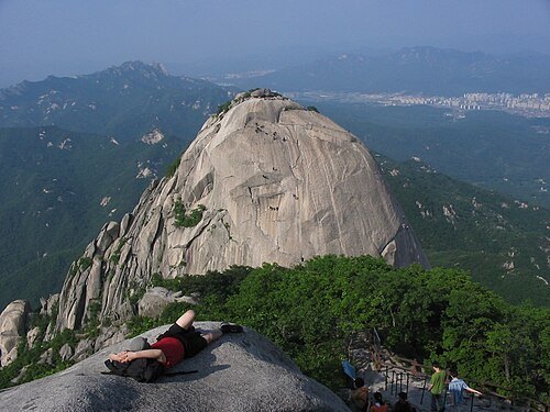
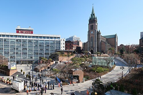
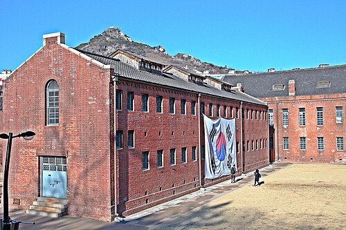 historic site
Seodaemun Prison
prison museum in Seoul
Getting there Nearest stop or station Dongnimmun, about 2 min on foot OpenStreetMap
- gate
Independence Gate
memorial gate in Seoul celebrating independence from Qing China
Getting there Nearest stop or station Dongnimmun, about 4 min on foot OpenStreetMap
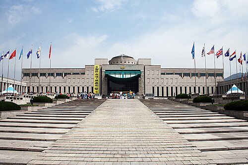 military museum
War Memorial of Korea
military museum
Getting there Nearest stop or station Samgakji, about 5 min on foot OpenStreetMap
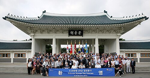
Republic of Korea from Seoul, Republic of Korea / CC BY-SA 2.0
national cemeterySeoul National Cemetery
South Korean cemetery
Getting there Nearest stop or station Dongjak, about 11 min on foot OpenStreetMap
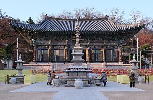
- pagoda
Wongaksa Pagoda
Stone pagoda in Seoul, South Korea
Getting there Nearest stop or station Jongno 3(sam)-ga, about 3 min on foot OpenStreetMap
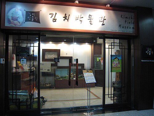 museum
Museum Kimchikan
museum
Getting there Nearest stop or station Bongeunsa, about 4 min on foot OpenStreetMap
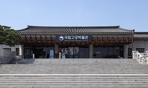 national museum
National Palace Museum of Korea
national museum
Getting there Nearest stop or station Gyeongbokgung, about 3 min on foot OpenStreetMap
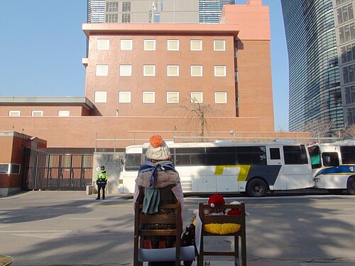 statue
Statue of Peace
memorial statue
Getting there Nearest stop or station Gwanghwamun, about 7 min on foot OpenStreetMap
- park
Tapgol Park
park in Seoul, South Korea
Getting there Nearest stop or station Jongno 3(sam)-ga, about 4 min on foot OpenStreetMap
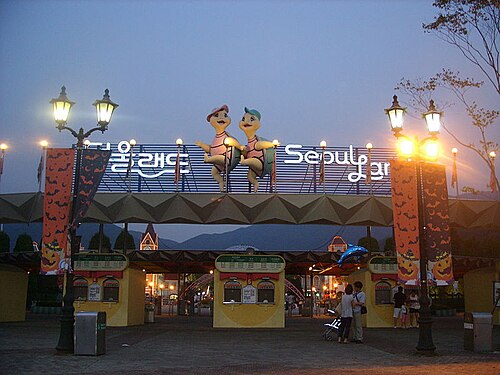 amusement park
Seoul Land
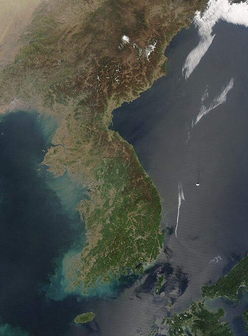
Jeff Schmaltz, MODIS Rapid Response Team, NASA/GSFC / Public domain
peninsulaKorean Peninsula
peninsula in East Asia
Getting there Nearest stop or station Sinbanpo, about 8 min on foot OpenStreetMap
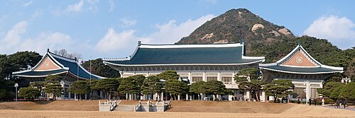 presidential palace
Blue House
former official residence of the president of South Korea
Getting there Nearest stop or station Gyeongbokgung, about 19 min on foot OpenStreetMap
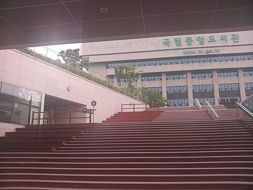 national library
National Library of Korea
the national library of South Korea
Getting there Nearest stop or station Central City Bus Terminal, about 11 min on foot OpenStreetMap
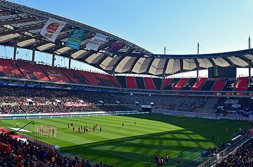
- olympic stadium
Seoul Olympic Main Stadium
stadium located in Seoul, South Korea
Getting there Nearest stop or station Sports Complex, about 8 min on foot OpenStreetMap
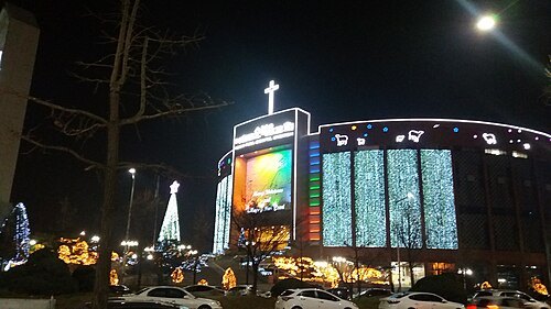 church building
Yoido Full Gospel Church
Pentecostal church
Getting there Nearest stop or station National Assembly, about 9 min on foot OpenStreetMap
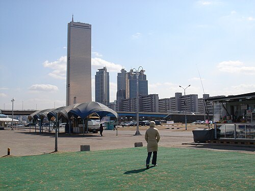
Pavel Kanzelsberger / Public domain
skyscraper63 Building
skyscraper in South Korea
Getting there Nearest stop or station Noryangjin, about 10 min on foot OpenStreetMap
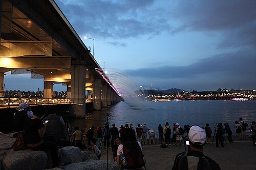
Bryan Dorrough / Public domain
girder bridgeBanpo Bridge
girder bridge
Getting there Nearest stop or station Seobinggo, about 12 min on foot OpenStreetMap
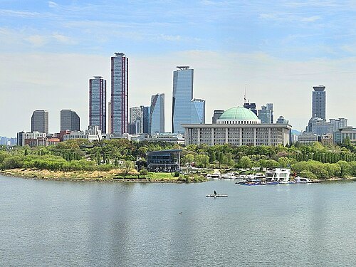 river island
Yeouido
island in the Han River
Getting there Nearest stop or station National Assembly, about 7 min on foot OpenStreetMap
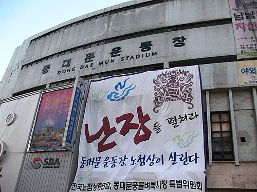 defunct sports venue
Dongdaemun Stadium
demolished stadium in Seoul, South Korea
Getting there Nearest stop or station Dongdaemun History & Culture Park Station (DDP), about 4 min on foot OpenStreetMap
- sports venue
Gocheok Sky Dome
Domed baseball stadium located in Gocheok-dong, Seoul, South Korea.
Getting there Nearest stop or station Guil, about 6 min on foot OpenStreetMap
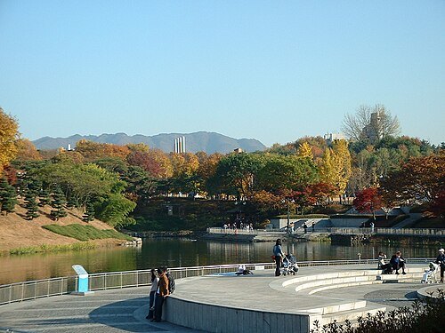
by nagyman (a flickr user) / CC BY-SA 2.0
parkOlympic Park
park in Seoul, South Korea
Getting there Nearest stop or station Hanseong Baekje, about 11 min on foot OpenStreetMap
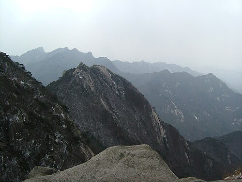
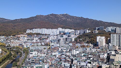
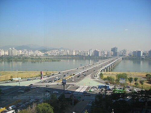
Bobbie (a flickr user) / CC BY 2.0
road bridgeMapo Bridge
bridge in Seoul
Getting there Nearest stop or station Hangang Bus Yeouido Terminal, about 9 min on foot OpenStreetMap
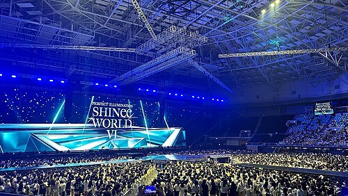 arena
Olympic Gymnastics Arena
arena in South Korea
Getting there Nearest stop or station Olympic Park, about 7 min on foot OpenStreetMap
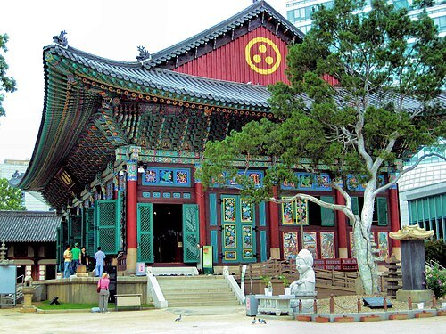 korean buddhist temple
Jogyesa
Buddhist temple in Seoul, South Korea
Getting there Nearest stop or station Jonggak, about 7 min on foot OpenStreetMap
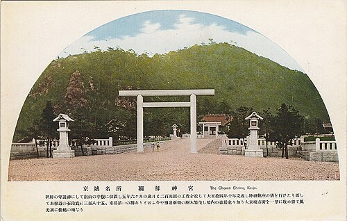 shinmei shrine
Chōsen Jingū
1925–1945 Shinto shrine in Seoul, Korea
Getting there Nearest stop or station Namsan Cable Car, about 5 min on foot OpenStreetMap
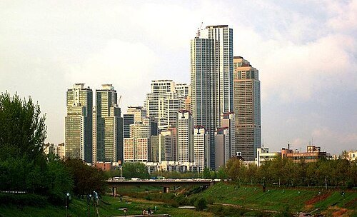 skyscraper
Samsung Tower Palace
skyscraper
Getting there Nearest stop or station Dogok, about 4 min on foot OpenStreetMap
- archaeological site
Amsa-dong
neighborhood in Gangdong-gu, Seoul, South Korea
Getting there Nearest stop or station Amsa History Park, about 12 min on foot OpenStreetMap
- city gate
Donuimun
one of The Four Great Gates (cardinal) as one of The Eight Gates of Seoul as part of the Fortress Wall of Seoul, South Korea
Getting there Nearest stop or station Seodaemun, about 5 min on foot OpenStreetMap
- stadium
Jamsil Baseball Stadium
baseball stadium in Songpa-gu, Seoul, South Korea
Getting there Nearest stop or station Sports Complex, about 3 min on foot OpenStreetMap
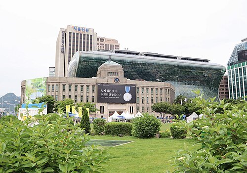
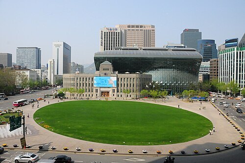 square
Seoul Plaza
square in Seoul, South Korea
Getting there Nearest stop or station City Hall, about 1 min on foot OpenStreetMap
- library
Kyujanggak
Korean library
Getting there Nearest stop or station Gwanaksan, about 13 min on foot OpenStreetMap
- city gate
Sukjeongmun


Places to eat
- cafe
빙빙빙 삼청점
Food: ice cream
- restaurant
옴 레스토랑 & 카페
Food: indian
- restaurant
청우림
Food: regional, korean
- cafe
커피빈 하나은행경복궁역점
Food: coffee shop
- cafe
커피스트
Food: coffee shop
- restaurant
콩불
Food: local
- restaurant
거북이의 주방
Food: japanese curry & asian fusions
- restaurant
교동집
Food: spicy(fiery) webfoot octopus
- restaurant
김돈이
Food: korean bbq
- restaurant
장꼬방
Food: patbingsu (red been ice flake), red been soup, chapssaltteok (korean-style mochi)
- cafe
Tom N Toms
Food: coffee shop, pretzel, smoothie, tea, bread
Nothing here matches that. Clear a filter and try again.
Opening hours and tickets: OpenStreetMap contributors. Each one shows the day a volunteer last wrote it down, so check the official site before you set out.