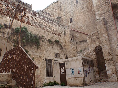
Nablus: what to see and where to eat

Everything below comes from open data and each row says where it came from. We have not been to any of these places and we do not rank them.

60,000 people live here

Distances are straight-line and the walking time is an estimate, not a route.

Filters

Things to see

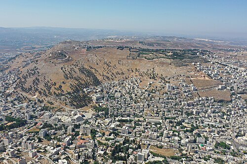
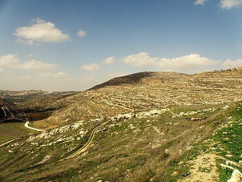
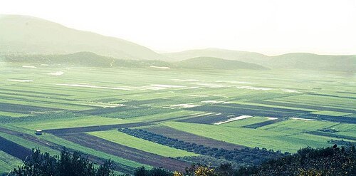
  • Mount Gerizim

    יאיר דב / CC BY-SA 4.0

    mountain

    Mount Gerizim

    mountain in Judea and Samaria Area, Palestine

    Opening hours Not checked

    Admission Not checked

    Map

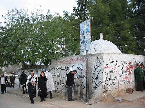
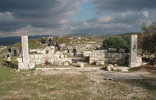
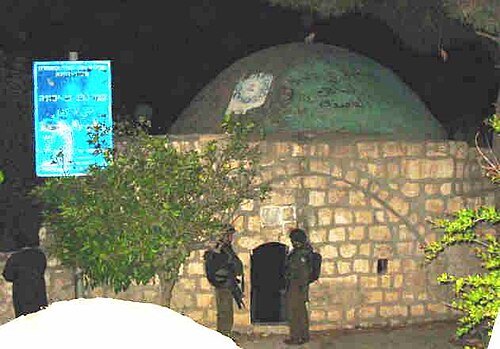
  • Tomb of Joshua

    Shuki / CC BY 2.5

    archaeological site

    Tomb of Joshua

    Biblical figure tomb in the West Bank

    Opening hours Not checked

    Admission Not checked

    About 15 km from the city centre

    Map

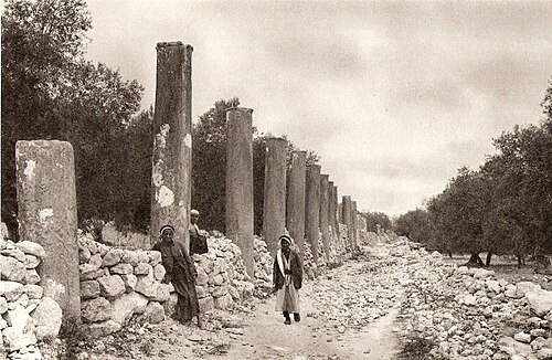
  • Samaria

    Unknown / Public domain

    archaeological site

    Samaria

    ancient city in the West Bank, Palestine

    Opening hours Not checked

    Admission Not checked

    About 9 km from the city centre

    Map

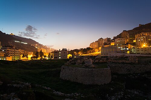
  • Shechem

    Ibrahim Dwaikat / CC BY-SA 3.0

    ancient city

    Shechem

    ancient Canaanite and Israelite city in central Samaria in the West Bank

    Opening hours Not checked

    Admission Not checked

    Map

  • Shiloh

    RonAlmog from Israel (ישראל) / CC BY 2.0

    ancient city

    Shiloh

    Biblical city

    Opening hours Not checked

    Admission Not checked

    About 19 km from the city centre

    Map

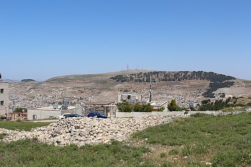
  • Mount Ebal

    Deror_avi / CC BY-SA 3.0

    mountain

    Mount Ebal

    mountain in the immediate vicinity of the city of Nablus in the West Bank

    Opening hours Not checked

    Admission Not checked

    Map

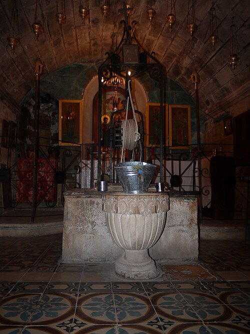
  • Jacob's Well

    Jeremiah K Garrett / CC BY-SA 3.0

    archaeological site

    Jacob's Well

    Biblical place at the West Bank

    Opening hours Not checked

    Admission Not checked

    Map

  • archaeological site

    Tirzah

    ancient Samarian town

    Opening hours Not checked

    Admission Not checked

    About 10 km from the city centre

    Map

  • national park

    Alexander

    river in Israel and the West Bank

    Opening hours Not checked

    Admission Not checked

    About 42 km from the city centre

    Map

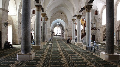
  • Great Mosque of Nablus

    عمرو بن كلثوم / CC BY-SA 3.0

    mosque

    Great Mosque of Nablus

    mosque in Palestine

    Opening hours Not checked

    Admission Not checked

    Getting there Nearest stop or station Old Nablus Train Station Building, about 5 min on foot OpenStreetMap

    Map

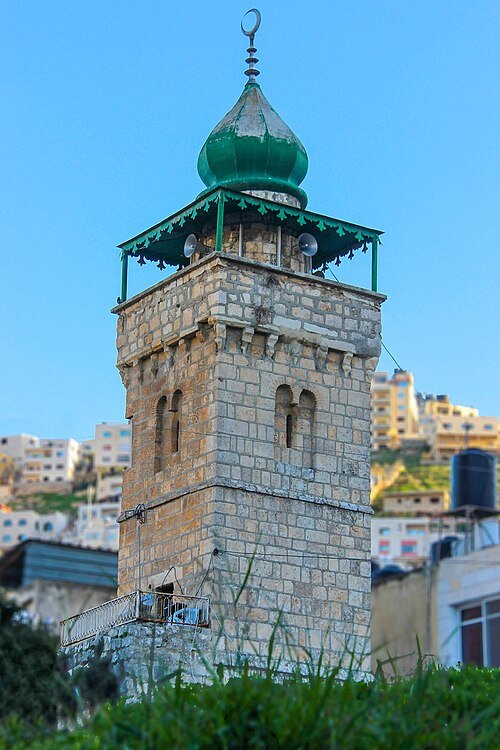
  • mosque

    An-Nasr Mosque

    Mosque in Nablus, Palestine

    Opening hours Not checked

    Admission Not checked

    Getting there Nearest stop or station Old Nablus Train Station Building, about 8 min on foot OpenStreetMap
    Map

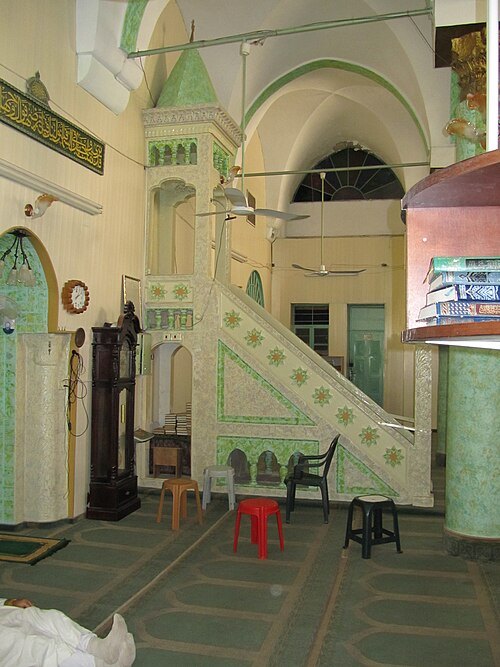
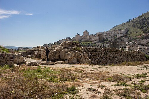
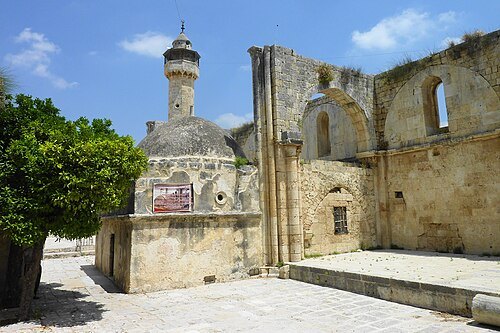
  • Al-Khadra Mosque

    المصور: معتز توفيق اغبارية / CC BY-SA 4.0

    mosque

    Al-Khadra Mosque

    mosque in Nablus, West Bank, Palestine

    Opening hours Not checked

    Admission Not checked

    Getting there Nearest stop or station Old Nablus Train Station Building, about 14 min on foot OpenStreetMap
    Map

  • river

    Wadi al-Far'a

    river in the West Bank

    Opening hours Not checked

    Admission Not checked

    About 31 km from the city centre

    Map

  • Tell Balata

    TrickyH / CC BY-SA 4.0

    archaeological site

    Tell Balata

    site of an ancient Canaanite/Israelite city in the West Bank

    Opening hours Not checked

    Admission Not checked

    Map

  • ancient city

    Timnath-heres

    ancient city in modern Palestine

    Opening hours Not checked

    Admission Not checked

    About 15 km from the city centre

    Map

  • Nabi Yahya Mosque

    Mujaddara / CC BY-SA 3.0

    mosque

    Nabi Yahya Mosque

    Mosque in Sebastia, Nablus, West Bank

    Opening hours Not checked

    Admission Not checked

    About 9 km from the city centre

    Map

  • stadium

    Nablus Football Stadium

    football stadium in Nablus, Palestine

    Opening hours Not checked

    Admission Not checked

    Map

  • Hanbali Mosque, Nablus

    Andreas Tanner / CC BY-SA 3.0

    mosque

    Hanbali Mosque, Nablus

    mosque in Nablus, West Bank, Palestine

    Opening hours Not checked

    Admission Not checked

    Getting there Nearest stop or station Old Nablus Train Station Building, about 8 min on foot OpenStreetMap
    Map

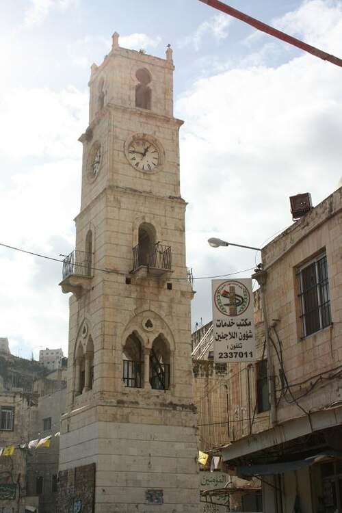
  • Manara Clock Tower

    Tiamat / CC BY-SA 3.0

    clock tower

    Manara Clock Tower

    Clock tower in Nablus, West Bank

    Opening hours Not checked

    Admission Not checked

    Getting there Nearest stop or station Old Nablus Train Station Building, about 8 min on foot OpenStreetMap
    Map

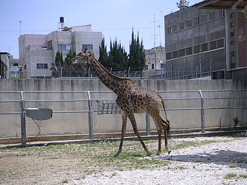
  • Qalqilya Zoo

    Soman / CC BY-SA 2.5

    zoo

    Qalqilya Zoo

    Opening hours Not checked

    Admission Not checked

    About 28 km from the city centre

    Map

  • archaeological site

    Deir ad-Derb

    rock-cut tomb in Palestine

    Opening hours Not checked

    Admission Not checked

    About 18 km from the city centre

    Map

  • Khirbet Samara

    Bukvoed / CC BY 3.0

    archaeological site

    Khirbet Samara

    archaeological site in the West Bank

    Opening hours Not checked

    Admission Not checked

    About 15 km from the city centre

    Map

  • mountain

    Mount Hureish

    mountain in State of Palestine

    Opening hours Not checked

    Admission Not checked

    About 12 km from the city centre

    Map

  • Marj Sanur

    Xxxmatrex / CC BY-SA 3.0

    valley

    Marj Sanur

    valley in West Bank

    Opening hours Not checked

    Admission Not checked

    About 16 km from the city centre

    Map

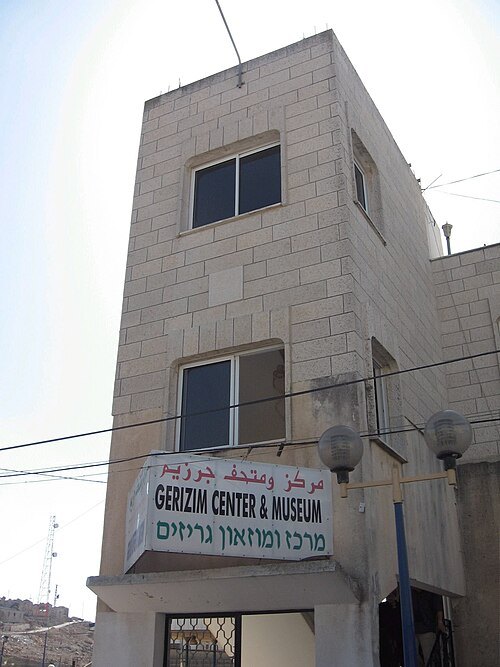
  • The Samaritan Museum

    Daniel from Israel / CC BY 2.0

    museum

    The Samaritan Museum

    Opening hours Not checked

    Admission Not checked

    Map

  • old town

    Old City of Nablus

    Old city in the West Bank, Palestine

    Opening hours Not checked

    Admission Not checked

    Getting there Nearest stop or station Old Nablus Train Station Building, about 8 min on foot OpenStreetMap
    Map

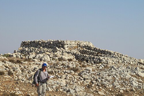
  • Altar on Mount Ebal

    Elad Tzur / CC BY 3.0

    archaeological site

    Altar on Mount Ebal

    archaeological site in the West Bank

    Opening hours Not checked

    Admission Not checked

    Map

  • Caleb's Tomb

    http://en.wikipedia.org/wiki/User:Shuki / Public domain

    mausoleum

    Caleb's Tomb

    Opening hours Not checked

    Admission Not checked

    About 15 km from the city centre

    Map

  • mountain

    Mount Sabih

    Mountain in Nablus

    Opening hours Not checked

    Admission Not checked

    About 11 km from the city centre

    Map

  • archaeological site

    Khirbet el Urma

    archaeological site in Palestine

    Opening hours Not checked

    Admission Not checked

    About 10 km from the city centre

    Map

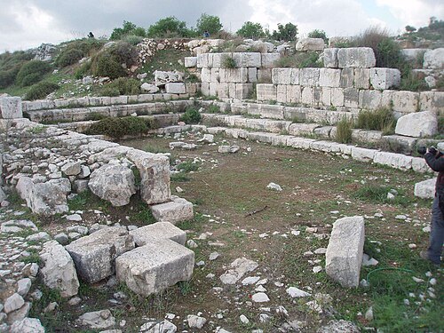
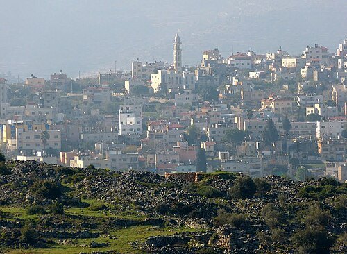
  • Abd al-Hadi Palace

    Palobserver / Public domain

    city palace

    Abd al-Hadi Palace

    19th-century palatial residence in Nablus

    Opening hours Not checked

    Admission Not checked

    Getting there Nearest stop or station Old Nablus Train Station Building, about 12 min on foot OpenStreetMap
    Map

  • mountain

    Mount Rushin

    mountain in Tulkarm, Palestine

    Opening hours Not checked

    Admission Not checked

    About 17 km from the city centre

    Map

  • El-Khirbe

    Bukvoed / CC BY 3.0

    archaeological site

    El-Khirbe

    archaeological site in the Samarian hills of the modern-day West Bank

    Opening hours Not checked

    Admission Not checked

    About 9 km from the city centre

    Map

  • Khirbat ash-Shajara

    Ameen Rammal / CC BY-SA 4.0

    archaeological site

    Khirbat ash-Shajara

    archaeological site

    Opening hours Not checked

    Admission Not checked

    About 16 km from the city centre

    Map

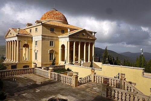
  • mountain

    Mount Tarouja

    mountain in the West Bank of Palestine
    Opening hours Not checked

    Admission Not checked

    About 17 km from the city centre

    Map

  • archaeological site

    Khirbet el-Qutt

    archaeological site in the West Bank

    Opening hours Not checked

    Admission Not checked

    About 18 km from the city centre

    Map

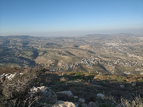
  • El-Masri palace on Mount Gerizim

    Miriam Mezzera / CC BY 2.0

    mansion

    El-Masri palace on Mount Gerizim

    Palace on Mount Gerizim, in Nablus, in the occupied West Bank

    Opening hours Not checked

    Admission Not checked

    Getting there Nearest stop or station Old Nablus Train Station Building, about 17 min on foot OpenStreetMap
    Map

  • archaeological site

    Khirbet Tana et-Tahta

    village and archeological site located in the West Bank

    Opening hours Not checked

    Admission Not checked

    About 15 km from the city centre

    Map

  • Har kabir

    Yywilk / CC BY-SA 4.0

    mountain

    Har kabir

    Opening hours Not checked

    Admission Not checked

    Map

  • mountain range

    Tammun Ridge

    mountain range in eastern West Bank, State of Palestine
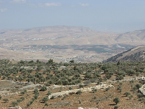
    Opening hours Not checked

    Admission Not checked

    About 14 km from the city centre

    Map

  • Mount Gadir

    יעקב / CC BY-SA 4.0

    mountain

    Mount Gadir

    Opening hours Not checked

    Admission Not checked

    About 17 km from the city centre

    Map

  • archaeological site

    Khirbet Kheibar

    archaeological site in the West Bank

    Opening hours Not checked

    Admission Not checked

    About 15 km from the city centre

    Map

  • amusement park

    Mega Land, Tulkarm

    Opening hours Not checked

    Admission Not checked

    About 25 km from the city centre

    Map

Places to eat

Opening hours and tickets: OpenStreetMap contributors. Each one shows the day a volunteer last wrote it down, so check the official site before you set out.

Nothing picked yet
    Add a place that is not listed here

    One per line. Pasting a list works too.

    Palestine