Mardan: what to see and where to eat
Everything below comes from open data and each row says where it came from. We have not been to any of these places and we do not rank them.
Filters
Things to see
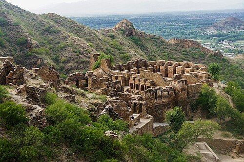 archaeological site
Takht-i-Bahi
archaeological site of an ancient Buddhist monastery in Pakistan
Getting there Nearest stop or station Parkhoo Dheri, about 20 min on foot OpenStreetMap
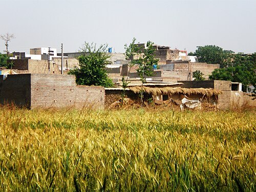
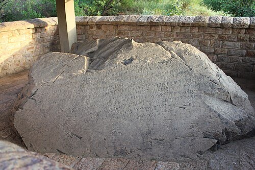
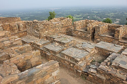
- cave
Kashmir Smast
cave in Pakistan
Getting there Nearest stop or station Shaheen Bus Terminal, about 11 min on foot OpenStreetMap
- museum
Mardan Museum
museum in Pakistan
Getting there Nearest stop or station Shaheen Bus Terminal, about 14 min on foot OpenStreetMap
- hill
Mutānan
hill in Pakistan
- hill
Jango Dheri
- hill
Bangiān Dheri
- hill
Bābo Dheri
- mountain
Karamār
mountain in Pakistan
- mountain
Mādho Garhi
mountain in Pakistan
- mountain
Shekh Gadar Bāba
mountain in Pakistan
- mountain
Kata Sar
mountain in Pakistan
- mountain
Husi Ghundai
mountain in Pakistan
- river
Amzarai Kandah
river in Pakistan
- river
Baghiāri Khwār
river in Pakistan
- river
Burazai Nāla
river in Pakistan
- canal
Adina Drain
canal in Khyber Pakhtunkhwa, Pakistan
- canal
Daulat Minor
canal in Khyber Pakhtunkhwa, Pakistan
- canal
Dhobiān Drain
canal in Khyber Pakhtunkhwa, Pakistan
- canal
Hussai Minor
canal in Khyber Pakhtunkhwa, Pakistan
- canal
Jalāla Distributary
canal in Khyber Pakhtunkhwa, Pakistan
- canal
Maqām Drain
canal in Khyber Pakhtunkhwa, Pakistan
- canal
Maqām Nāla Drain
canal in Khyber Pakhtunkhwa, Pakistan
- canal
Ziam Drain
canal in Khyber Pakhtunkhwa, Pakistan
- mountain ridge
Takht-i Bhāi
ridge in Pakistan
Getting there Nearest stop or station Takht Bhai, about 16 min on foot OpenStreetMap
- hill
Sūrkamar Dheri
hill in Pakistan
- hill
Pīr Sabāk Dheri
hill in Pakistan
- hill
Sūrkamar Dheri
- hill
Akhkari Dheri
- hill
Shamsa Dheri
- mountain
Chittai Dheri
mountain in Pakistan
- mountain
Karkand Dheri
mountain in Pakistan
- mountain
Akhkari Dheri
mountain in Pakistan
Getting there Nearest stop or station Risalpur Cantt, about 20 min on foot OpenStreetMap
- river
Gadar Khwār
river in Pakistan
- canal
Darrah Main Drain
canal in Khyber Pakhtunkhwa, Pakistan
- canal
Ismāīla Drain
canal in Khyber Pakhtunkhwa, Pakistan
- canal
Lower Swāt Canal
canal in Khyber Pakhtunkhwa, Pakistan
- canal
Mardān Distributary
canal in Khyber Pakhtunkhwa, Pakistan
- canal
Palosa Branch
canal in Khyber Pakhtunkhwa, Pakistan
- canal
Pīr Sabāk Minor
canal in Khyber Pakhtunkhwa, Pakistan
- canal
Qāsim East Drain
canal in Khyber Pakhtunkhwa, Pakistan
- canal
Qāsim Minor Number One
canal in Khyber Pakhtunkhwa, Pakistan
- canal
Qāsim Minor Number Two
canal in Khyber Pakhtunkhwa, Pakistan
- canal
Rashkai Minor
canal in Khyber Pakhtunkhwa, Pakistan
- canal
Shaikh Yūsuf Minor
canal in Khyber Pakhtunkhwa, Pakistan
- canal
Toru Minor
canal in Khyber Pakhtunkhwa, Pakistan
- canal
Toru Minor
canal in Khyber Pakhtunkhwa, Pakistan; geonames ID = 1377755
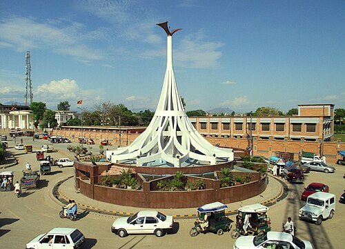 monument
Anwar Ziad
Researcher Mardan, Khyber Pakhtoon Khwa Pakistan
Getting there Nearest stop or station Saddat Bus Terminal, about 2 min on foot OpenStreetMap


Places to eat
No eating place in this city lists its cuisine and opening hours yet.
Nothing here matches that. Clear a filter and try again.
Opening hours and tickets: OpenStreetMap contributors. Each one shows the day a volunteer last wrote it down, so check the official site before you set out.