Wonsan: what to see and where to eat

Everything below comes from open data and each row says where it came from. We have not been to any of these places and we do not rank them.

363,127 people live here

Nearest airport: Wonsan Kalma International Airport (WOS), about 4.79 km from the centre

Distances are straight-line and the walking time is an estimate, not a route.

Filters

Things to see

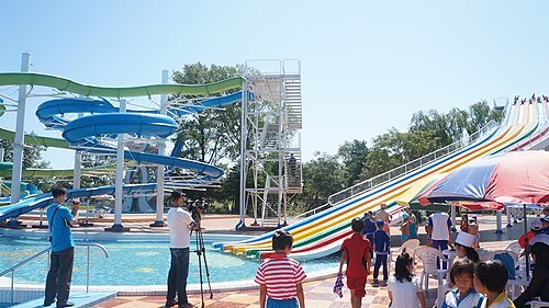
  • Songdowŏn International Children's Camp

    Uri Tours / CC BY-SA 2.0

    resort

    Songdowŏn International Children's Camp

    summer camp school

    Opening hours Not checked

    Admission Not checked

    Getting there Nearest stop or station Leadership Station, about 11 min on foot OpenStreetMap
    Map

  • resort

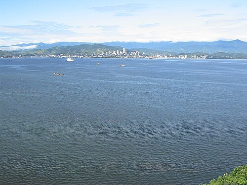
    Wonsan Kalma Coastal Tourist Area

    tourist resort in North Korea

    Opening hours Not checked

    Admission Not checked

    Map

  • Yŏnghŭng Man

    Alkhimov Maxim / CC BY 3.0

    bay

    Yŏnghŭng Man

    bay in North Korea

    Opening hours Not checked

    Admission Not checked

    About 9 km from the city centre

    Map

  • island

    Ryŏdo

    island of North Korea

    Opening hours Not checked

    Admission Not checked

    About 18 km from the city centre

    Map

  • peninsula

    Kalma Peninsula

    Peninsula located in Wonsan

    Opening hours Not checked

    Admission Not checked

    Map

  • stadium

    Sinpung Stadium

    sports venue in Wonsan, North Korea

    Opening hours Not checked

    Admission Not checked

    Getting there Nearest stop or station Wonsan, about 17 min on foot OpenStreetMap
    Map

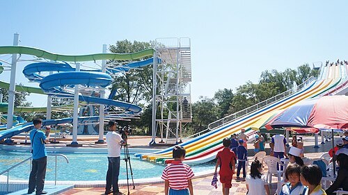
  • Songdowŏn

    Uri Tours / CC BY-SA 2.0

    beach

    Songdowŏn

    Opening hours Not checked

    Admission Not checked

    Getting there Nearest stop or station Songdowon, about 15 min on foot OpenStreetMap

    Map

  • island

    Hwangto-do

    island in North Korea
    Opening hours Not checked

    Admission Not checked

    About 8 km from the city centre

    Map

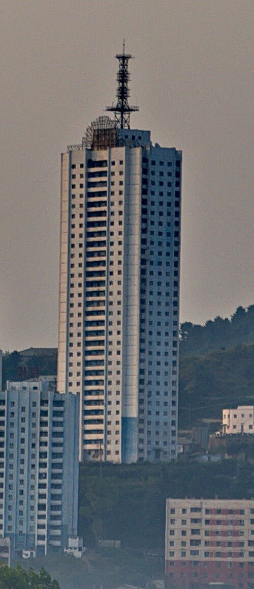
  • Pukmang Tower

    Uwe Brodrecht / CC BY-SA 2.0

    skyscraper

    Pukmang Tower

    tower in Wonsan, North Korea

    Opening hours Not checked

    Admission Not checked

    Getting there Nearest stop or station Songdowon, about 20 min on foot OpenStreetMap

    Map

  • island

    Ung-do

    island in North Korea

    Opening hours Not checked

    Admission Not checked

    About 20 km from the city centre

    Map

  • island

    Tae-do

    island in North Korea

    Opening hours Not checked

    Admission Not checked

    Map

  • island

    Sin-do

    island in North Korea

    Opening hours Not checked

    Admission Not checked

    About 10 km from the city centre

    Map

  • bay

    Hamgumi-man

    bay in North Korea

    Opening hours Not checked

    Admission Not checked

    About 15 km from the city centre

    Map

  • destroyed monastery

    Tokwon Abbey

    lost Benedictine monastery in North Korea

    Opening hours Not checked

    Admission Not checked

    Getting there Nearest stop or station Segil, about 10 min on foot OpenStreetMap

    Map

  • river

    Changnim-ch'ŏn

    river in North Korea

    Opening hours Not checked

    Admission Not checked

    Getting there Nearest stop or station Leadership Station, about 8 min on foot OpenStreetMap

    Map

  • river

    Chŏkchŏn-ch'ŏn

    river in North Korea

    Opening hours Not checked

    Admission Not checked

    Getting there Nearest stop or station Songdowon, about 15 min on foot OpenStreetMap

    Map

  • river

    Namch'ŏn-gang

    river in North Korea

    Opening hours Not checked

    Admission Not checked

    About 13 km from the city centre

    Map

  • river

    Namdae-ch'ŏn

    river in Kangwon Province, North Korea

    Opening hours Not checked

    Admission Not checked

    About 9 km from the city centre

    Map

  • river

    P'ungnam-ch'ŏn

    river in North Korea

    Opening hours Not checked

    Admission Not checked

    About 19 km from the city centre

    Map

  • river

    Simp'o-ch'ŏn

    river in North Korea

    Opening hours Not checked

    Admission Not checked

    Getting there Nearest stop or station Leadership Station, about 10 min on foot OpenStreetMap

    Map

  • river

    Sop'o-ch'ŏn

    river in North Korea

    Opening hours Not checked

    Admission Not checked

    About 8 km from the city centre

    Map

  • river

    Tongdae-ch'ŏn

    river in Kangwon Province, North Korea

    Opening hours Not checked

    Admission Not checked

    About 16 km from the city centre

    Map

  • river

    Yŏmjung-ch'ŏn

    river in North Korea

    Opening hours Not checked

    Admission Not checked

    Getting there Nearest stop or station Munchon, about 16 min on foot OpenStreetMap

    About 9 km from the city centre

    Map

Places to eat

  • restaurant

    모란식당

    Food: korean

    Mo-Su

    원산시

    Map

  • restaurant

    Daesong Restaurant

    Food: korean

    Mo-Su

    원산시

    Map

  • restaurant

    Ragwon Restaurant

    Food: seafood

    Mo-Su

    원산시

    Map

  • cafe

    동명려관차집

    Food: korean

    Mo-Su

    원산시

    Map

  • restaurant

    송도식당 (쉐마리나)

    Food: barbecue

    Mo-Su

    원산시

    Map

  • restaurant

    송도원려관 금강관식당

    Food: noodle

    Mo-Su

    원산시

    Map

  • restaurant

    송도원려관 단관식당

    Food: seafood

    Mo-Su

    원산시

    Map

  • cafe

    송도원려관커피점

    Food: korean

    Mo-Su

    원산시

    Map

Opening hours and tickets: OpenStreetMap contributors. Each one shows the day a volunteer last wrote it down, so check the official site before you set out.

Nothing picked yet
    Add a place that is not listed here

    One per line. Pasting a list works too.

    North Korea