Seremban: what to see and where to eat
Everything below comes from open data and each row says where it came from. We have not been to any of these places and we do not rank them.
419,536 people live here
Nearest airport: Kuala Lumpur International Airport (KUL), about 26.43 km from the centre
Distances are straight-line and the walking time is an estimate, not a route.
Filters Things to see Places to eat
Sort Most Wikipedia articles Nearest the centre By name
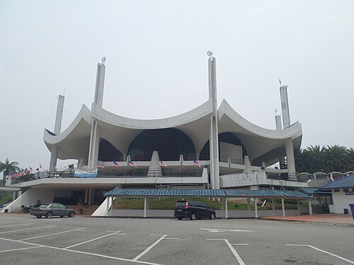
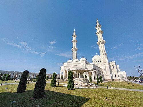
Things to see Chongkian / CC BY-SA 3.0
mosque mosque in Malaysia
Opening hours Not checked
Admission Not checked
Getting there Nearest stop or station Seremban, about 7 min on foot OpenStreetMap
Map
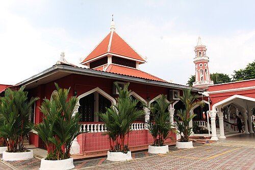
Add Michellegoh / CC BY-SA 4.0
mosque mosque in Seremban, Negeri Sembilan, Malaysia
Opening hours Not checked
Admission Not checked
Getting there Nearest stop or station Terminal 1 Bus Station, about 16 min on foot OpenStreetMap
Map
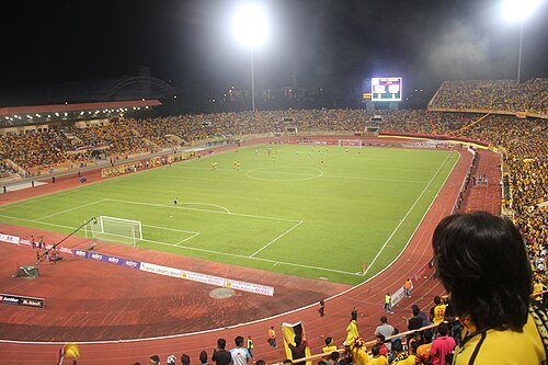
Add Mohd Izzudin / CC BY-SA 3.0
stadium stadium in Paroi, Malaysia
Opening hours Not checked
Admission Not checked
Map
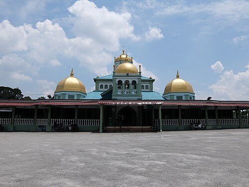
Add Chongkian / CC BY-SA 4.0
mosque historical mosque in Beranang, Malaysia
Opening hours Not checked
Admission Not checked
About 18 km from the city centre
Map
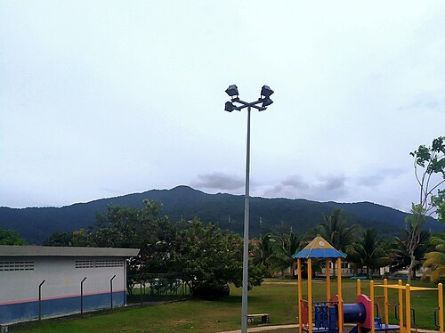
Add AyyanD / CC BY-SA 4.0
mountain mountain in Negeri Sembilan, Malaysia
Opening hours Not checked
Admission Not checked
About 13 km from the city centre
Map
Add Zahirul Nukman / CC BY-SA 4.0
mosque mosque in Seremban, Negeri Sembilan, Malaysia
Opening hours Not checked
Admission Not checked
About 12 km from the city centre
Map
Add river river in Malaysia
Opening hours Not checked
Admission Not checked
About 11 km from the city centre
Map
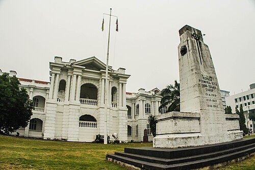
Add Natalie.Thoo / CC BY-SA 4.0
memorial war memorial in Seremban, Malaysia
Opening hours Not checked
Admission Not checked
Map
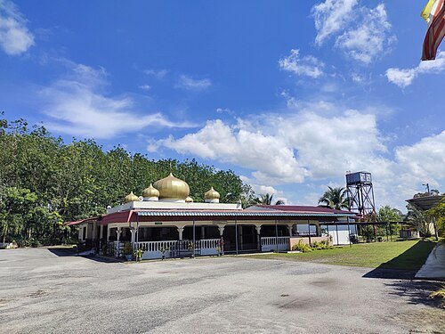
Add Zahirulnukman / CC BY-SA 3.0
mosque Masjid Kariah Kampung Daching mosque in Malaysia
Opening hours Not checked
Admission Not checked
About 18 km from the city centre
Map
Add 龍崎 Jeffrey / CC BY-SA 3.0
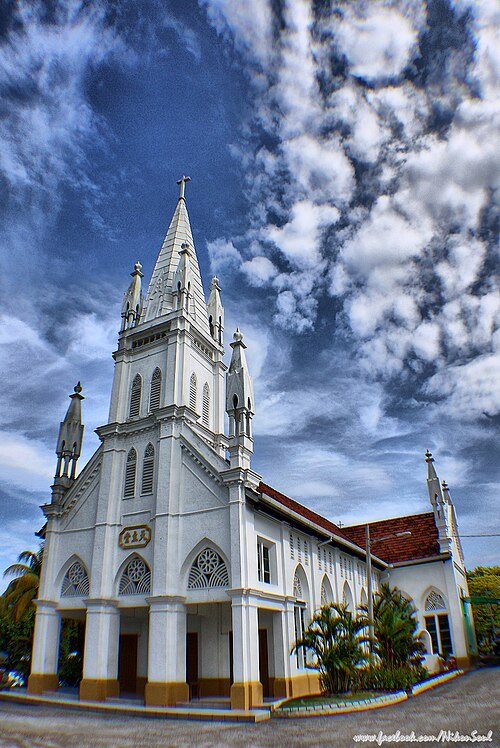
catholic church building Church of St Aloysius, Mantin Opening hours Not checked
Admission Not checked
About 11 km from the city centre
Map
Add Farouk Azim / CC BY 4.0
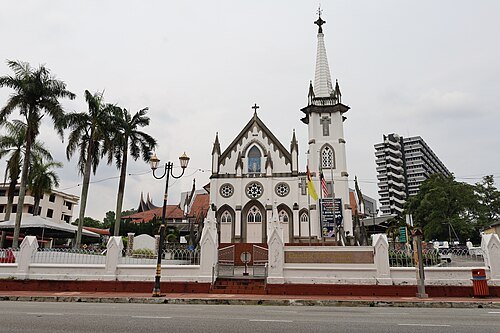
catholic church building Category:Church of the Visitation, Seremban Opening hours Not checked
Admission Not checked
Getting there Nearest stop or station Terminal 1 Bus Station, about 10 min on foot OpenStreetMap
Map
Add mountain mountain in Negeri Sembilan, Malaysia
Opening hours Not checked
Admission Not checked
About 19 km from the city centre
Map
Add mosque Masjid Kariah Lenggeng mosque in Malaysia
Opening hours Not checked
Admission Not checked
About 15 km from the city centre
Map
Add mosque Masjid Kariah Sungai Jai mosque in Malaysia
Opening hours Not checked
Admission Not checked
About 17 km from the city centre
Map
Add mosque Masjid Kariah Sungai Machang Ulu mosque in Malaysia
Opening hours Not checked
Admission Not checked
About 16 km from the city centre
Map
Add hill Bukit Kumus hill in Malaysia
Opening hours Not checked
Admission Not checked
About 18 km from the city centre
Map
Add hill Bukit Sinong hill in Negeri Sembilan, Malaysia
Opening hours Not checked
Admission Not checked
About 15 km from the city centre
Map
Add hill Bukit Silang Nombor Satu hill in Negeri Sembilan, Malaysia
Opening hours Not checked
Admission Not checked
About 15 km from the city centre
Map
Add hill Bukit Sapu Tangga Opening hours Not checked
Admission Not checked
About 18 km from the city centre
Map
Add mountain Bukit Sinang mountain in Negeri Sembilan, Malaysia
Opening hours Not checked
Admission Not checked
About 14 km from the city centre
Map
Add mountain Bukit Petai mountain in Negeri Sembilan, Malaysia
Opening hours Not checked
Admission Not checked
About 12 km from the city centre
Map
Add mountain Bukit Kelusau mountain in Negeri Sembilan, Malaysia
Opening hours Not checked
Admission Not checked
About 16 km from the city centre
Map
Add mountain Bukit Bolau mountain in Negeri Sembilan, Malaysia
Opening hours Not checked
Admission Not checked
About 10 km from the city centre
Map
Add mountain Bukit Bioh mountain in Negeri Sembilan, Malaysia
Opening hours Not checked
Admission Not checked
About 11 km from the city centre
Map
Add forest Gapau Forest Reserve Opening hours Not checked
Admission Not checked
About 18 km from the city centre
Map
Add forest Setul Forest Reserve Opening hours Not checked
Admission Not checked
About 8 km from the city centre
Map
Add river Sungai Batang Benar stream in Negeri Sembilan, Malaysia
Opening hours Not checked
Admission Not checked
About 19 km from the city centre
Map
Add river Sungai Batang Ganai stream in Negeri Sembilan, Malaysia
Opening hours Not checked
Admission Not checked
About 10 km from the city centre
Map
Add river Sungai Batang Jeralang stream in Negeri Sembilan, Malaysia
Opening hours Not checked
Admission Not checked
About 11 km from the city centre
Map
Add river Sungai Batang Merling stream in Negeri Sembilan, Malaysia
Opening hours Not checked
Admission Not checked
About 11 km from the city centre
Map
Add river Sungai Belau stream in Negeri Sembilan, Malaysia
Opening hours Not checked
Admission Not checked
About 19 km from the city centre
Map
Add river Sungai Solok Opening hours Not checked
Admission Not checked
About 14 km from the city centre
Map
Add river Sungai Setul Opening hours Not checked
Admission Not checked
About 12 km from the city centre
Map
Add river Sungai Puteh Opening hours Not checked
Admission Not checked
About 18 km from the city centre
Map
Add river Sungai Puteh Opening hours Not checked
Admission Not checked
About 17 km from the city centre
Map
Add river Sungai Nyoi Nyoi Opening hours Not checked
Admission Not checked
About 10 km from the city centre
Map
Add river Sungai Mandum Opening hours Not checked
Admission Not checked
About 14 km from the city centre
Map
Add river Sungai Machang Opening hours Not checked
Admission Not checked
About 16 km from the city centre
Map
Add river Sungai Lenggeng Opening hours Not checked
Admission Not checked
About 16 km from the city centre
Map
Add river Sungai Kelusau Opening hours Not checked
Admission Not checked
About 14 km from the city centre
Map
Add river Sungai Jelatok Opening hours Not checked
Admission Not checked
About 9 km from the city centre
Map
Add river Sungai Jelatok Opening hours Not checked
Admission Not checked
About 14 km from the city centre
Map
Add river Sungai Gebok Opening hours Not checked
Admission Not checked
About 15 km from the city centre
Map
Add river Sungai Emi Opening hours Not checked
Admission Not checked
Map
Add river Sungai Chuping Opening hours Not checked
Admission Not checked
About 13 km from the city centre
Map
Add river Sungai Chuho Opening hours Not checked
Admission Not checked
About 14 km from the city centre
Map
Add river Sungai Bioh Opening hours Not checked
Admission Not checked
About 16 km from the city centre
Map
Add river Sungai Sompo Opening hours Not checked
Admission Not checked
About 13 km from the city centre
Map
Add river Sungai Golai Opening hours Not checked
Admission Not checked
About 8 km from the city centre
Map
Add river Sungai Petai Opening hours Not checked
Admission Not checked
About 12 km from the city centre
Map
Add river Sungai Mahang Opening hours Not checked
Admission Not checked
About 18 km from the city centre
Map
Add river Sungai Kabul Opening hours Not checked
Admission Not checked
About 19 km from the city centre
Map
Add river Sungai Jai Opening hours Not checked
Admission Not checked
About 18 km from the city centre
Map
Add river Sungai Pajam Opening hours Not checked
Admission Not checked
About 20 km from the city centre
Map
Add river Sungai Suak Mengkarong Opening hours Not checked
Admission Not checked
About 19 km from the city centre
Map
Add river Sungai Beranang Opening hours Not checked
Admission Not checked
About 19 km from the city centre
Map
Add river Sungai Tarim Opening hours Not checked
Admission Not checked
About 19 km from the city centre
Map
Add square Nilai Square Opening hours Not checked
Admission Not checked
About 19 km from the city centre
Map
Add mosque Dato' Bandar Haji Ahmad Rasah Jamek Mosque mosque in Negeri Sembilan, Malaysia
Opening hours Not checked
Admission Not checked
Map
Add hill Bukit Nibong hill in Negeri Sembilan, Malaysia
Opening hours Not checked
Admission Not checked
About 14 km from the city centre
Map
Add Places to eat cafe Food: coffee shop
24/7
Seremban
Map
Add restaurant Nasi Kandar NS Food: mamak
24/7
Seremban
Map
Add restaurant Restoran Al-Jasira Food: mamak
24/7
Seremban
Map
Add restaurant Restoran Azhaar Maju Food: mamak, malay, western
24/7
Seremban
Map
Add Nothing here matches that. Clear a filter and try again.
Opening hours and tickets: OpenStreetMap contributors . Each one shows the day a volunteer last wrote it down, so check the official site before you set out.
Nothing picked yet Build my plan Clear picks Add a place that is not listed here You can write in places yourself One per line. Pasting a list works too.
Add these
Malaysia
 mosque
 mosque
 mosque
 catholic church building
 catholic church building


