Salamá: what to see and where to eat

Everything below comes from open data and each row says where it came from. We have not been to any of these places and we do not rank them.

71,478 people live here

Filters

Things to see

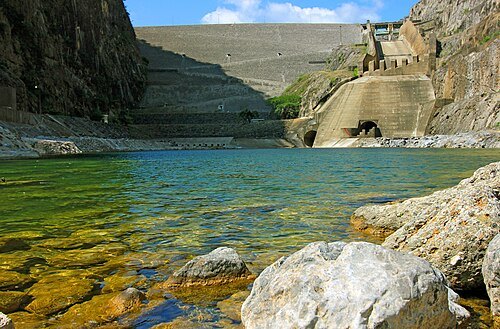
  • Chixoy Hydroelectric Dam

    INDE / CC BY-SA 3.0

    dam

    Chixoy Hydroelectric Dam

    Gravity dam in San Cristóbal Verapaz(Alta Verapaz), with annual storage cycle. Provides energy to the largest hydroelectric power station of Guatemala.
    Opening hours Not checked

    Admission Not checked

    About 27 km from the city centre

    Map

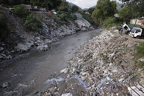
  • Las Vacas River

    Gobierno de Guatemala / Public domain

    river

    Las Vacas River

    river in Guatemala

    Opening hours Not checked

    Admission Not checked

    About 27 km from the city centre

    Map

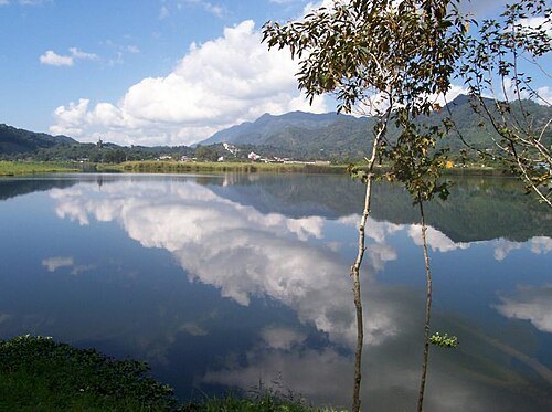
  • Lake Chichoj

    Fernandingas / CC BY-SA 4.0

    lake

    Lake Chichoj

    body of water

    Opening hours Not checked

    Admission Not checked

    About 33 km from the city centre

    Map

  • river

    Salamá River

    river in Guatemala

    Opening hours Not checked

    Admission Not checked

    About 27 km from the city centre

    Map

  • temple

    Cobán Guatemala Temple

    Opening hours Not checked

    Admission Not checked

    About 40 km from the city centre

    Map

  • hill

    Cerro La Potenciana

    hill in El Progreso Department, Guatemala
    Opening hours Not checked

    Admission Not checked

    About 36 km from the city centre

    Map

  • seasonal river

    Quebrada de Pasasagua

    Opening hours Not checked

    Admission Not checked

    About 35 km from the city centre

    Map

  • mountain

    Cerro Comaja

    mountain in Guatemala

    Opening hours Not checked

    Admission Not checked

    About 32 km from the city centre

    Map

  • hill

    Cerro Don Chico

    hill in El Progreso Department, Guatemala

    Opening hours Not checked

    Admission Not checked

    About 31 km from the city centre

    Map

  • hill

    Cerro El Matochal

    hill in El Progreso Department, Guatemala

    Opening hours Not checked

    Admission Not checked

    About 31 km from the city centre

    Map

  • hill

    Cerro Injerto

    hill in El Progreso Department, Guatemala

    Opening hours Not checked

    Admission Not checked

    About 35 km from the city centre

    Map

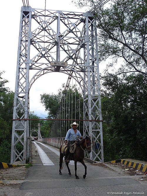
  • Puente Orellana

    Fernando Reyes Palencia / CC BY-SA 2.0

    road bridge

    Puente Orellana

    Road bridge in El Rancho, Guatemala; El Rancho, Guatemala

    Opening hours Not checked

    Admission Not checked

    About 40 km from the city centre

    Map

  • mountain

    Cerro Tuncaj

    mountain in Guatemala

    Opening hours Not checked

    Admission Not checked

    About 33 km from the city centre

    Map

  • hill

    Cerro del Tamarindo

    hill in El Progreso Department, Guatemala

    Opening hours Not checked

    Admission Not checked

    About 28 km from the city centre

    Map

  • hill

    Cerro La Trementina

    hill in El Progreso Department, Guatemala

    Opening hours Not checked

    Admission Not checked

    About 30 km from the city centre

    Map

  • hill

    Cerro Los Petates

    hill in Guatemala Department, Guatemala

    Opening hours Not checked

    Admission Not checked

    About 30 km from the city centre

    Map

  • hill

    Cerro Mitute

    hill in Baja Verapaz Department, Guatemala

    Opening hours Not checked

    Admission Not checked

    About 38 km from the city centre

    Map

  • hill

    Cerro El Apazote

    hill in Guatemala Department, Guatemala

    Opening hours Not checked

    Admission Not checked

    About 38 km from the city centre

    Map

  • hill

    Cerro El Coloxito

    hill in Guatemala Department, Guatemala

    Opening hours Not checked

    Admission Not checked

    About 38 km from the city centre

    Map

  • seasonal river

    Riachuelo El Naranjo

    Opening hours Not checked

    Admission Not checked

    About 34 km from the city centre

    Map

  • mountain

    Cerro Xucaneb

    mountain in Guatemala

    Opening hours Not checked

    Admission Not checked

    About 30 km from the city centre

    Map

  • mountain

    Cerro Ocote Rajado

    mountain in Guatemala

    Opening hours Not checked

    Admission Not checked

    About 22 km from the city centre

    Map

  • hill

    Cerro Guayabitas

    hill in El Progreso Department, Guatemala

    Opening hours Not checked

    Admission Not checked

    About 24 km from the city centre

    Map

  • archaeological site

    Belejtzak

    Opening hours Not checked

    Admission Not checked

    About 34 km from the city centre

    Map

Places to eat

No eating place in this city lists its cuisine and opening hours yet.

Opening hours and tickets: OpenStreetMap contributors. Each one shows the day a volunteer last wrote it down, so check the official site before you set out.

Nothing picked yet
    Add a place that is not listed here

    One per line. Pasting a list works too.

    Guatemala