Puerto Barrios: what to see and where to eat

Everything below comes from open data and each row says where it came from. We have not been to any of these places and we do not rank them.

110,846 people live here

Nearest airport: Puerto Barrios Airport (PBR), about 1.66 km from the centre

Distances are straight-line and the walking time is an estimate, not a route.

Filters

Things to see

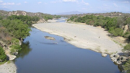
  • Motagua River

    Kymacpherson / CC BY-SA 3.0

    river

    Motagua River

    river in Guatemala

    Opening hours Not checked

    Admission Not checked

    About 273 km from the city centre

    Map

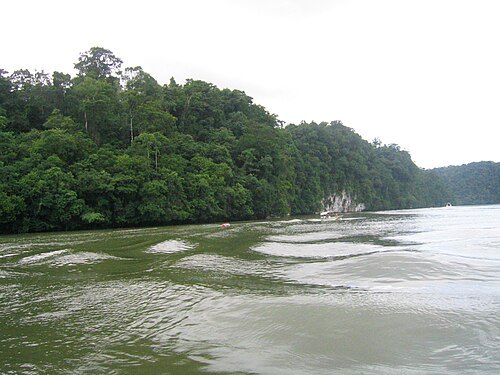
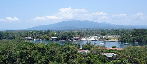
  • Dulce River

    MacAllenBrothers' / CC BY-SA 2.0

    river

    Dulce River

    river in Guatemala

    Opening hours Not checked

    Admission Not checked

    About 29 km from the city centre

    Map

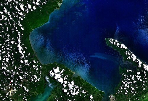
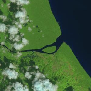
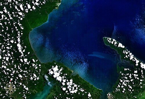
  • Amatique Bay

    Unknown / Public domain

    bay

    Amatique Bay

    Bay of the Gulf of Honduras, Belize, Guatemala

    Opening hours Not checked

    Admission Not checked

    About 26 km from the city centre

    Map

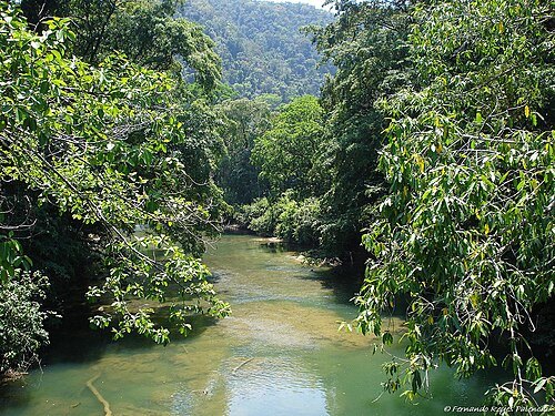
  • Sarstoon River

    Fernando Reyes Palencia / CC BY-SA 2.0

    river

    Sarstoon River

    river in Guatemala and Belize

    Opening hours Not checked

    Admission Not checked

    About 38 km from the city centre

    Map

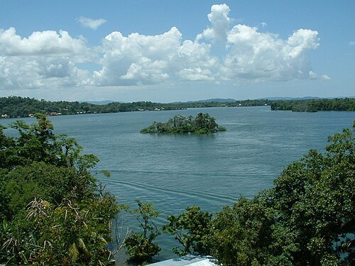
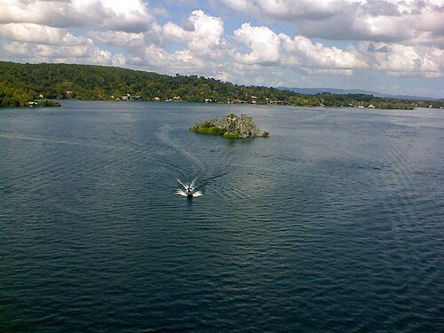
  • El Golfete

    Jjaz / Public domain

    lake

    El Golfete

    lake in Guatemala

    Opening hours Not checked

    Admission Not checked

    About 29 km from the city centre

    Map

  • Sierra del Mico

    Fernando Reyes Palencia / CC BY-SA 2.0

    mountain

    Sierra del Mico

    mountain in Guatemala

    Opening hours Not checked

    Admission Not checked

    About 21 km from the city centre

    Map

  • river

    Chocón Machacas River

    river in Guatemala

    Opening hours Not checked

    Admission Not checked

    About 30 km from the city centre

    Map

  • Sarstoon Island

    United States Geological Survey / Public domain

    island

    Sarstoon Island

    Belizean island in the Sarstoon River

    Opening hours Not checked

    Admission Not checked

    About 39 km from the city centre

    Map

  • cave

    Cuevas del Silvino

    national park in Guatemala

    Opening hours Not checked

    Admission Not checked

    About 37 km from the city centre

    Map

  • Rio Dulce National Park

    seperezu / CC BY-SA 3.0

    national park

    Rio Dulce National Park

    park in Izabal Department, Guatemala
    Opening hours Not checked

    Admission Not checked

    About 39 km from the city centre

    Map

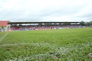
  • Estadio Del Monte

    Briangs16 / CC BY-SA 4.0

    stadium

    Estadio Del Monte

    multi-use stadium in Morales, Izabal Department, Guatemala

    Opening hours Not checked

    Admission Not checked

    About 39 km from the city centre

    Map

  • association football venue

    Estadio Roy Fearon

    football (soccer) stadium in Puerto Barrios, Izabal, Guatemala

    Opening hours Not checked

    Admission Not checked

    Getting there Nearest stop or station Litegua, about 15 min on foot OpenStreetMap

    Map

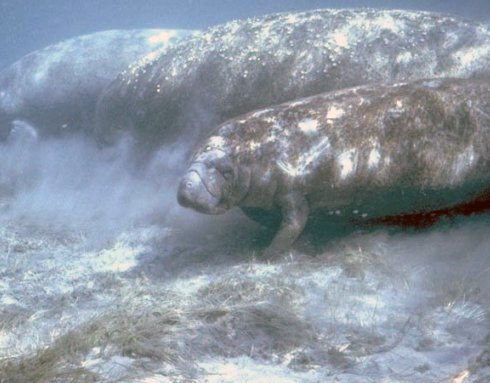
  • coast

    Caribbean Coast of Guatemala

    northeastern coast of Guatemala
    Opening hours Not checked

    Admission Not checked

    About 22 km from the city centre

    Map

  • Chocón Machacas

    Unknown / Public domain

    protected area

    Chocón Machacas

    Nature reserve in Guatemala

    Opening hours Not checked

    Admission Not checked

    About 31 km from the city centre

    Map

  • mountain range

    Sierra del Caral

    Opening hours Not checked

    Admission Not checked

    About 33 km from the city centre

    Map

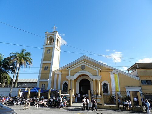
  • Cathedral of the Immaculate Conception of Mary

    Cvargas95 / CC BY-SA 3.0

    catholic cathedral

    Cathedral of the Immaculate Conception of Mary

    Opening hours Not checked

    Admission Not checked

    Getting there Nearest stop or station Litegua, about 5 min on foot OpenStreetMap

    Map

  • mountain

    Cerro las Crucitas

    mountain in Guatemala

    Opening hours Not checked

    Admission Not checked

    About 30 km from the city centre

    Map

  • island group

    Cuatro Cayos

    Opening hours Not checked

    Admission Not checked

    About 36 km from the city centre

    Map

  • island

    Cayo Julio

    island in Izabal Department, Guatemala

    Opening hours Not checked

    Admission Not checked

    About 34 km from the city centre

    Map

  • mountain

    Cerro Petatillel

    mountain in Guatemala

    Opening hours Not checked

    Admission Not checked

    About 36 km from the city centre

    Map

  • mountain

    Cerro El Caral

    mountain in Guatemala

    Opening hours Not checked

    Admission Not checked

    About 32 km from the city centre

    Map

  • mountain

    Cerro Merendoncito

    mountain in Guatemala

    Opening hours Not checked

    Admission Not checked

    About 34 km from the city centre

    Map

  • mountain

    Cerro Escarpado

    mountain in Honduras

    Opening hours Not checked

    Admission Not checked

    About 27 km from the city centre

    Map

  • mountain

    Cerro Caobanal

    mountain in Honduras

    Opening hours Not checked

    Admission Not checked

    About 39 km from the city centre

    Map

  • mountain ridge

    Cuchilla Zacatales

    ridge in Honduras

    Opening hours Not checked

    Admission Not checked

    About 39 km from the city centre

    Map

  • mountain ridge

    Cuchilla Cerro Grande

    ridge in Honduras

    Opening hours Not checked

    Admission Not checked

    About 39 km from the city centre

    Map

  • mountain

    Cerro Tintines

    mountain in Honduras

    Opening hours Not checked

    Admission Not checked

    About 38 km from the city centre

    Map

  • mountain

    Loma Encerrada

    mountain in Honduras

    Opening hours Not checked

    Admission Not checked

    About 36 km from the city centre

    Map

  • mountain ridge

    Fila El Zapote

    ridge in Honduras

    Opening hours Not checked

    Admission Not checked

    About 36 km from the city centre

    Map

  • mountain ridge

    Cuchilla El Estero

    ridge in Honduras

    Opening hours Not checked

    Admission Not checked

    About 35 km from the city centre

    Map

  • mountain

    Cerro El Chirico

    mountain in Honduras

    Opening hours Not checked

    Admission Not checked

    About 35 km from the city centre

    Map

  • island group

    Cayos de Punta Moreno

    Opening hours Not checked

    Admission Not checked

    About 16 km from the city centre

    Map

  • island

    Cayo Santa Isabel

    island in Izabal Department, Guatemala

    Opening hours Not checked

    Admission Not checked

    About 16 km from the city centre

    Map

  • island

    Cayo de La Graciosa

    island in Izabal Department, Guatemala

    Opening hours Not checked

    Admission Not checked

    About 16 km from the city centre

    Map

  • river mouth

    Estero Motagua Viejo

    Opening hours Not checked

    Admission Not checked

    About 31 km from the city centre

    Map

  • reef

    Bajo de Ox Tongue

    reef in Guatemala

    Opening hours Not checked

    Admission Not checked

    About 17 km from the city centre

    Map

  • lake

    Laguna Jaloa

    lake in Honduras

    Opening hours Not checked

    Admission Not checked

    About 40 km from the city centre

    Map

  • Cabo Tres Puntas Lighthouse

    Unknown / Public domain

    lighthouse

    Cabo Tres Puntas Lighthouse

    lighthouse in Guatemala

    Opening hours Not checked

    Admission Not checked

    About 26 km from the city centre

    Map

Places to eat

No eating place in this city lists its cuisine and opening hours yet.

Opening hours and tickets: OpenStreetMap contributors. Each one shows the day a volunteer last wrote it down, so check the official site before you set out.

Nothing picked yet
    Add a place that is not listed here

    One per line. Pasting a list works too.

    Guatemala