Usulután: what to see and where to eat

Everything below comes from open data and each row says where it came from. We have not been to any of these places and we do not rank them.

66,125 people live here

Filters

Things to see

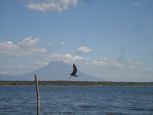
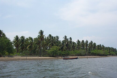
  • Jiquilisco Bay

    ElmerGuevara / CC BY-SA 3.0

    bay

    Jiquilisco Bay

    Salvadoran coastal nature reserve

    Opening hours Not checked

    Admission Not checked

    About 12 km from the city centre

    Map

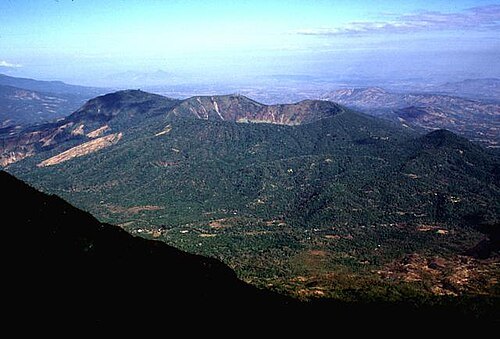
  • Chinameca

    Lee Siebert, Smithsonian Institution / Public domain

    mountain

    Chinameca

    volcano

    Opening hours Not checked

    Admission Not checked

    About 19 km from the city centre

    Map

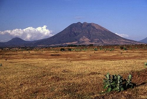
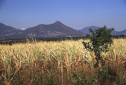
  • Usulután

    Lee Siebert, Smithsonian Institution / Public domain

    mountain

    Usulután

    mountain in El Salvador

    Opening hours Not checked

    Admission Not checked

    About 9 km from the city centre

    Map

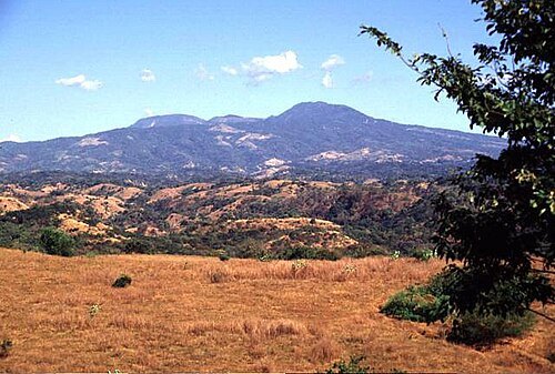
  • Tecapa

    Lee Siebert / Public domain

    mountain

    Tecapa

    mountain in El Salvador

    Opening hours Not checked

    Admission Not checked

    About 18 km from the city centre

    Map

  • Taburete

    Lee Siebert, Smithsonian Institution / Public domain

    mountain

    Taburete

    mountain in El Salvador

    Opening hours Not checked

    Admission Not checked

    About 14 km from the city centre

    Map

  • river

    Río Grande de San Miguel

    river in El Salvador

    Opening hours Not checked

    Admission Not checked

    About 15 km from the city centre

    Map

  • stadium

    Sergio Torres Stadium

    multi-purpose stadium in Usulután, El Salvador

    Opening hours Not checked

    Admission Not checked

    Map

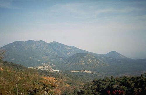
  • mountain range

    Sierra Tecapa-Chinameca
    Opening hours Not checked

    Admission Not checked

    About 18 km from the city centre

    Map

  • El Tigre

    Kristal Dorion, U.S. Geological Survey / Public domain

    volcano

    El Tigre

    volcano in El Salvador

    Opening hours Not checked

    Admission Not checked

    About 14 km from the city centre

    Map

  • Isla Madre Sal

    Metztli / CC BY-SA 3.0

    island

    Isla Madre Sal

    Opening hours Not checked

    Admission Not checked

    About 16 km from the city centre

    Map

  • island

    Isla San Sebastián

    Opening hours Not checked

    Admission Not checked

    About 18 km from the city centre

    Map

  • mountain

    Cerro El Tigre

    mountain in Usulután Department, El Salvador

    Opening hours Not checked

    Admission Not checked

    About 14 km from the city centre

    Map

  • volcano

    Cerro El Pacayal

    Opening hours Not checked

    Admission Not checked

    About 18 km from the city centre

    Map

  • mountain

    Cerro El Limbo

    mountain in San Miguel Department, El Salvador

    Opening hours Not checked

    Admission Not checked

    About 18 km from the city centre

    Map

  • mountain

    Cerro Alegría

    mountain in Usulután Department, El Salvador

    Opening hours Not checked

    Admission Not checked

    About 18 km from the city centre

    Map

  • lake

    Laguna de Alegría

    lake in El Salvador

    Opening hours Not checked

    Admission Not checked

    About 18 km from the city centre

    Map

  • mountain

    Cerro Verde

    mountain in Usulután Department, El Salvador

    Opening hours Not checked

    Admission Not checked

    About 19 km from the city centre

    Map

  • mountain

    Cerro Pelón

    mountain in Usulután Department, El Salvador

    Opening hours Not checked

    Admission Not checked

    About 18 km from the city centre

    Map

  • mountain

    Cerro Oromontique

    mountain in Usulután Department, El Salvador

    Opening hours Not checked

    Admission Not checked

    About 15 km from the city centre

    Map

  • nature reserve

    Bahía de Jiquilisco Biosphere Reserve

    Opening hours Not checked

    Admission Not checked

    About 15 km from the city centre

    Map

  • river

    Estero del Mapachín

    river in El Salvador

    Opening hours Not checked

    Admission Not checked

    About 13 km from the city centre

    Map

  • river

    Estero Los Mancornados

    river in El Salvador

    Opening hours Not checked

    Admission Not checked

    About 15 km from the city centre

    Map

  • island

    Isla El Bajón

    island in El Salvador

    Opening hours Not checked

    Admission Not checked

    About 18 km from the city centre

    Map

  • island

    Isla El Platanar

    island in El Salvador

    Opening hours Not checked

    Admission Not checked

    About 19 km from the city centre

    Map

  • island

    Isla La Empalizada

    island in El Salvador

    Opening hours Not checked

    Admission Not checked

    About 18 km from the city centre

    Map

  • island

    Isla Los Cedros

    island in El Salvador

    Opening hours Not checked

    Admission Not checked

    About 17 km from the city centre

    Map

  • island

    Isla Pajarito

    island in El Salvador

    Opening hours Not checked

    Admission Not checked

    About 16 km from the city centre

    Map

  • island

    Isla Samuria

    island in El Salvador

    Opening hours Not checked

    Admission Not checked

    About 19 km from the city centre

    Map

  • island

    Isla San Dionisio

    island in El Salvador

    Opening hours Not checked

    Admission Not checked

    About 13 km from the city centre

    Map

  • island

    Isla Santa Catarina

    island in El Salvador

    Opening hours Not checked

    Admission Not checked

    About 12 km from the city centre

    Map

  • island

    Isla Tortuga

    island in El Salvador

    Opening hours Not checked

    Admission Not checked

    About 16 km from the city centre

    Map

  • river

    Quebrada Gualache

    river in Usulután Department, El Salvador

    Opening hours Not checked

    Admission Not checked

    About 9 km from the city centre

    Map

  • river

    Quebrada Guarumo

    river in Usulután Department, El Salvador

    Opening hours Not checked

    Admission Not checked

    About 18 km from the city centre

    Map

  • river

    Río Aguacayo

    river in Usulután Department, El Salvador

    Opening hours Not checked

    Admission Not checked

    About 18 km from the city centre

    Map

  • river

    Río de Batres

    river in El Salvador - Geonames ID = 3587276

    Opening hours Not checked

    Admission Not checked

    Map

  • river

    Río El Cacao

    river in Usulután Department, El Salvador

    Opening hours Not checked

    Admission Not checked

    About 18 km from the city centre

    Map

  • river

    Río El Molino

    river in Usulután Department, El Salvador

    Opening hours Not checked

    Admission Not checked

    About 9 km from the city centre

    Map

  • river

    Río Ereguayquín

    river in Usulután Department, El Salvador

    Opening hours Not checked

    Admission Not checked

    Map

  • river

    Río Méndez

    river in Usulután Department, El Salvador

    Opening hours Not checked

    Admission Not checked

    About 12 km from the city centre

    Map

  • catholic cathedral

    Cathedral of St. James the Apostle

    Opening hours Not checked

    Admission Not checked

    About 16 km from the city centre

    Map

Places to eat

Opening hours and tickets: OpenStreetMap contributors. Each one shows the day a volunteer last wrote it down, so check the official site before you set out.

Nothing picked yet
    Add a place that is not listed here

    One per line. Pasting a list works too.

    El Salvador