Azogues: what to see and where to eat

Everything below comes from open data and each row says where it came from. We have not been to any of these places and we do not rank them.

35,763 people live here

Nearest airport: Mariscal Lamar Airport (CUE), about 24.16 km from the centre

Distances are straight-line and the walking time is an estimate, not a route.

Filters

Things to see

  • sports venue

    Estadio Jorge Andrade

    multi-use stadium in Azogues, Ecuador

    Opening hours Not checked

    Admission Not checked

    Getting there Nearest stop or station Cooperativa Panamericano, about 19 min on foot OpenStreetMap
    Map

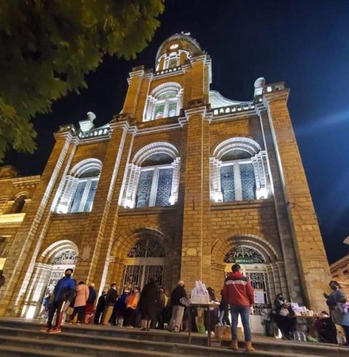
  • Cathedral of Azogues

    Lmpesantezt / CC BY-SA 4.0

    catholic cathedral

    Cathedral of Azogues

    church in Azogues, Ecuador
    Opening hours Not checked

    Admission Not checked

    Map

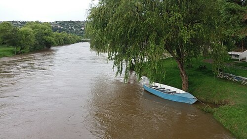
  • Santa Bárbara River

    Jfbeltranr / CC BY-SA 4.0

    river

    Santa Bárbara River

    right headwater of the Paute River in Ecuador
    Opening hours Not checked

    Admission Not checked

    About 46 km from the city centre

    Map

  • stadium

    Estadio Federativo

    multi-use stadium in Azogues, Ecuador

    Opening hours Not checked

    Admission Not checked

    Map

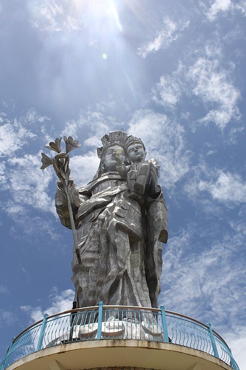
  • Our Lady of the Cloud Monument

    KathyAMC / CC BY-SA 4.0

    sculpture

    Our Lady of the Cloud Monument

    monument in Mount Abuga,, Azogues, Ecuador

    Opening hours Not checked

    Admission Not checked

    Map

  • mountain

    Yausay

    mountain in Ecuador

    Opening hours Not checked

    Admission Not checked

    About 13 km from the city centre

    Map

  • mountain

    Cerro Molobog Grande

    mountain in Ecuador

    Opening hours Not checked

    Admission Not checked

    About 12 km from the city centre

    Map

  • mountain

    Buerán

    mountain in Ecuador

    Opening hours Not checked

    Admission Not checked

    About 18 km from the city centre

    Map

  • mountain

    Cerro Abuga

    Ecuadorian mountain in Azogues, Cañar, Ecuador

    Opening hours Not checked

    Admission Not checked

    Map

  • mountain

    Cerro Verde

    mountain in Ecuador

    Opening hours Not checked

    Admission Not checked

    About 12 km from the city centre

    Map

  • mountain

    Ñamurelte

    mountain in Ecuador

    Opening hours Not checked

    Admission Not checked

    About 17 km from the city centre

    Map

  • park

    Parque Central de Gualaceo

    park in Ecuador

    Opening hours Not checked

    Admission Not checked

    Getting there Nearest stop or station Parada Coperativa Trans Uzhupud, about 8 min on foot OpenStreetMap

    About 18 km from the city centre

    Map

  • monument

    Monasterio de Santa Clara

    christian catholic monastery in Azogues, Cañar, Ecuador

    Opening hours Not checked

    Admission Not checked

    Getting there Nearest stop or station Terminal Terrestre Segundo Serrano, about 19 min on foot OpenStreetMap
    Map

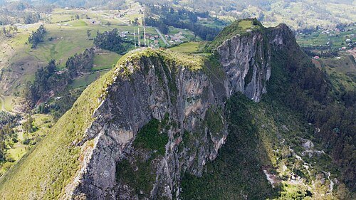
  • Cerro Cojitambo

    Jhalvico / CC BY-SA 4.0

    mountain

    Cerro Cojitambo

    Ecuadorian mountain in Azogues, Cañar, Ecuador

    Opening hours Not checked

    Admission Not checked

    Map

  • bridge

    Puente Roto

    Opening hours Not checked

    Admission Not checked

    About 27 km from the city centre

    Map

  • scenic viewpoint

    Turi viewpoint

    Opening hours Not checked

    Admission Not checked

    About 29 km from the city centre

    Map

Places to eat

  • restaurant

    Aquí me quedo

    Food: italian pizza

    24/7

    Map

  • restaurant

    Tifozzi

    Food: argentinian, italian

    Mo-Su 12:00-22:00

    Azogues

    Map

Opening hours and tickets: OpenStreetMap contributors. Each one shows the day a volunteer last wrote it down, so check the official site before you set out.

Nothing picked yet
    Add a place that is not listed here

    One per line. Pasting a list works too.

    Ecuador