Santa Cruz de Barahona: what to see and where to eat
Everything below comes from open data and each row says where it came from. We have not been to any of these places and we do not rank them.
83,619 people live here
Nearest airport: María Montez International Airport (BRX), about 5.41 km from the centre
Distances are straight-line and the walking time is an estimate, not a route.
Filters Sort Most Wikipedia articles Nearest the centre By name
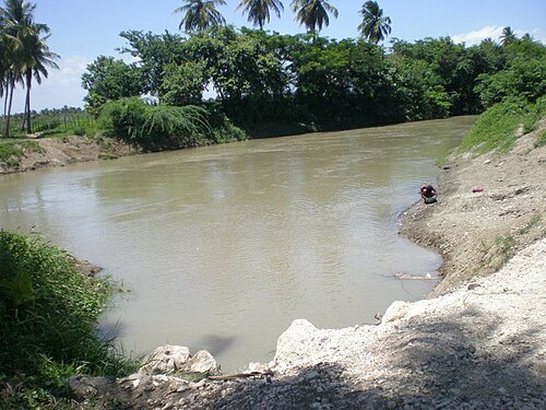
Things to see Ronny Medina / CC BY 4.0
river river in the Dominican Republic
Opening hours Not checked
Admission Not checked
About 8 km from the city centre
Map
Add bay Neiba bay bight in the Dominican Republic
Opening hours Not checked
Admission Not checked
About 8 km from the city centre
Map
Add river Arroyo del Yeso river in the Dominican Republic
Opening hours Not checked
Admission Not checked
About 15 km from the city centre
Map
Add intermittent lake Laguneta Seca Opening hours Not checked
Admission Not checked
About 19 km from the city centre
Map
Add lagoon Laguna del Rincón lagoon in the Dominican Republic
Opening hours Not checked
Admission Not checked
About 16 km from the city centre
Map
Add mountain ridge Cerros de Peñón Viejo ridge in the Dominican Republic
Opening hours Not checked
Admission Not checked
About 17 km from the city centre
Map
Add hill Cerros de Mena hill in the Dominican Republic
Opening hours Not checked
Admission Not checked
About 19 km from the city centre
Map
Add lagoon Laguna Los Aletones lagoon in the Dominican Republic
Opening hours Not checked
Admission Not checked
Map
Add lagoon Laguna La Sierra lagoon in the Dominican Republic
Opening hours Not checked
Admission Not checked
About 13 km from the city centre
Map
Add mountain La Sierrita mountain in the Dominican Republic
Opening hours Not checked
Admission Not checked
About 20 km from the city centre
Map
Add reef La Piedra Prieta reef in the Dominican Republic
Opening hours Not checked
Admission Not checked
Map
Add hill Loma La Piedra Prieta hill in the Dominican Republic
Opening hours Not checked
Admission Not checked
About 19 km from the city centre
Map
Add mountain ridge Gajo Largo ridge in the Dominican Republic
Opening hours Not checked
Admission Not checked
About 19 km from the city centre
Map
Add hill Cerros del Isleton hill in the Dominican Republic
Opening hours Not checked
Admission Not checked
About 19 km from the city centre
Map
Add hill El Yeso hill in the Dominican Republic
Opening hours Not checked
Admission Not checked
About 17 km from the city centre
Map
Add mountain Loma Fría mountain in Dominican Republic; GeoNames ID = 3508385
Opening hours Not checked
Admission Not checked
About 19 km from the city centre
Map
Add mountain ridge Loma El Curro ridge in the Dominican Republic
Opening hours Not checked
Admission Not checked
About 18 km from the city centre
Map
Add canal Canal Cristóbal canal in Dominican Republic
Opening hours Not checked
Admission Not checked
About 19 km from the city centre
Map
Add hill Cerros de Cristóbal hill in the Dominican Republic
Opening hours Not checked
Admission Not checked
About 20 km from the city centre
Map
Add tied island Isleta de Barahona Opening hours Not checked
Admission Not checked
Map
Add hill Loma Yimbí hill in the Dominican Republic
Opening hours Not checked
Admission Not checked
About 13 km from the city centre
Map
Add river Cañada Turnino river in the Dominican Republic
Opening hours Not checked
Admission Not checked
Map
Add river Arroyo Uvero river in the Dominican Republic
Opening hours Not checked
Admission Not checked
About 13 km from the city centre
Map
Add mountain Loma Remigio mountain in the Dominican Republic
Opening hours Not checked
Admission Not checked
About 16 km from the city centre
Map
Add mountain Loma Pie de Palo mountain in the Dominican Republic
Opening hours Not checked
Admission Not checked
About 12 km from the city centre
Map
Add mountain Loma Paimingo mountain in the Dominican Republic
Opening hours Not checked
Admission Not checked
About 9 km from the city centre
Map
Add mountain Loma Los Lirios mountain in the Dominican Republic
Opening hours Not checked
Admission Not checked
About 19 km from the city centre
Map
Add mountain Loma La Trocha de Pey mountain in the Dominican Republic
Opening hours Not checked
Admission Not checked
About 17 km from the city centre
Map
Add hill Loma La Filipina hill in the Dominican Republic
Opening hours Not checked
Admission Not checked
Map
Add hill Loma de La Jo hill in the Dominican Republic
Opening hours Not checked
Admission Not checked
About 20 km from the city centre
Map
Add hill Loma La Elva hill in the Dominican Republic
Opening hours Not checked
Admission Not checked
Map
Add mountain Loma José Joaquín mountain in the Dominican Republic
Opening hours Not checked
Admission Not checked
About 15 km from the city centre
Map
Add hill Loma Juan Esteban hill in the Dominican Republic
Opening hours Not checked
Admission Not checked
About 9 km from the city centre
Map
Add intermittent lake Laguna Guayavito Opening hours Not checked
Admission Not checked
About 10 km from the city centre
Map
Add lagoon Laguna de Estero lagoon in the Dominican Republic
Opening hours Not checked
Admission Not checked
Map
Add mountain Loma El Palo Veinte mountain in the Dominican Republic
Opening hours Not checked
Admission Not checked
About 12 km from the city centre
Map
Add hill Loma El Manantial hill in the Dominican Republic
Opening hours Not checked
Admission Not checked
Map
Add mountain ridge El Derrumbado ridge in the Dominican Republic
Opening hours Not checked
Admission Not checked
About 16 km from the city centre
Map
Add hill Loma El Fundo hill in the Dominican Republic
Opening hours Not checked
Admission Not checked
Map
Add hill Loma El Aguacate hill in the Dominican Republic
Opening hours Not checked
Admission Not checked
About 15 km from the city centre
Map
Add intermittent lake Laguna Caballero Opening hours Not checked
Admission Not checked
Map
Add hill Lomas Caballero hill in the Dominican Republic
Opening hours Not checked
Admission Not checked
Map
Add hill Loma Cabeza de Vaca hill in the Dominican Republic
Opening hours Not checked
Admission Not checked
Map
Add catholic cathedral Cathedral of Our Lady of the Rosary Opening hours Not checked
Admission Not checked
Map
Add Places to eat No eating place in this city lists its cuisine and opening hours yet.
Nothing here matches that. Clear a filter and try again.
Opening hours and tickets: OpenStreetMap contributors . Each one shows the day a volunteer last wrote it down, so check the official site before you set out.
Nothing picked yet Build my plan Clear picks Add a place that is not listed here You can write in places yourself One per line. Pasting a list works too.
Add these
Dominican Republic