Santiago de Cuba: what to see and where to eat

Everything below comes from open data and each row says where it came from. We have not been to any of these places and we do not rank them.

506,037 people live here

Nearest airport: Antonio Maceo International Airport (SCU), about 5.21 km from the centre

Distances are straight-line and the walking time is an estimate, not a route.

Filters

Things to see

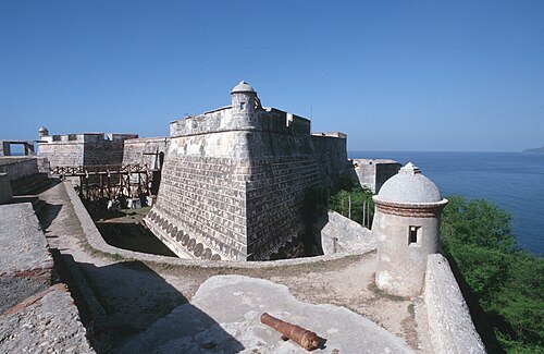
  • Castillo de San Pedro de la Roca

    Glogg, Peter, Switzerland / CC BY 2.0

    fortress

    Castillo de San Pedro de la Roca

    fortress in Santiago de Cuba

    Opening hours Not checked

    Admission Not checked

    Map

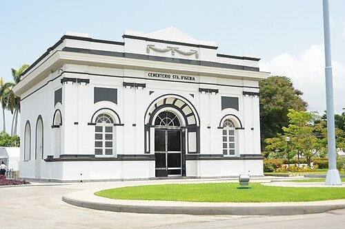
  • Santa Ifigenia Cemetery

    Escla / CC BY-SA 4.0

    cemetery

    Santa Ifigenia Cemetery

    Cemetery in Santiago de Cuba, Cuba

    Opening hours Not checked

    Admission Not checked

    Getting there Nearest stop or station Santiago de Cuba, about 14 min on foot OpenStreetMap
    Map

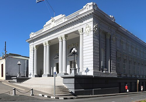
  • Museo Municipal Emilio Bacardi Moreau

    Maesi64 / CC0

    museum

    Museo Municipal Emilio Bacardi Moreau

    Museum in Santiago de Cuba

    Tu-Fr 09:00-17:00; Sa 09:00-13:00; Mo 13:00-17:00 OpenStreetMap, written 2026-07-20

    Admission Not checked

    Getting there Nearest stop or station Santiago de Cuba, about 19 min on foot OpenStreetMap
    Map

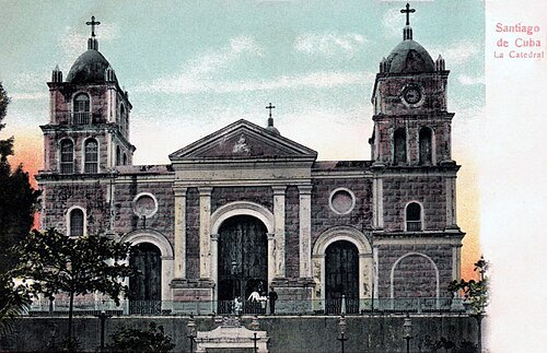
  • Cathedral Basilica of Our Lady of the Assumption, Santiago de Cuba

    Unknown author / Public domain

    cathedral

    Cathedral Basilica of Our Lady of the Assumption, Santiago de Cuba

    cathedral church in Santiago de Cuba
    Opening hours Not checked

    Admission Not checked

    Map

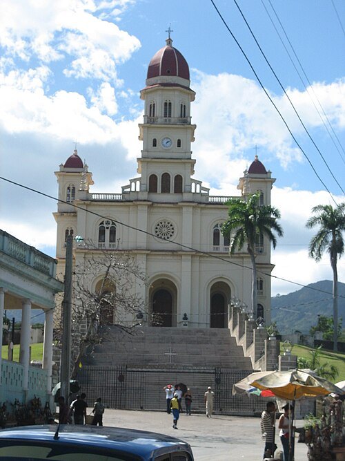
  • Basílica Santuario Nacional de Nuestra Señora de la Caridad del Cobre

    Escla / CC BY-SA 3.0

    minor basilica

    Basílica Santuario Nacional de Nuestra Señora de la Caridad del Cobre

    church in Santiago de Cuba, Cuba
    Opening hours Not checked

    Admission Not checked

    About 13 km from the city centre

    Map

  • San Juan Hill

    Christian Pirkl / CC BY-SA 4.0

    hill chain

    San Juan Hill

    series of hills to the east of Santiago, Cuba, running north to south and scene of a battle

    Opening hours Not checked

    Admission Not checked

    Map

  • island

    Cayo Granma

    island in Santiago de Cuba Province, Cuba

    Opening hours Not checked

    Admission Not checked

    Map

  • sports venue

    Estadio Guillermón Moncada

    stadium named in honour of the Cuban soldier Guillermón Moncada

    Opening hours Not checked

    Admission Not checked

    Getting there Nearest stop or station Terminal Intermunicipal, about 14 min on foot OpenStreetMap
    Map

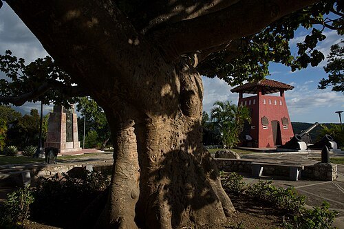
  • heritage tree

    Santiago Surrender Tree

    historic tree (defunct), Santiago de Cuba

    Opening hours Not checked

    Admission Not checked

    Map

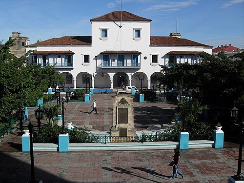
  • City Hall (former)

    Tina Li from Hamilton, Canada / CC BY-SA 2.0

    city hall

    City Hall (former)

    former city hall, Santiago de Cuba

    Opening hours Not checked

    Admission Not checked

    Getting there Nearest stop or station Santiago de Cuba, about 17 min on foot OpenStreetMap

    Map

  • river

    Arroyo San Pedro

    river in Cuba

    Opening hours Not checked

    Admission Not checked

    About 16 km from the city centre

    Map

  • river

    Arroyo Rubí

    river in Cuba

    Opening hours Not checked

    Admission Not checked

    About 20 km from the city centre

    Map

  • river

    Arroyo Boniatico

    river in Cuba

    Opening hours Not checked

    Admission Not checked

    About 17 km from the city centre

    Map

  • river

    Arroyo Bellaco

    river in Cuba

    Opening hours Not checked

    Admission Not checked

    About 15 km from the city centre

    Map

  • river

    Arroyo Blanco

    river in Santiago de Cuba Province, Cuba - Geonames ID = 3567258
    Opening hours Not checked

    Admission Not checked

    About 19 km from the city centre

    Map

  • river

    Arroyo Gil

    river in Santiago de Cuba Province, Cuba

    Opening hours Not checked

    Admission Not checked

    About 16 km from the city centre

    Map

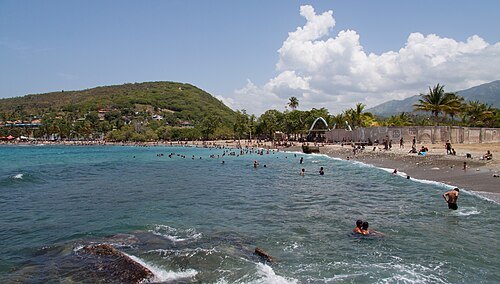
  • Playa Siboney

    Christian Pirkl / CC BY-SA 4.0

    beach

    Playa Siboney

    Opening hours Not checked

    Admission Not checked

    About 15 km from the city centre

    Map

  • river

    Arroyo Rívoli

    river in Cuba

    Opening hours Not checked

    Admission Not checked

    About 15 km from the city centre

    Map

  • island

    Cayo Ratones

    island in Santiago de Cuba Province, Cuba

    Opening hours Not checked

    Admission Not checked

    Map

  • mountain ridge

    Sierra de Puerto Pelado

    Opening hours Not checked

    Admission Not checked

    Map

  • river

    Arroyo Perú

    river in Cuba

    Opening hours Not checked

    Admission Not checked

    About 13 km from the city centre

    Map

  • mountain

    Loma de los Pozos

    mountain in Cuba

    Opening hours Not checked

    Admission Not checked

    About 12 km from the city centre

    Map

  • river

    Arroyo Noruega

    river in Cuba

    Opening hours Not checked

    Admission Not checked

    About 14 km from the city centre

    Map

  • river

    Arroyo Palmas

    river in Santiago de Cuba Province, Cuba

    Opening hours Not checked

    Admission Not checked

    About 12 km from the city centre

    Map

  • island

    Cayo Paradas

    island in Santiago de Cuba Province, Cuba

    Opening hours Not checked

    Admission Not checked

    Map

  • river

    Arroyo Naranjo

    river in Santiago de Cuba Province, Cuba

    Opening hours Not checked

    Admission Not checked

    Map

  • river

    Arroyo Melgarejo

    river in Cuba

    Opening hours Not checked

    Admission Not checked

    About 12 km from the city centre

    Map

  • river

    Arroyo Minas

    river in Cuba

    Opening hours Not checked

    Admission Not checked

    About 11 km from the city centre

    Map

  • river

    Arroyo Manacal

    river in Santiago de Cuba Province, Cuba

    Opening hours Not checked

    Admission Not checked

    About 17 km from the city centre

    Map

  • river

    Arroyo Juan González

    river in Cuba

    Opening hours Not checked

    Admission Not checked

    About 18 km from the city centre

    Map

  • river

    Arroyo Justicia

    river in Cuba

    Opening hours Not checked

    Admission Not checked

    About 11 km from the city centre

    Map

  • river

    Arroyo Ermitaño

    river in Cuba

    Opening hours Not checked

    Admission Not checked

    About 10 km from the city centre

    Map

  • hill

    Loma la Estrella

    hill in Santiago de Cuba Province, Cuba

    Opening hours Not checked

    Admission Not checked

    About 11 km from the city centre

    Map

  • hill

    Loma la Cruz

    hill in Santiago de Cuba Province, Cuba

    Opening hours Not checked

    Admission Not checked

    About 9 km from the city centre

    Map

  • river

    Arroyo Dos Comadres

    river in Cuba

    Opening hours Not checked

    Admission Not checked

    About 14 km from the city centre

    Map

  • river

    Arroyo Celis

    river in Cuba

    Opening hours Not checked

    Admission Not checked

    About 18 km from the city centre

    Map

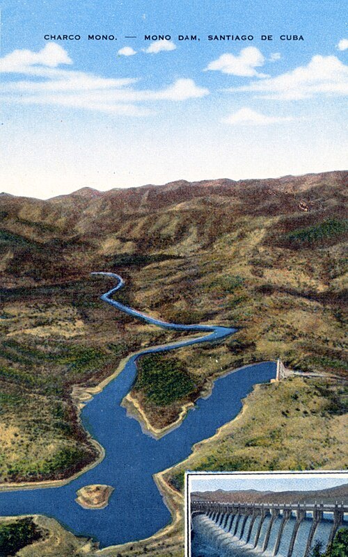
  • Charco Mono reservoir

    Edicion Renacimiento, Santiago de Cuba (publisher) / Public domain

    reservoir

    Charco Mono reservoir

    reservoir in Santiago de Cuba Province

    Opening hours Not checked

    Admission Not checked

    About 19 km from the city centre

    Map

  • mountain

    Pico Cobre

    mountain in Cuba

    Opening hours Not checked

    Admission Not checked

    About 15 km from the city centre

    Map

  • river

    Arroyo Congo

    river in Cuba

    Opening hours Not checked

    Admission Not checked

    About 10 km from the city centre

    Map

  • beach

    Playa los Coquitos

    Opening hours Not checked

    Admission Not checked

    Map

  • island

    Caimanes

    island in Santiago de Cuba Province, Cuba

    Opening hours Not checked

    Admission Not checked

    Map

  • river

    Arroyo Canasí

    river in Cuba

    Opening hours Not checked

    Admission Not checked

    Map

  • Sierra de Boniato

    Christian Pirkl / CC BY-SA 4.0

    mountain ridge

    Sierra de Boniato

    mountain range in Cuba

    Opening hours Not checked

    Admission Not checked

    About 8 km from the city centre

    Map

  • river

    Arroyo Avilés

    river in Cuba

    Opening hours Not checked

    Admission Not checked

    About 20 km from the city centre

    Map

  • beach

    Playa de Aguadores

    Opening hours Not checked

    Admission Not checked

    Map

  • reef

    Bajo Diamante

    reef in Cuba

    Opening hours Not checked

    Admission Not checked

    Map

  • lighthouse

    Morro Santiago de Cuba Lighthouse

    lighthouse in Cuba

    Opening hours Not checked

    Admission Not checked

    Map

  • mausoleum

    José Martí Mausoleum

    José Martí Mausoleum at Santa Ifigenia Cemetery in Santiago de Cuba

    Opening hours Not checked

    Admission Not checked

    Getting there Nearest stop or station Santiago de Cuba, about 12 min on foot OpenStreetMap
    Map

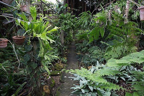
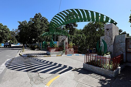
  • Jardín de los Helechos de Santiago de Cuba

    Christian Pirkl / CC BY-SA 4.0

    botanical garden

    Jardín de los Helechos de Santiago de Cuba

    Botanical garden in Cuba
    Opening hours Not checked

    Admission Not checked

    Map

  • parque zoologico santiago

    Christian Pirkl / CC BY-SA 4.0

    park

    parque zoologico santiago

    park in Cuba

    Opening hours Not checked

    Admission Not checked

    Map

  • river

    Arroyo Zacatecas

    river in Cuba

    Opening hours Not checked

    Admission Not checked

    Map

  • river

    Arroyo Tunas

    river in Cuba

    Opening hours Not checked

    Admission Not checked

    About 10 km from the city centre

    Map

  • river

    Arroyo Simona

    river in Cuba

    Opening hours Not checked

    Admission Not checked

    About 15 km from the city centre

    Map

  • hill

    Loma San Juan

    hill in Santiago de Cuba Province, Cuba

    Opening hours Not checked

    Admission Not checked

    Map

  • river

    Arroyo Santa Ana

    river in Cuba

    Opening hours Not checked

    Admission Not checked

    About 15 km from the city centre

    Map

  • river

    Arroyo Quibarí

    river in Cuba

    Opening hours Not checked

    Admission Not checked

    Getting there Nearest stop or station Santiago de Cuba, about 18 min on foot OpenStreetMap

    Map

  • hill

    Loma Quintero

    hill in Santiago de Cuba Province, Cuba

    Opening hours Not checked

    Admission Not checked

    Map

  • river

    Arroyo Mayeta

    river in Cuba

    Opening hours Not checked

    Admission Not checked

    About 18 km from the city centre

    Map

  • river

    Arroyo Majín

    river in Cuba

    Opening hours Not checked

    Admission Not checked

    Map

  • river

    Arroyo Lajas

    river in Santiago de Cuba Province, Cuba - Geonames ID = 3553338

    Opening hours Not checked

    Admission Not checked

    Map

Places to eat

  • restaurant

    El Paraíso

    Food: italian

    Mo-Su 12:00-23:00

    Map

  • restaurant

    Los Manolos

    Food: italian pizza

    Mo-Fr 12:00-23:00; Sa-Su 12:00-00:00

    Map

  • restaurant

    Thomas & Yadira

    Food: regional, italian, seafood, fish and chips, chicken, ice cream, international, german

    10:00-23:00

    Santiago de Cuba

    Map

  • restaurant

    Iré a Santiago

    Food: 1

    Mo-Su 12:00-23:30

    Santiago de Cuba

    Map

  • restaurant

    Isla Bella

    Food: cuban

    Mo-Su 12:00-23:30

    Santiago de Cuba

    Map

Opening hours and tickets: OpenStreetMap contributors. Each one shows the day a volunteer last wrote it down, so check the official site before you set out.

Nothing picked yet
    Add a place that is not listed here

    One per line. Pasting a list works too.

    Cuba