Sancti Spíritus: what to see and where to eat

Everything below comes from open data and each row says where it came from. We have not been to any of these places and we do not rank them.

138,504 people live here

Nearest airport: Aeródromo Sancti Spíritus (USS), about 3.99 km from the centre

Distances are straight-line and the walking time is an estimate, not a route.

Filters

Things to see

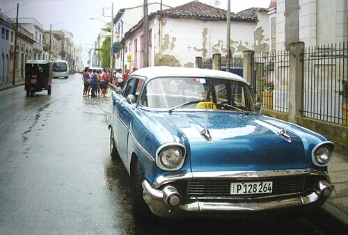
  • Cuba

    Виктор Пинчук (автор фото и книги) / CC BY-SA 4.0

    island country

    Cuba

    sovereign state situated on an island in the Caribbean Sea

    Opening hours Not checked

    Admission Not checked

    About 9 km from the city centre

    Map

  • reservoir

    Zaza Reservoir

    man-made reservoir in Cuba

    Opening hours Not checked

    Admission Not checked

    About 14 km from the city centre

    Map

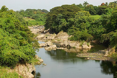
  • Yayabo River (Cuba)

    Ivan2010 / CC BY-SA 3.0

    river

    Yayabo River (Cuba)

    river in Sancti Spiritu province, Cuba

    Opening hours Not checked

    Admission Not checked

    Map

  • mountain range

    Sierra de Sancti Spíritus

    Opening hours Not checked

    Admission Not checked

    About 20 km from the city centre

    Map

  • mountain range

    Lomas Peladas

    Opening hours Not checked

    Admission Not checked

    About 16 km from the city centre

    Map

  • mountain range

    Lomas del Obispo

    Opening hours Not checked

    Admission Not checked

    About 9 km from the city centre

    Map

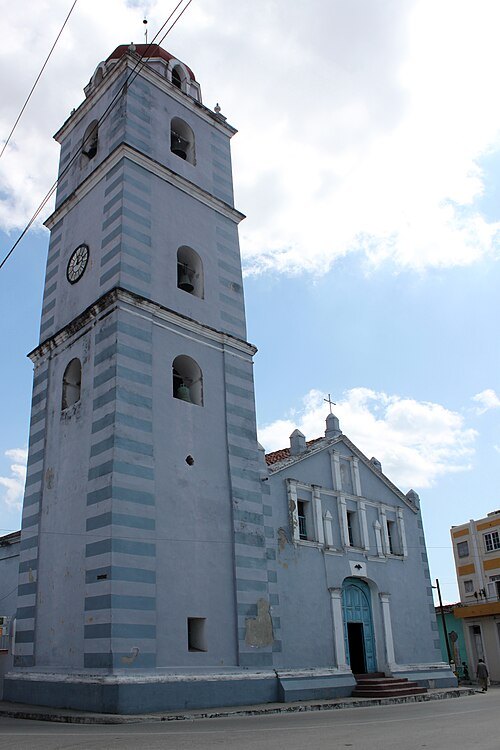
  • Iglesia Parroquial Mayor del Espíritu Santo

    Anagoria / CC BY 3.0

    church building

    Iglesia Parroquial Mayor del Espíritu Santo

    church building in Sancti Spíritus, Cuba

    Opening hours Not checked

    Admission Not checked

    Getting there Nearest stop or station Estación Sancti Spíritus, about 7 min on foot OpenStreetMap

    Map

  • multi-purpose stadium

    José Antonio Huelga Stadium

    multi-use stadium in Sancti Spíritus, Cuba

    Opening hours Not checked

    Admission Not checked

    Getting there Nearest stop or station Terminal Ómnibus Provincial, about 14 min on foot OpenStreetMap
    Map

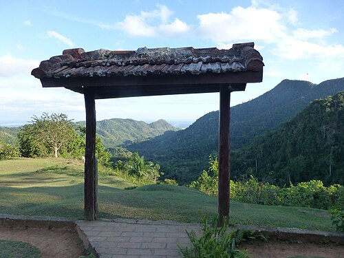
  • Lomas de Banao

    Ji-Elle / CC BY-SA 4.0

    protected area

    Lomas de Banao

    Opening hours Not checked

    Admission Not checked

    About 17 km from the city centre

    Map

  • mountain range

    Sierras de Ocho de Agosto

    Opening hours Not checked

    Admission Not checked

    About 19 km from the city centre

    Map

  • dam

    Zaza Dam

    dam in Sancti Spíritus, Sancti Spíritus Province

    Opening hours Not checked

    Admission Not checked

    About 17 km from the city centre

    Map

  • hill

    Lomas de Vigía

    hill in Sancti Spíritus Province, Cuba

    Opening hours Not checked

    Admission Not checked

    About 14 km from the city centre

    Map

  • hill

    Loma Siguaney

    hill in Sancti Spíritus Province, Cuba

    Opening hours Not checked

    Admission Not checked

    About 16 km from the city centre

    Map

  • river

    Arroyo Santa Cruz

    river in Sancti Spíritus Province, Cuba

    Opening hours Not checked

    Admission Not checked

    Map

  • mountain

    Monte los Santos

    mountain in Cuba

    Opening hours Not checked

    Admission Not checked

    About 12 km from the city centre

    Map

  • river

    Arroyo Sabanilla

    river in Sancti Spíritus Province, Cuba

    Opening hours Not checked

    Admission Not checked

    About 13 km from the city centre

    Map

  • river

    Arroyo Remates

    river in Cuba

    Opening hours Not checked

    Admission Not checked

    About 20 km from the city centre

    Map

  • river

    Arroyo Quintiano

    river in Cuba

    Opening hours Not checked

    Admission Not checked

    About 20 km from the city centre

    Map

  • mountain

    Loma Pico Tuerto

    mountain in Cuba

    Opening hours Not checked

    Admission Not checked

    About 14 km from the city centre

    Map

  • mountain ridge

    Sierras de Ocho de Agosto

    Opening hours Not checked

    Admission Not checked

    About 18 km from the city centre

    Map

  • river

    Arroyo Palmas

    river in Cuba

    Opening hours Not checked

    Admission Not checked

    About 19 km from the city centre

    Map

  • river

    Arroyo Malangas

    river in Cuba

    Opening hours Not checked

    Admission Not checked

    About 13 km from the city centre

    Map

  • river

    Arroyo Managuaco

    river in Cuba

    Opening hours Not checked

    Admission Not checked

    About 14 km from the city centre

    Map

  • river

    Arroyo Los Muertos

    river in Sancti Spíritus Province, Cuba

    Opening hours Not checked

    Admission Not checked

    About 11 km from the city centre

    Map

  • hill

    Lomas La Gloria

    hill in Sancti Spíritus Province, Cuba

    Opening hours Not checked

    Admission Not checked

    About 18 km from the city centre

    Map

  • river

    Arroyo Jarao

    river in Cuba

    Opening hours Not checked

    Admission Not checked

    About 12 km from the city centre

    Map

  • river

    Arroyo Guayos

    river in Cuba

    Opening hours Not checked

    Admission Not checked

    About 8 km from the city centre

    Map

  • river

    Arroyo Grande

    river in Sancti Spíritus Province, Cuba - Geonames ID = 3558103

    Opening hours Not checked

    Admission Not checked

    About 17 km from the city centre

    Map

  • river

    Arroyo Grande

    river in Sancti Spíritus Province, Cuba - Geonames ID = 3558099

    Opening hours Not checked

    Admission Not checked

    About 14 km from the city centre

    Map

  • river

    Arroyo Dos Brazos

    river in Cuba

    Opening hours Not checked

    Admission Not checked

    About 17 km from the city centre

    Map

  • mountain ridge

    Caballete de Casas

    Opening hours Not checked

    Admission Not checked

    About 17 km from the city centre

    Map

  • river

    Arroyo Brazo Este del Tuinicú

    river in Cuba

    Opening hours Not checked

    Admission Not checked

    About 16 km from the city centre

    Map

  • river

    Arroyo Brazo Oeste del Tuinicú

    river in Cuba

    Opening hours Not checked

    Admission Not checked

    About 16 km from the city centre

    Map

  • mountain ridge

    Sierra de Banao

    Opening hours Not checked

    Admission Not checked

    About 17 km from the city centre

    Map

  • river

    Arroyo Bacuino

    river in Cuba

    Opening hours Not checked

    Admission Not checked

    About 16 km from the city centre

    Map

  • hill

    Lomas de Alonso Sánchez

    hill in Sancti Spíritus Province, Cuba

    Opening hours Not checked

    Admission Not checked

    About 12 km from the city centre

    Map

  • river

    Arroyo las Avispas

    river in Cuba

    Opening hours Not checked

    Admission Not checked

    About 18 km from the city centre

    Map

  • monument

    Monumento de Cristo

    monument in Sancti Spíritus Province, Cuba

    Opening hours Not checked

    Admission Not checked

    Map

  • reservoir

    Presa Siguaney

    Opening hours Not checked

    Admission Not checked

    About 18 km from the city centre

    Map

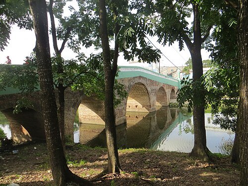
  • Yayabo bridge (Cuba)

    Dickelbers / CC BY-SA 3.0

    bridge

    Yayabo bridge (Cuba)

    Historic bridge in Sancti Spiritus, Cuba

    Opening hours Not checked

    Admission Not checked

    Getting there Nearest stop or station Estación Sancti Spíritus, about 4 min on foot OpenStreetMap

    Map

Places to eat

  • cafe

    Sarandonga

    Food: coffee shop, sandwich, cake, pancake, chocolate, dessert, donut

    Mo-Su 09:00-23:30

    Sancti Spíritus

    Map

  • restaurant

    Al Medio

    Food: pizza, cuban

    Mo-Su 11:00-21:59

    Sancti Spiritus

    Map

Opening hours and tickets: OpenStreetMap contributors. Each one shows the day a volunteer last wrote it down, so check the official site before you set out.

Nothing picked yet
    Add a place that is not listed here

    One per line. Pasting a list works too.

    Cuba