Guantánamo: what to see and where to eat

Everything below comes from open data and each row says where it came from. We have not been to any of these places and we do not rank them.

228,436 people live here

Nearest airport: Mariana Grajales Airport (GAO), about 7.68 km from the centre

Distances are straight-line and the walking time is an estimate, not a route.

Filters

Things to see

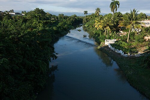
  • Guaso River

    Christian Pirkl / CC BY-SA 4.0

    river

    Guaso River

    river in Guantánamo province, Cuba

    Opening hours Not checked

    Admission Not checked

    About 14 km from the city centre

    Map

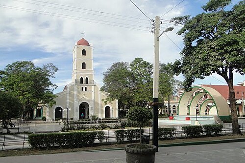
  • St. Catherine of Ricci Cathedral, Guantánamo

    Leon Petrosyan / CC BY-SA 3.0

    cathedral

    St. Catherine of Ricci Cathedral, Guantánamo

    church in Guantánamo, Cuba

    Opening hours Not checked

    Admission Not checked

    Getting there Nearest stop or station Piquera de Coches, about 7 min on foot OpenStreetMap
    Map

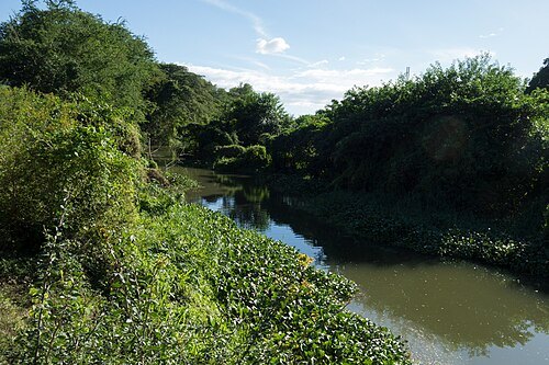
  • Jaibo River

    Christian Pirkl / CC BY-SA 4.0

    river

    Jaibo River

    river in Guantánamo, Cuba

    Opening hours Not checked

    Admission Not checked

    About 12 km from the city centre

    Map

  • sports venue

    Nguyen Van Troi Stadium

    Opening hours Not checked

    Admission Not checked

    Getting there Nearest stop or station Estación Sur, about 8 min on foot OpenStreetMap
    Map

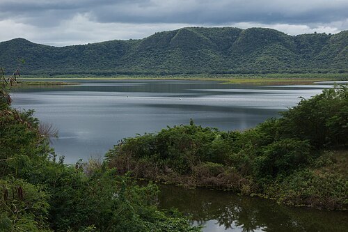
  • La Yaya Dam

    Christian Pirkl / CC BY-SA 4.0

    dam

    La Yaya Dam

    dam in Niceto Pérez, Guantánamo Province

    Opening hours Not checked

    Admission Not checked

    About 16 km from the city centre

    Map

  • river

    Arroyo Ubera

    river in Cuba

    Opening hours Not checked

    Admission Not checked

    Map

  • river

    Arroyo Salado

    river in Cuba

    Opening hours Not checked

    Admission Not checked

    About 10 km from the city centre

    Map

  • river

    Arroyo Salado

    river in Guantánamo Province, Cuba - Geonames ID = 3541403

    Opening hours Not checked

    Admission Not checked

    Map

  • river

    Arroyo Salado

    river in Guantánamo Province, Cuba - Geonames ID = 3541397

    Opening hours Not checked

    Admission Not checked

    About 10 km from the city centre

    Map

  • island

    Cayo Ramón

    island in Guantánamo Province, Cuba

    Opening hours Not checked

    Admission Not checked

    About 18 km from the city centre

    Map

  • island

    Cayo Redondo

    island in Guantánamo Province, Cuba

    Opening hours Not checked

    Admission Not checked

    About 19 km from the city centre

    Map

  • island

    Cayo Piedra

    island in Guantánamo Province, Cuba

    Opening hours Not checked

    Admission Not checked

    About 18 km from the city centre

    Map

  • river

    Arroyo Plátanos

    river in Cuba

    Opening hours Not checked

    Admission Not checked

    Map

  • river

    Arroyo Maquey

    river in Cuba

    Opening hours Not checked

    Admission Not checked

    About 14 km from the city centre

    Map

  • mountain ridge

    Sierra del Maquey

    Opening hours Not checked

    Admission Not checked

    About 16 km from the city centre

    Map

  • beach

    Playa de Manatí

    Opening hours Not checked

    Admission Not checked

    About 14 km from the city centre

    Map

  • mountain

    Monte Líbano

    mountain in Guantánamo Province, Cuba

    Opening hours Not checked

    Admission Not checked

    About 17 km from the city centre

    Map

  • river mouth

    Boca Jaibo

    Opening hours Not checked

    Admission Not checked

    About 12 km from the city centre

    Map

  • bay

    Ensenada de Joa

    bay in Guantánamo Province, Cuba

    Opening hours Not checked

    Admission Not checked

    About 15 km from the city centre

    Map

  • river

    Arroyo Hondo

    river in Cuba

    Opening hours Not checked

    Admission Not checked

    About 13 km from the city centre

    Map

  • river

    Arroyo Jaguey

    river in Cuba

    Opening hours Not checked

    Admission Not checked

    Getting there Nearest stop or station Cuneira, about 18 min on foot OpenStreetMap

    About 18 km from the city centre

    Map

  • valley

    Guantanamo Valley

    Opening hours Not checked

    Admission Not checked

    About 16 km from the city centre

    Map

  • hill

    Loma Gobernadora

    hill in Guantánamo Province, Cuba

    Opening hours Not checked

    Admission Not checked

    About 19 km from the city centre

    Map

  • island

    Flamingo Cay

    Opening hours Not checked

    Admission Not checked

    About 19 km from the city centre

    Map

  • mountain ridge

    Sierra de Canasta

    nature reserve in Cuba

    Opening hours Not checked

    Admission Not checked

    About 13 km from the city centre

    Map

  • river

    Arroyo Casisey

    river in Cuba

    Opening hours Not checked

    Admission Not checked

    About 13 km from the city centre

    Map

  • river

    Arroyo Catey

    river in Cuba

    Opening hours Not checked

    Admission Not checked

    About 11 km from the city centre

    Map

  • river

    Arroyo Cacao

    river in Cuba

    Opening hours Not checked

    Admission Not checked

    Getting there Nearest stop or station Base de Transporte, about 19 min on foot OpenStreetMap

    Map

  • river

    Arroyo Benigno

    river in Cuba

    Opening hours Not checked

    Admission Not checked

    About 15 km from the city centre

    Map

  • river

    Arroyo Blanco

    river in Guantánamo Province, Cuba - Geonames ID = 3567263

    Opening hours Not checked

    Admission Not checked

    About 15 km from the city centre

    Map

  • river

    Arroyo Ají

    river in Cuba

    Opening hours Not checked

    Admission Not checked

    About 9 km from the city centre

    Map

  • lagoon

    Laguna Abajo

    Opening hours Not checked

    Admission Not checked

    About 17 km from the city centre

    Map

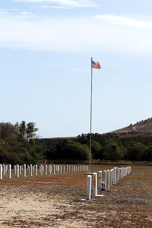
  • Cuzco Wells Cemetery

    Kenneth Tuceri / Public domain

    war memorial

    Cuzco Wells Cemetery

    war memorial in Guantanamo Bay, Cuba

    Opening hours Not checked

    Admission Not checked

    About 14 km from the city centre

    Map

  • square

    Martí Park

    central square in Guantánamo, Cuba

    Opening hours Not checked

    Admission Not checked

    Getting there Nearest stop or station Piquera de Coches, about 6 min on foot OpenStreetMap

    Map

Places to eat

  • cafe

    Cafetería Lilian

    Food: pizza, italian, chicken, breakfast

    24/7

    Guantánamo

    Map

  • cafe

    Cafetería Reparto 1

    Food: pizza, american

    Mo-Su 10:00-21:00

    Ciudad de Guantánamo

    Map

  • restaurant

    La Italiana

    Food: breakfast, burger, chicken, coffee shop, italian pizza, pizza, sandwich

    24/7

    Guantánamo

    Map

Opening hours and tickets: OpenStreetMap contributors. Each one shows the day a volunteer last wrote it down, so check the official site before you set out.

Nothing picked yet
    Add a place that is not listed here

    One per line. Pasting a list works too.

    Cuba