Brod: what to see and where to eat

Everything below comes from open data and each row says where it came from. We have not been to any of these places and we do not rank them.

6,767 people live here

Distances are straight-line and the walking time is an estimate, not a route.

Filters

Things to see

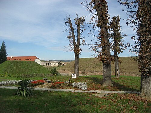
  • Brod Fortress

    Modzzak / CC BY-SA 3.0

    fortress

    Brod Fortress

    fortress

    Opening hours Not checked

    Admission Not checked

    Getting there Nearest stop or station Autobusni kolodvor Slavonski Brod, about 11 min on foot OpenStreetMap

    Map

  • mosque

    Hüseyin Bey Mosque, Brod

    Opening hours Not checked

    Admission Not checked

    Getting there Nearest stop or station Autobuska stanica Brod, about 5 min on foot OpenStreetMap
    Map

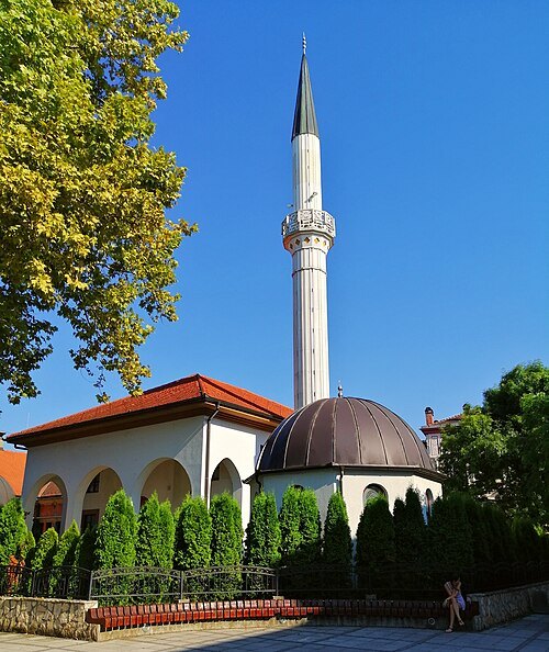
  • Derventa city mosque

    MarinaSimic / CC BY-SA 4.0

    mosque

    Derventa city mosque

    Opening hours Not checked

    Admission Not checked

    Getting there Nearest stop or station Autobuska stanica NAS, about 20 min on foot OpenStreetMap

    About 18 km from the city centre

    Map

  • mosque

    Dolnjačka mosque

    mosque in Derventa, Bosnia and Herzegovina

    Opening hours Not checked

    Admission Not checked

    Getting there Nearest stop or station Autobuska stanica NAS, about 18 min on foot OpenStreetMap
    About 18 km from the city centre

    Map

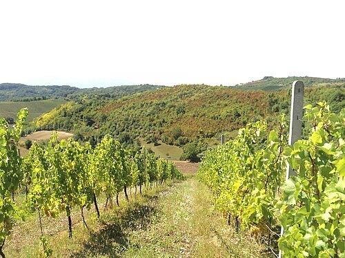
  • Dilj

    Sokac121 / CC BY-SA 3.0

    hill

    Dilj

    mountain in Croatia

    Opening hours Not checked

    Admission Not checked

    About 17 km from the city centre

    Map

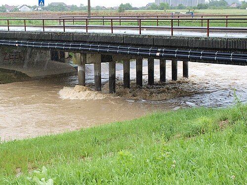
  • Ukrina

    Yoanne at English Wikipedia / Public domain

    river

    Ukrina

    river in Bosnia and Herzegovina

    Opening hours Not checked

    Admission Not checked

    About 44 km from the city centre

    Map

  • demolished synagogue

    Slavonski Brod Synagogue

    former synagogue in Slavonski Brod, Croatia

    Opening hours Not checked

    Admission Not checked

    Getting there Nearest stop or station Autobusni kolodvor Slavonski Brod, about 13 min on foot OpenStreetMap

    Map

  • Glogovica

    Frka / CC BY 3.0

    river

    Glogovica

    river in Croatia

    Opening hours Not checked

    Admission Not checked

    Map

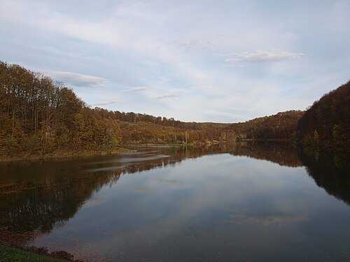
  • Petnja

    Frka / CC BY 3.0

    reservoir

    Petnja

    reservoir in Croatia

    Opening hours Not checked

    Admission Not checked

    About 8 km from the city centre

    Map

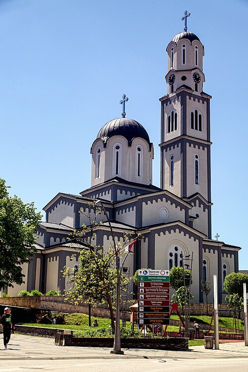
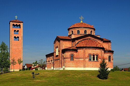
  • Church of the Assumption of the Blessed Virgin Mary in Derventa

    Gordanaignjatic / CC BY-SA 4.0

    church building

    Church of the Assumption of the Blessed Virgin Mary in Derventa

    Serbian orthodox church in Bosnia and Herzegovina

    Opening hours Not checked

    Admission Not checked

    Getting there Nearest stop or station Autobuska stanica NAS, about 18 min on foot OpenStreetMap
    About 18 km from the city centre

    Map

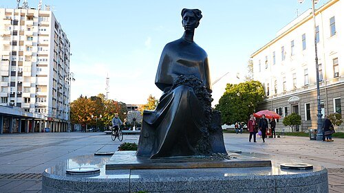
  • Mažuranić Square, Slavonski Brod

    035SB / CC BY-SA 4.0

    square

    Mažuranić Square, Slavonski Brod

    Opening hours Not checked

    Admission Not checked

    Getting there Nearest stop or station Autobusni kolodvor Slavonski Brod, about 14 min on foot OpenStreetMap

    Map

  • valley

    Baruge Do

    Opening hours Not checked

    Admission Not checked

    About 14 km from the city centre

    Map

  • river

    Dugovac

    river in Croatia

    Opening hours Not checked

    Admission Not checked

    About 10 km from the city centre

    Map

  • hill

    Macanovo Brdo

    hill in Brod-Posavina County, Croatia

    Opening hours Not checked

    Admission Not checked

    Map

  • mountain ridge

    Visovci

    Opening hours Not checked

    Admission Not checked

    About 10 km from the city centre

    Map

  • hill

    Ravnac

    hill in Brod-Posavina County, Croatia

    Opening hours Not checked

    Admission Not checked

    About 9 km from the city centre

    Map

  • spring

    Bogdonovac

    spring in Brod-Posavina County, Croatia

    Opening hours Not checked

    Admission Not checked

    About 11 km from the city centre

    Map

  • river

    Dugovac

    river in Croatia; GeoNames ID = 3240490

    Opening hours Not checked

    Admission Not checked

    About 9 km from the city centre

    Map

  • river

    Kikovac

    river in Croatia

    Opening hours Not checked

    Admission Not checked

    Getting there Nearest stop or station Sibinj, about 18 min on foot OpenStreetMap

    Map

  • hill

    Bazovac

    hill in Brod-Posavina County, Croatia

    Opening hours Not checked

    Admission Not checked

    Map

  • hill

    Tirkovac

    hill in Brod-Posavina County, Croatia

    Opening hours Not checked

    Admission Not checked

    Map

  • river

    Kapraljevac

    river in Croatia

    Opening hours Not checked

    Admission Not checked

    About 8 km from the city centre

    Map

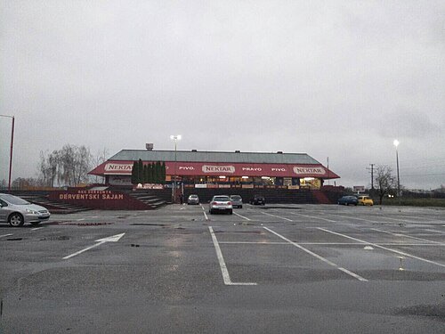
  • hill

    Sveti Luka

    hill in Brod-Posavina County, Croatia
    Opening hours Not checked

    Admission Not checked

    Map

  • river

    Duboki Potok

    river in Croatia

    Opening hours Not checked

    Admission Not checked

    Getting there Nearest stop or station Sibinj, about 14 min on foot OpenStreetMap

    About 9 km from the city centre

    Map

  • valley

    Grabik Dol

    Opening hours Not checked

    Admission Not checked

    About 12 km from the city centre

    Map

  • mountain

    Krizmica

    mountain in Brod-Posavina County, Croatia

    Opening hours Not checked

    Admission Not checked

    About 17 km from the city centre

    Map

  • hill

    Vidulj

    hill in Požega-Slavonia County, Croatia

    Opening hours Not checked

    Admission Not checked

    About 16 km from the city centre

    Map

  • mountain ridge

    Mitrova Greda

    Opening hours Not checked

    Admission Not checked

    About 13 km from the city centre

    Map

  • hill

    Sonog

    hill in Požega-Slavonia County, Croatia

    Opening hours Not checked

    Admission Not checked

    About 16 km from the city centre

    Map

  • hill

    Erdefilj

    hill in Požega-Slavonia County, Croatia

    Opening hours Not checked

    Admission Not checked

    About 17 km from the city centre

    Map

  • mountain

    Diljka

    mountain in Bosnia and Herzegovina

    Opening hours Not checked

    Admission Not checked

    About 13 km from the city centre

    Map

  • river

    Srednja Rijeka

    river in Bosnia and Herzegovina

    Opening hours Not checked

    Admission Not checked

    About 12 km from the city centre

    Map

  • mountain

    Aripova Kosa

    mountain in Bosnia and Herzegovina

    Opening hours Not checked

    Admission Not checked

    About 18 km from the city centre

    Map

  • mountain

    Rijedak

    mountain in Bosnia and Herzegovina

    Opening hours Not checked

    Admission Not checked

    About 19 km from the city centre

    Map

  • spring

    Sedam Vukova

    spring in Republika Srpska, Bosnia and Herzegovina

    Opening hours Not checked

    Admission Not checked

    About 20 km from the city centre

    Map

  • river

    Garinac

    river in Bosnia and Herzegovina

    Opening hours Not checked

    Admission Not checked

    About 10 km from the city centre

    Map

  • valley

    Cikov Do

    Opening hours Not checked

    Admission Not checked

    About 18 km from the city centre

    Map

  • hill

    Kozje Trtine

    hill in Brod-Posavina County, Croatia

    Opening hours Not checked

    Admission Not checked

    About 14 km from the city centre

    Map

  • hill

    Stormirnjak

    hill in Požega-Slavonia County, Croatia

    Opening hours Not checked

    Admission Not checked

    About 20 km from the city centre

    Map

  • canal

    Kanal Osatno

    Opening hours Not checked

    Admission Not checked

    About 19 km from the city centre

    Map

  • canal

    Kanal Bistra

    Opening hours Not checked

    Admission Not checked

    About 17 km from the city centre

    Map

  • river

    Vrbak

    river in Croatia

    Opening hours Not checked

    Admission Not checked

    Getting there Nearest stop or station Stari Slatinik, about 13 min on foot OpenStreetMap

    About 13 km from the city centre

    Map

  • mountain

    Kasonjski Vrh

    mountain in Požega-Slavonia County, Croatia

    Opening hours Not checked

    Admission Not checked

    About 19 km from the city centre

    Map

  • mountain

    Bilavinka

    mountain in Brod-Posavina County, Croatia

    Opening hours Not checked

    Admission Not checked

    About 18 km from the city centre

    Map

  • hill

    Janina Kosa

    hill in Bosnia and Herzegovina

    Opening hours Not checked

    Admission Not checked

    About 20 km from the city centre

    Map

  • spring

    Stankova Voda

    spring in Republika Srpska, Bosnia and Herzegovina

    Opening hours Not checked

    Admission Not checked

    About 17 km from the city centre

    Map

  • river

    Gladarica

    river in Bosnia and Herzegovina

    Opening hours Not checked

    Admission Not checked

    About 18 km from the city centre

    Map

  • river

    Osovica

    river in Bosnia and Herzegovina

    Opening hours Not checked

    Admission Not checked

    About 18 km from the city centre

    Map

  • river

    Pjevalovac

    river in Bosnia and Herzegovina

    Opening hours Not checked

    Admission Not checked

    About 15 km from the city centre

    Map

  • mountain

    Bunkeri

    mountain in Bosnia and Herzegovina

    Opening hours Not checked

    Admission Not checked

    About 20 km from the city centre

    Map

  • river

    Ukovija

    river in Bosnia and Herzegovina

    Opening hours Not checked

    Admission Not checked

    About 18 km from the city centre

    Map

  • valley

    Kolarica

    valley in Bosnia and Herzegovina

    Opening hours Not checked

    Admission Not checked

    About 16 km from the city centre

    Map

  • river

    Macanov Potok

    river in Bosnia and Herzegovina

    Opening hours Not checked

    Admission Not checked

    About 15 km from the city centre

    Map

  • canal

    Kanal Brusanka

    Opening hours Not checked

    Admission Not checked

    About 15 km from the city centre

    Map

  • canal

    Kanal Matnik

    Opening hours Not checked

    Admission Not checked

    About 12 km from the city centre

    Map

  • canal

    Kanal Ocavska

    Opening hours Not checked

    Admission Not checked

    About 11 km from the city centre

    Map

  • hill

    Dogavska Greda

    hill in Brod-Posavina County, Croatia

    Opening hours Not checked

    Admission Not checked

    About 10 km from the city centre

    Map

  • Sports and cultural center of Derwent

    MarinaSimic / CC BY-SA 4.0

    sports venue

    Sports and cultural center of Derwent

    Sports and cultural center in the Republic of Srpska

    Opening hours Not checked

    Admission Not checked

    Getting there Nearest stop or station Autobuska stanica NAS, about 7 min on foot OpenStreetMap
    About 17 km from the city centre

    Map

  • Church of the transfiguration of Jesus Christ in Derventa

    Gordanaignjatic / CC BY-SA 4.0

    church building

    Church of the transfiguration of Jesus Christ in Derventa

    orthodox church in Derventa

    Opening hours Not checked

    Admission Not checked

    About 19 km from the city centre

    Map

Places to eat

No eating place in this city lists its cuisine and opening hours yet.

Opening hours and tickets: OpenStreetMap contributors. Each one shows the day a volunteer last wrote it down, so check the official site before you set out.

Nothing picked yet
    Add a place that is not listed here

    One per line. Pasting a list works too.

    Bosnia and Herzegovina