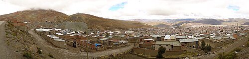
Potosí: what to see and where to eat

Everything below comes from open data and each row says where it came from. We have not been to any of these places and we do not rank them.

189,652 people live here

Nearest airport: Capitán Nicolás Rojas Airport (POI), about 6.1 km from the centre

Distances are straight-line and the walking time is an estimate, not a route.

Filters

Things to see

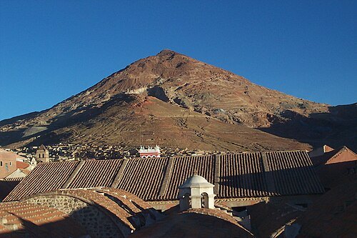
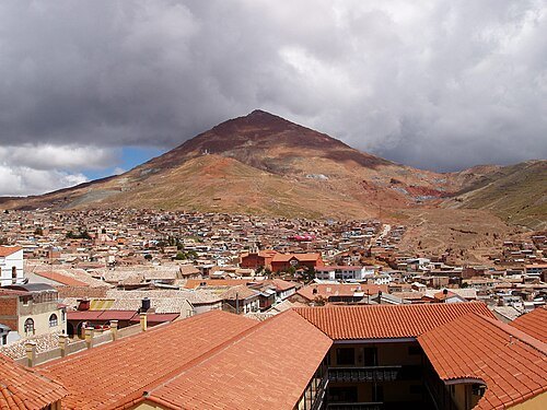
  • Cerro Rico

    Mhwater at Dutch Wikipedia / Public domain

    mountain

    Cerro Rico

    mountain in the Andes near the Bolivian city of Potosí

    Opening hours Not checked

    Admission Not checked

    Map

  • National Mint of Bolivia

    Elemaki / CC BY 2.5

    museum

    National Mint of Bolivia

    former mint located in the city of Potos, Bolivia

    Tu-Sa 09:00-16:30; Su 09:00-12:00 OpenStreetMap, written 2025-02-03

    Ticket needed OpenStreetMap, written 2025-02-03

    Getting there Nearest stop or station Potosí, about 17 min on foot OpenStreetMap
    Map

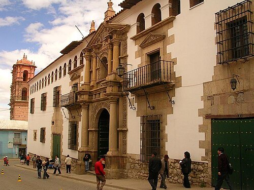
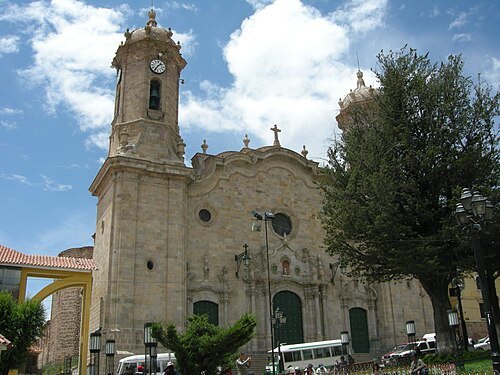
  • Cathedral Basilica of Our Lady of Peace, Potosí

    einalem from Leeds / CC BY-SA 2.0

    catholic cathedral

    Cathedral Basilica of Our Lady of Peace, Potosí

    Roman catholic cathedral in Potosí, Bolivia
    Opening hours Not checked

    Admission Not checked

    Map

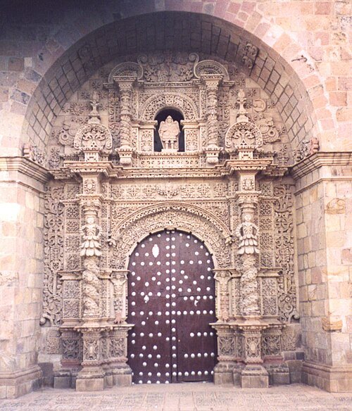
  • San Lorenzo Church, Potosí

    Mark Hills from London, England / CC BY 2.0

    church building

    San Lorenzo Church, Potosí

    church building in Potosí, Bolivia
    Opening hours Not checked

    Admission Not checked

    Map

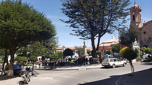
  • Plaza 10 de Noviembre

    Vanett Graneros / CC BY-SA 4.0

    square

    Plaza 10 de Noviembre

    urban square in Potosi, Bolivia

    Opening hours Not checked

    Admission Not checked

    Getting there Nearest stop or station Potosí, about 18 min on foot OpenStreetMap

    Map

  • stadium

    Estadio Víctor Agustín Ugarte

    stadium in Bolivia

    Opening hours Not checked

    Admission Not checked

    Getting there Nearest stop or station Potosí, about 4 min on foot OpenStreetMap
    Map

  • mountain

    Lik'ichiri

    mountain in Bolivia

    Opening hours Not checked

    Admission Not checked

    About 14 km from the city centre

    Map

  • mountain

    Jatun Kunturiri

    mountain in Bolivia

    Opening hours Not checked

    Admission Not checked

    About 19 km from the city centre

    Map

  • mountain

    Kimsa Kunturiri

    mountain in Bolivia

    Opening hours Not checked

    Admission Not checked

    About 9 km from the city centre

    Map

  • mountain

    Khari Khari

    mountain in Bolivia

    Opening hours Not checked

    Admission Not checked

    About 9 km from the city centre

    Map

  • Pari Urqu

    Blibah / Public domain

    mountain

    Pari Urqu

    mountain in Bolivia

    Opening hours Not checked

    Admission Not checked

    Getting there Nearest stop or station Potosí, about 16 min on foot OpenStreetMap

    Map

  • mountain

    Mount Uma Jalanta

    mountain in Bolivia

    Opening hours Not checked

    Admission Not checked

    About 12 km from the city centre

    Map

  • mountain

    Kimsa Waylla

    mountain in Bolivia

    Opening hours Not checked

    Admission Not checked

    About 9 km from the city centre

    Map

  • mountain

    Illimani

    mountain in Bolivia close to Potosí

    Opening hours Not checked

    Admission Not checked

    About 12 km from the city centre

    Map

  • mountain

    Mawk'a Tampu

    mountain in Bolivia

    Opening hours Not checked

    Admission Not checked

    About 9 km from the city centre

    Map

  • mountain

    Jatun Q'asa

    Opening hours Not checked

    Admission Not checked

    About 18 km from the city centre

    Map

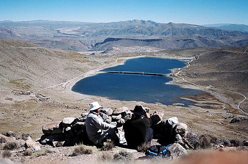
  • Potosí mountain range

    Victor Sounds / CC BY-SA 2.0

    mountain range

    Potosí mountain range

    mountain range in Bolivia

    Opening hours Not checked

    Admission Not checked

    About 16 km from the city centre

    Map

  • mountain

    Yuraq Yuraq

    mountain in Bolivia

    Opening hours Not checked

    Admission Not checked

    About 15 km from the city centre

    Map

  • mountain

    Yana Mayu

    mountain in Bolivia

    Opening hours Not checked

    Admission Not checked

    About 20 km from the city centre

    Map

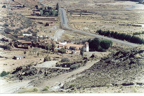
  • Tarapaya River

    TupajAmaru / CC BY-SA 3.0

    river

    Tarapaya River

    river in Bolivia

    Opening hours Not checked

    Admission Not checked

    About 16 km from the city centre

    Map

  • Kunturiri

    Martin St-Amant (S23678) / CC BY 3.0

    mountain

    Kunturiri

    mountain in Bolivia

    Opening hours Not checked

    Admission Not checked

    About 12 km from the city centre

    Map

Places to eat

  • restaurant

    Chicharroneria Copacabana

    Food: regional

    Mo-Su 09:00-18:00

    Potosí

    Map

  • cafe

    La Plata

    Food: sandwich, breakfast, tea, coffee shop, pasta, pizza, italian pizza

    Tu-Sa 10:00-23:00; Mo 13:30-23:00

    Map

Opening hours and tickets: OpenStreetMap contributors. Each one shows the day a volunteer last wrote it down, so check the official site before you set out.

Nothing picked yet
    Add a place that is not listed here

    One per line. Pasting a list works too.

    Bolivia