Oruro: what to see and where to eat

Everything below comes from open data and each row says where it came from. We have not been to any of these places and we do not rank them.

264,683 people live here

Nearest airport: Juan Mendoza International Airport (ORU), about 4.2 km from the centre

Distances are straight-line and the walking time is an estimate, not a route.

Filters

Things to see

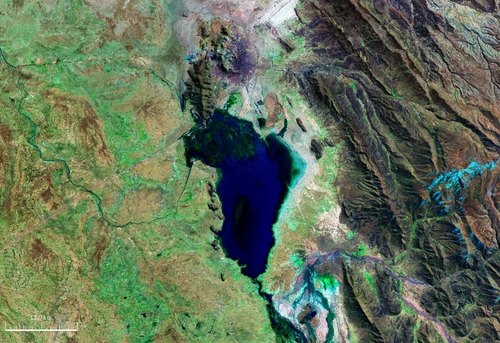
  • Uru Uru Lake

    NASA / Public domain

    lake

    Uru Uru Lake

    lake in Bolivia

    Opening hours Not checked

    Admission Not checked

    About 14 km from the city centre

    Map

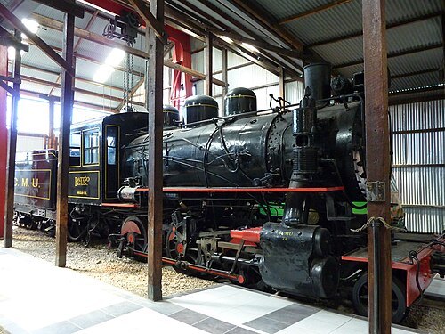
  • Machacamarca Railway museum

    Nils Öberg / CC BY-SA 3.0

    railway museum

    Machacamarca Railway museum

    railway museum in Bolivia

    Opening hours Not checked

    Admission Not checked

    Getting there Nearest stop or station Estación Machacamarca, about 7 min on foot OpenStreetMap
    About 25 km from the city centre

    Map

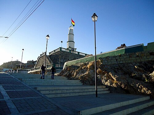
  • Conchupata Lighthouse

    Ruditaly / CC BY-SA 3.0

    lighthouse

    Conchupata Lighthouse

    lighthouse in Bolivia

    Opening hours Not checked

    Admission Not checked

    Getting there Nearest stop or station Estación Socavón, about 9 min on foot OpenStreetMap
    Map

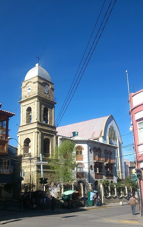
  • Cathedral of Our Lady of the Assumption

    Alexandro82 / CC BY-SA 3.0

    catholic cathedral

    Cathedral of Our Lady of the Assumption

    Opening hours Not checked

    Admission Not checked

    Getting there Nearest stop or station Estación Socavón, about 8 min on foot OpenStreetMap

    Map

  • stadium

    Estadio Jesús Bermúdez

    Bolivian multi purpose stadium

    Opening hours Not checked

    Admission Not checked

    Getting there Nearest stop or station Parada a Patacamaya, about 3 min on foot OpenStreetMap
    Map

  • mountain

    Jach'a Ch'ankha

    mountain in Bolivia

    Opening hours Not checked

    Admission Not checked

    About 21 km from the city centre

    Map

  • river

    Jach'a Uma

    river in Bolivia

    Opening hours Not checked

    Admission Not checked

    About 23 km from the city centre

    Map

  • archaeological site

    Qala Qala

    archaeological site in Bolivia

    Opening hours Not checked

    Admission Not checked

    About 23 km from the city centre

    Map

  • mountain

    Wichhu Qullu

    mountain in the Cercado Province, Oruro Department, Bolivia

    Opening hours Not checked

    Admission Not checked

    About 22 km from the city centre

    Map

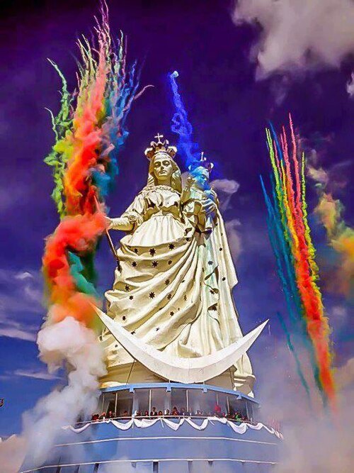
  • Virgen del Socavón

    Tony2510 / CC BY-SA 3.0

    colossal statue

    Virgen del Socavón

    Opening hours Not checked

    Admission Not checked

    Getting there Nearest stop or station Estación Monumento Virgen, about 1 min on foot OpenStreetMap

    Map

  • mountain

    Ñuñu Qullu (Dalence)

    mountain in the Pantaleón Dalence Province, Oruro Department, Bolivia

    Opening hours Not checked

    Admission Not checked

    About 38 km from the city centre

    Map

  • mountain

    Janq'u Qalani (Oruro)

    mountain in Bolivia

    Opening hours Not checked

    Admission Not checked

    About 38 km from the city centre

    Map

  • mountain

    Cerro Toriri

    mountain in Bolivia

    Opening hours Not checked

    Admission Not checked

    About 35 km from the city centre

    Map

  • mountain

    Cerro Soracachi

    mountain in Bolivia

    Opening hours Not checked

    Admission Not checked

    About 26 km from the city centre

    Map

  • mountain

    Cerro Parbellon

    mountain in Bolivia

    Opening hours Not checked

    Admission Not checked

    About 38 km from the city centre

    Map

  • mountain

    Cerro Huaillas

    mountain in Bolivia

    Opening hours Not checked

    Admission Not checked

    About 36 km from the city centre

    Map

  • mountain

    Cerro Huichu Kkollu

    mountain in Bolivia

    Opening hours Not checked

    Admission Not checked

    About 39 km from the city centre

    Map

  • river

    Quebrada Kello

    river in Bolivia

    Opening hours Not checked

    Admission Not checked

    About 30 km from the city centre

    Map

  • mountain

    Cerro Khala Phutuncu

    mountain in Bolivia

    Opening hours Not checked

    Admission Not checked

    About 34 km from the city centre

    Map

  • mountain

    Cerro Condeauque

    mountain in Bolivia

    Opening hours Not checked

    Admission Not checked

    About 35 km from the city centre

    Map

  • mountain

    Cerro Apachuencani

    mountain in Bolivia

    Opening hours Not checked

    Admission Not checked

    About 30 km from the city centre

    Map

  • mountain

    Cerro Aysa Kkollu

    mountain in Bolivia

    Opening hours Not checked

    Admission Not checked

    About 32 km from the city centre

    Map

  • mountain

    Lluxita

    mountain in the Cochabamba Department, Bolivia

    Opening hours Not checked

    Admission Not checked

    About 40 km from the city centre

    Map

  • mountain

    Chunkara

    mountain in Bolivia

    Opening hours Not checked

    Admission Not checked

    About 21 km from the city centre

    Map

  • mountain

    Wayllani

    Opening hours Not checked

    Admission Not checked

    About 22 km from the city centre

    Map

  • river

    Quebrada Tauca Chullpa

    river in Bolivia

    Opening hours Not checked

    Admission Not checked

    About 36 km from the city centre

    Map

  • mountain

    Cerro Sellota

    mountain in Bolivia

    Opening hours Not checked

    Admission Not checked

    About 29 km from the city centre

    Map

  • mountain

    Cerro Panaya

    mountain in Bolivia

    Opening hours Not checked

    Admission Not checked

    About 17 km from the city centre

    Map

  • mountain

    Cerro Hospitaya

    mountain in Bolivia

    Opening hours Not checked

    Admission Not checked

    About 17 km from the city centre

    Map

  • mountain

    Cerro Hurputanca

    mountain in Bolivia

    Opening hours Not checked

    Admission Not checked

    About 25 km from the city centre

    Map

  • river

    Quebrada Jalantiri

    river in Bolivia

    Opening hours Not checked

    Admission Not checked

    About 32 km from the city centre

    Map

  • mountain

    Cerro Khakha Pata

    mountain in Bolivia

    Opening hours Not checked

    Admission Not checked

    About 33 km from the city centre

    Map

  • mountain

    Cerro Haichacosi

    mountain in Bolivia

    Opening hours Not checked

    Admission Not checked

    About 15 km from the city centre

    Map

  • mountain

    Cerro Chullancachi

    mountain in Bolivia

    Opening hours Not checked

    Admission Not checked

    About 22 km from the city centre

    Map

  • mountain

    Cerro Cajsani

    mountain in Bolivia

    Opening hours Not checked

    Admission Not checked

    About 35 km from the city centre

    Map

  • river

    Quebrada Chiara

    river in Bolivia

    Opening hours Not checked

    Admission Not checked

    About 16 km from the city centre

    Map

  • mountain

    Wallatiri

    mountain in the Poopó Province, Oruro Department, Bolivia

    Opening hours Not checked

    Admission Not checked

    About 39 km from the city centre

    Map

Places to eat

  • cafe

    Pamatioli - Cafés y Pizzas

    Food: cafe, pizza

    Mo‑Sa 08:30‑22:00

    Oruro

    Map

Opening hours and tickets: OpenStreetMap contributors. Each one shows the day a volunteer last wrote it down, so check the official site before you set out.

Nothing picked yet
    Add a place that is not listed here

    One per line. Pasting a list works too.

    Bolivia