Guayaramerín: what to see and where to eat
Everything below comes from open data and each row says where it came from. We have not been to any of these places and we do not rank them.
36,008 people live here
Nearest airport: Aeropuerto de Guayaramerin (GYA), about 7.49 km from the centre
Distances are straight-line and the walking time is an estimate, not a route.
Filters Sort Most Wikipedia articles Nearest the centre By name
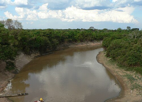
Things to see Grullab / CC BY-SA 3.0
river river in Bolivia
Opening hours Not checked
Admission Not checked
About 39 km from the city centre
Map
Add island island disputed by Bolivia and Brazil
Opening hours Not checked
Admission Not checked
Getting there Nearest stop or station Porto Oficial de Guajará-Mirim, about 20 min on foot OpenStreetMap
Map
Add river river in Rondônia, Brazil
Opening hours Not checked
Admission Not checked
About 31 km from the city centre
Map
Add river river in Rondônia, Brazil
Opening hours Not checked
Admission Not checked
About 9 km from the city centre
Map
Add river Arroyo Toraco river in Bolivia
Opening hours Not checked
Admission Not checked
About 30 km from the city centre
Map
Add island Isla Paconava Opening hours Not checked
Admission Not checked
About 13 km from the city centre
Map
Add island Isla de Las Piedras island in Beni Department, Bolivia
Opening hours Not checked
Admission Not checked
About 12 km from the city centre
Map
Add river Arroyo Piras river in Bolivia
Opening hours Not checked
Admission Not checked
About 15 km from the city centre
Map
Add waterfall Cachoeira das Bananeiras Opening hours Not checked
Admission Not checked
About 26 km from the city centre
Map
Add island Isla Caballo Marino island in Beni Department, Bolivia
Opening hours Not checked
Admission Not checked
About 20 km from the city centre
Map
Add river Rio Bananeiras river in Brazil
Opening hours Not checked
Admission Not checked
About 18 km from the city centre
Map
Add river Igarape 2 Irmaos river in Brazil
Opening hours Not checked
Admission Not checked
About 39 km from the city centre
Map
Add international bridge Puente Internacional del Río Mamoré projected bridge on the Mamoré River between Bolivia and Brazil
Opening hours Not checked
Admission Not checked
Map
Add catholic cathedral Cathedral of Our Lady Opening hours Not checked
Admission Not checked
Getting there Nearest stop or station Porto Oficial de Guajará-Mirim, about 11 min on foot OpenStreetMap
Map
Add Places to eat No eating place in this city lists its cuisine and opening hours yet.
Nothing here matches that. Clear a filter and try again.
Opening hours and tickets: OpenStreetMap contributors . Each one shows the day a volunteer last wrote it down, so check the official site before you set out.
Nothing picked yet Build my plan Clear picks Add a place that is not listed here You can write in places yourself One per line. Pasting a list works too.
Add these
Bolivia